

Marine layer returns to scour out poor air quality and cool highs to start the week

Air quality improves as onshore flow brings cooler temperatures
Q13 News Forecaster Erin Mayovsky says onshore flow will help improve our air quality and cool temperatures down this weekend.
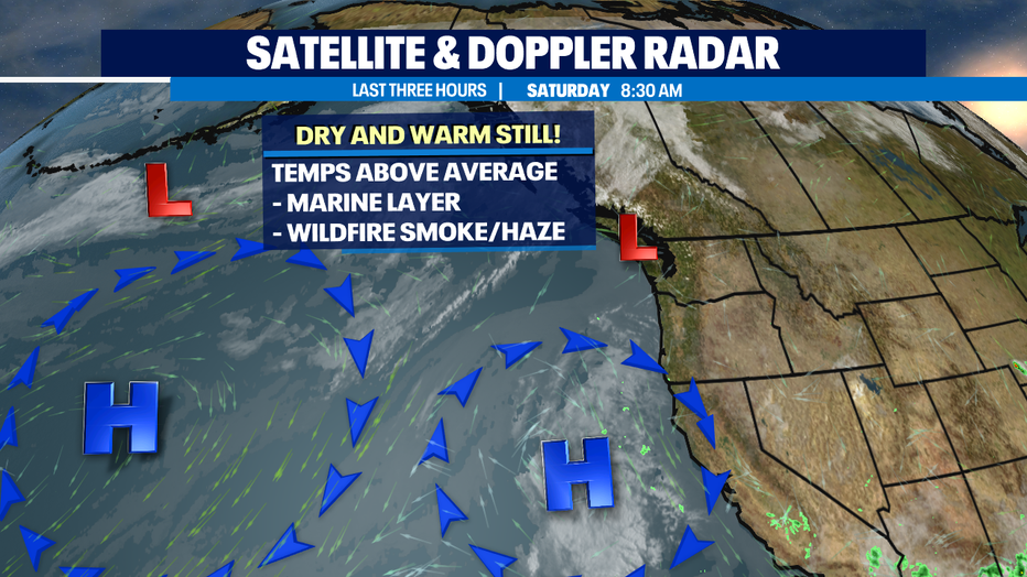
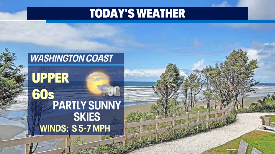
SEATTLE - A nice welcome to see the marine layer at the coast Saturday morning. A little fog too for our ocean beaches!
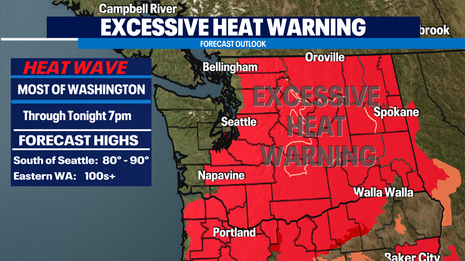
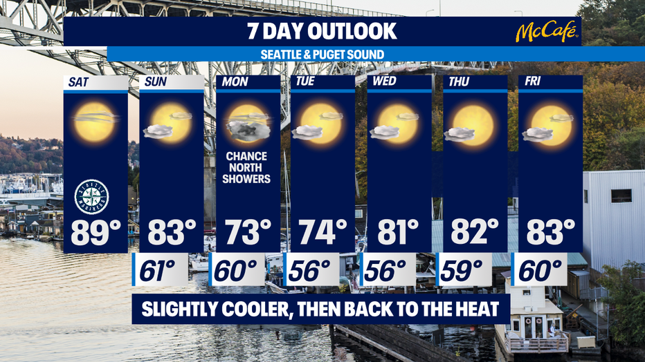
This combination helping to clear out some of the unhealthy air quality values across the state. Even though we're cooling off some areas are still under an Excessive Heat Warning through Saturday night.
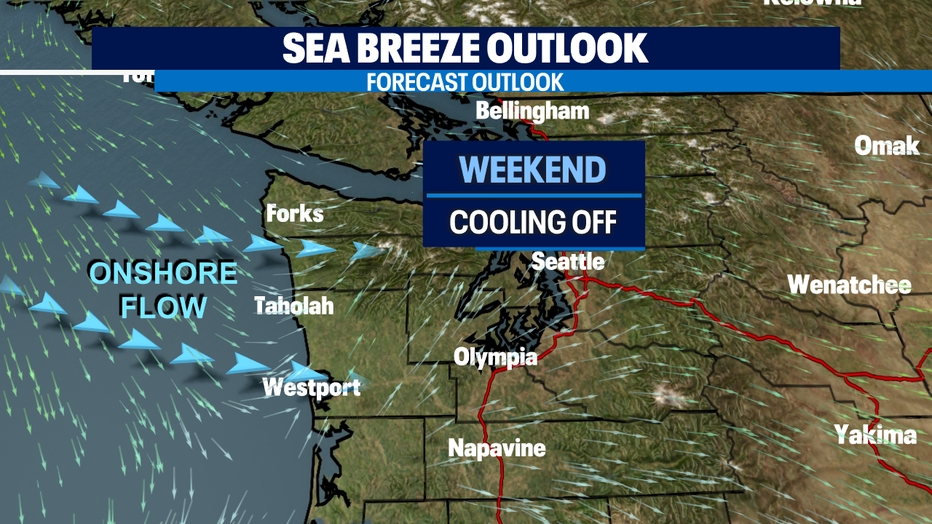
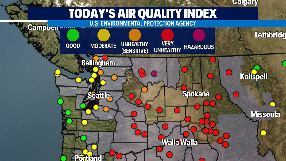
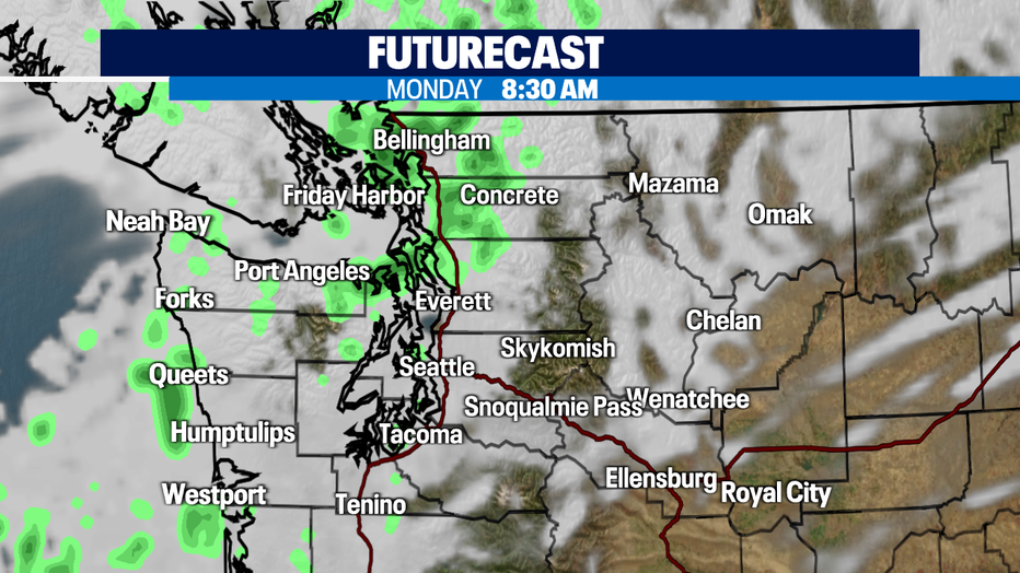
Air quality will steadily improve through Tuesday with winds out of the west southwest. A passing upper level low also helping keep the atmosphere clear of poor AQI levels through mid-week. As the low passes there's a chance for a few showers for the North Sound early Monday morning.
Futurecast showers the light rain Monday morning for the Coast and North Sound. Showers will be light and won't last too long. We'll take it though!
Our trough will shift east Wednesday opening the door for a ridge of high pressure to build back in over the Eastern Pacific. Throughout the rest of the work week the high will move east returning conditions back to dry and warm. Temperatures Wednesday through the start of the weekend will hang a few degrees above average, making the warmth much more tolerable! Enjoy!
Have a great day all! ~Erin Mayovsky, Q13 Forecaster
*Beach Forecast
*Mountain Forecast
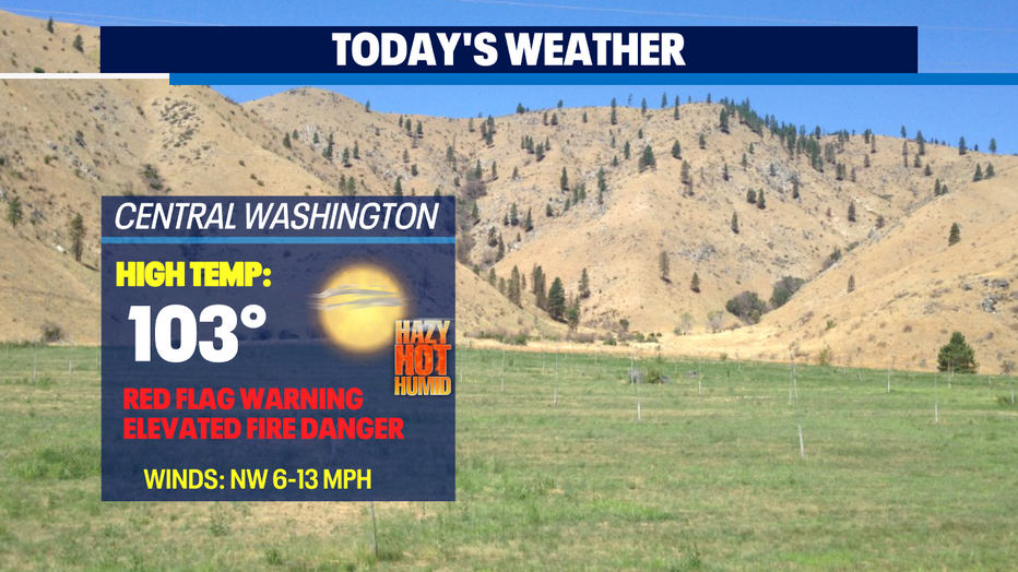
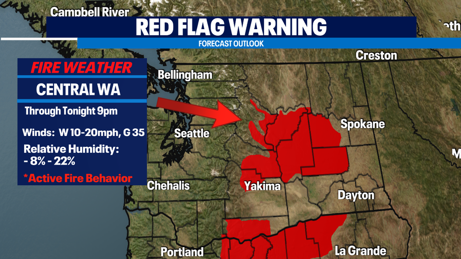
*Central WA Forecast
Q13 FOX WEATHER RESOURCES:
DOWNLOAD: Q13 Weather and News Apps
WATCH: Forecast and Radar
READ: Closures and Delays
CHECK: Latest Weather Alerts and Live Traffic Map
INTERACT: Submit your Weather Photo
DAILY BRIEF: Sign Up For Our Newsletter
FOLLOW: Lisa Villegas, MJ McDermott, Erin Mayovsky, and Scott Sistek