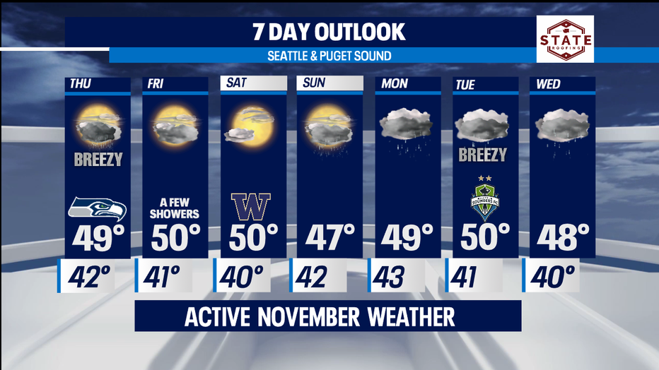
More rain, wind and possible thunderstorms Thursday with dry periods Friday and Saturday.
Seattle - Another typical November day around the Pacific Northwest. Heavy rain and wind at times made visibility poor in some areas, especially along the coast and North Sound. Everett had winds gusting to 40mph this afternoon.
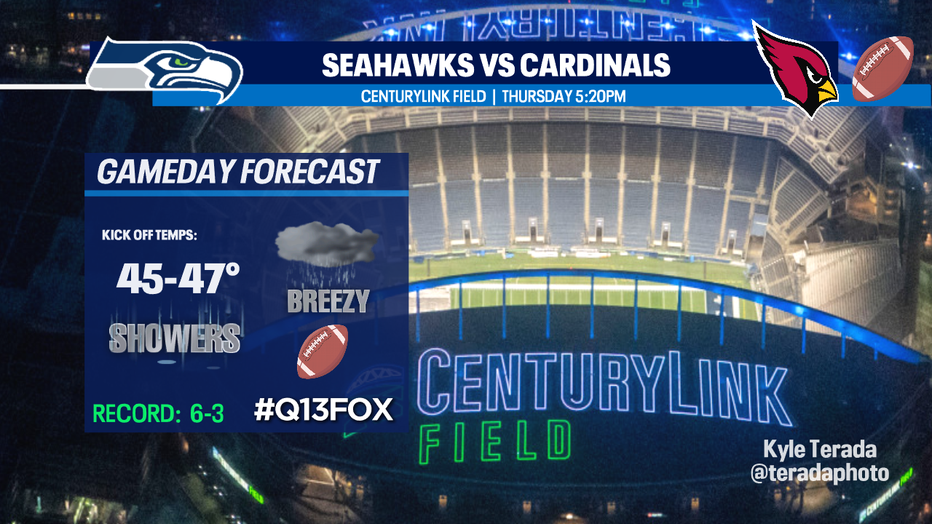
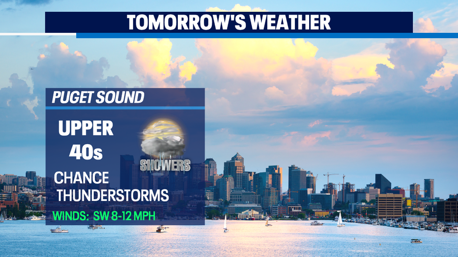
Tomorrow brings more unsettled weather our way. Showers will be present for the morning commute with a chance of thunderstorms in the afternoon. Winds will kick up a little too out of the south/southwest 8-16mph. Perfect weather for the Seahawks who are home taking on the Arizona Cardinals at CenturyLink Field. Highs will remain near normal, in the upper 40s to low 50s.
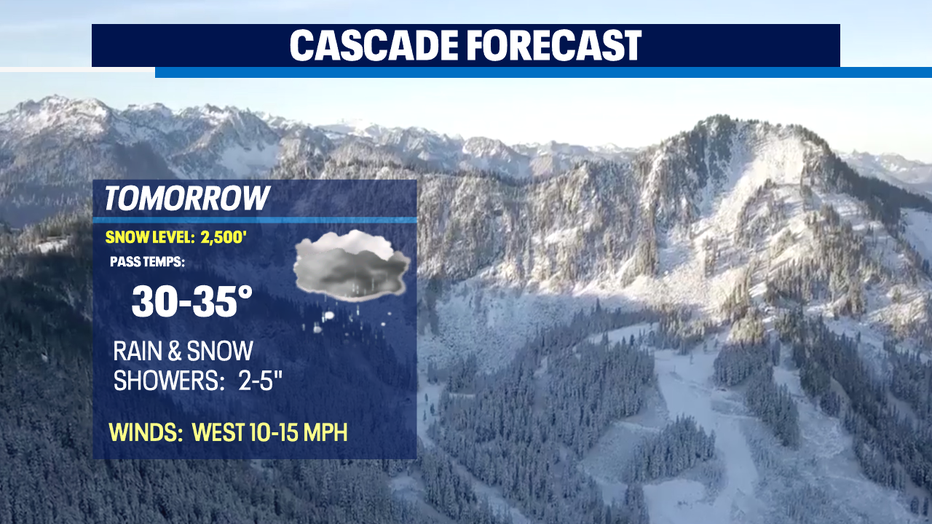
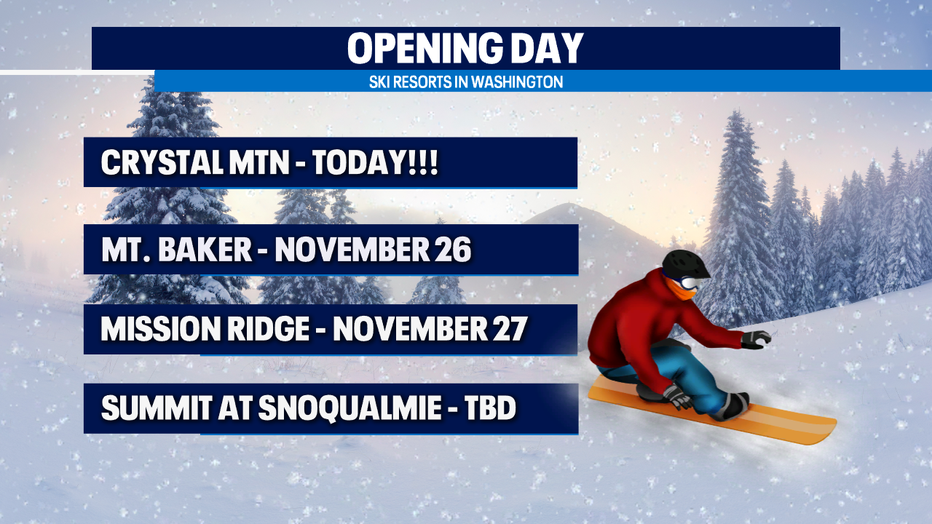
The mountains will continue to pick up fresh powder with snow levels dropping to 2,500'-3,000'. If you plan to drive through the Cascades, please check in on road conditions as it will be tough at times. Highs won't get much warmer than 35. Brr! Be prepared for wintry weather.
We start to dry out Friday with only a few showers stretching across Puget Sound mid-day. High near 50. The mountains will see just a few snow showers, otherwise look for mostly cloudy skies from the coast to the Cascades. Our dry weather will extend into Saturday too. This will be the nicer day of the weekend with partly cloudy skies. High near 50.
The rest of the weekend into next week looks sloppy at times with a series of several system pushing inland about every other day. We will get some ridging in between troughs, but it will not be that noticeable. Expect heavy rain at times through mid-week!
Have a great night! ~Erin
______________________________________________
- Erin Mayovsky, Q13 Forecaster
Twitter: @ErinMayovsky
FaceBook: /ErinMayovsky
Instagram: @ErinMayovsky
______________________________________________