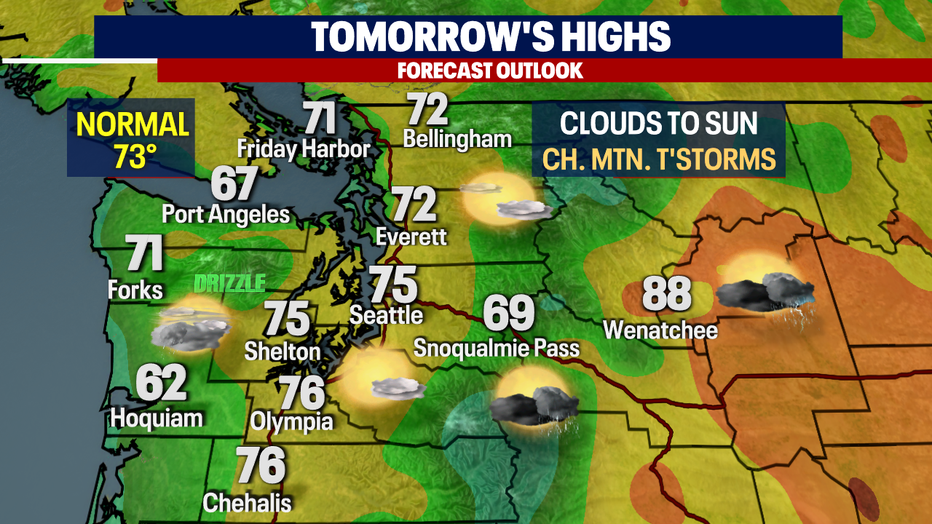
Seattle weather: Morning clouds to sunshine with highs in the 70s

Chance of mountain thunderstorms early this week
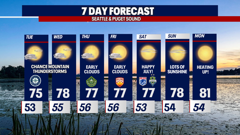
Temps will slowly warm this week until we reach low 80s by Monday.
SEATTLE - Monday's highs landing spot on with 73 at SeaTac. Normal is 73 for one more day and then Wednesday our average jumps 74.

Overnight low-level onshore flow returns blanketing the region with clouds to start the day. Temperatures cool into the low to mid 50. Our normal low for this time of year is 54.
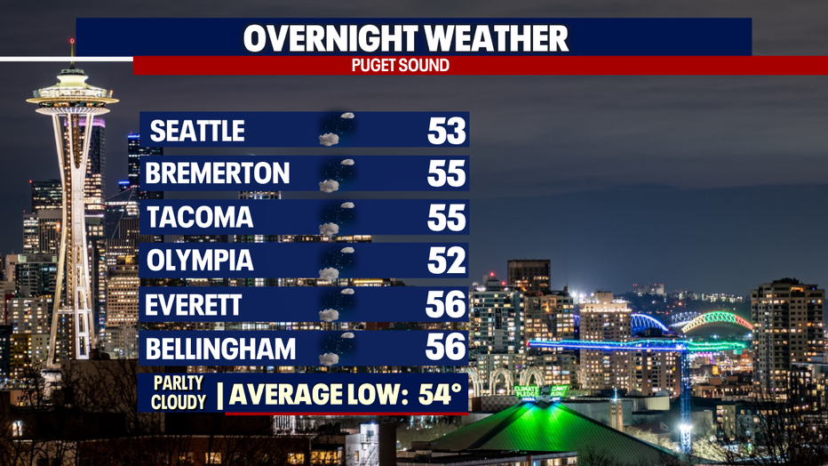
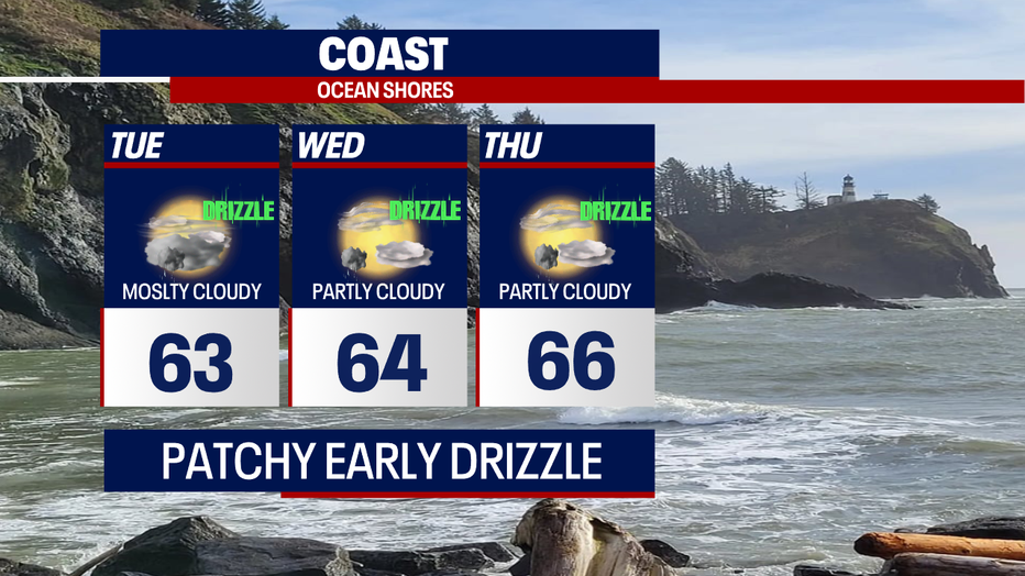
A few areas to the southwest could see a little patchy drizzle just after sunrise (5:14am) into the morning commute.
Clouds will clear by mid-morning along the I-5 corridor, but much of the coast and the foothills hang on to the marine layer a bit longer.
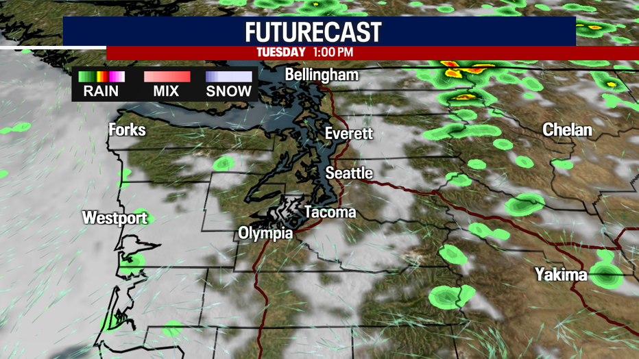
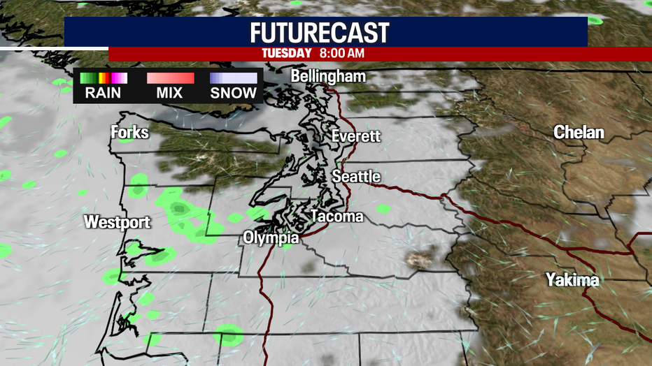
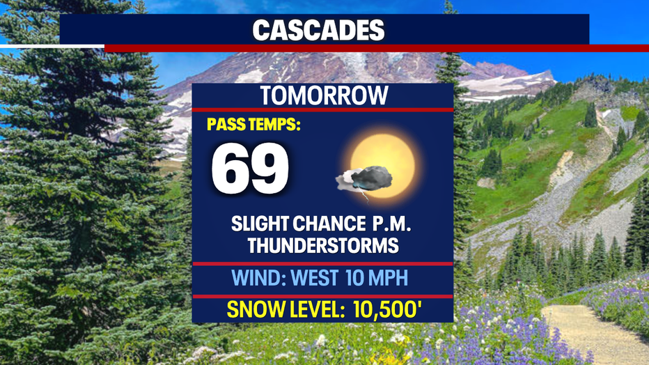
Tomorrow we're tracking another chance for a few Cascade thunderstorms to develop by the afternoon/evening.

We're forecasting low 70s for the North Sound, mid 70s for the Central & South Sounds with upper 70s farther south into Lewis County. If you're looking for much cooler temperatures, like in the low 60s, head to the beach where Ocean Shores high lands near 62.
As we move into July models have us warming into the upper 70s to low 80s as high pressure strengthens over the region. As the 4th of July approaches please be careful as our grounds are tinder dry.
Have a great week all! ~Erin Mayovsky, FOX 13 Forecaster
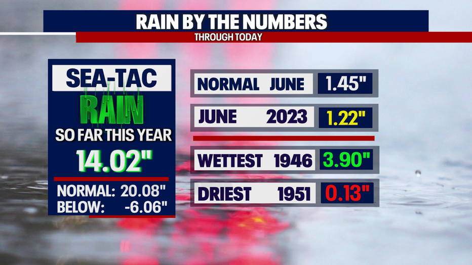
*SeaTac Rain Almanac
*Coast Forecast
*Mountain Forecast
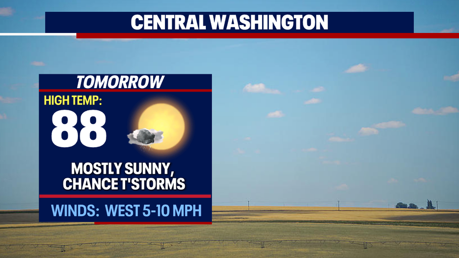
*Central WA Forecast