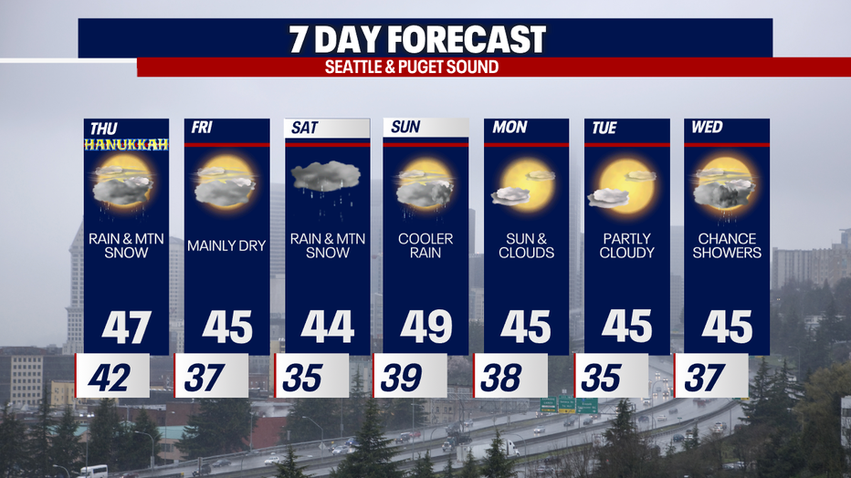
Seattle weather: Next system brings light rain, mountain snow to passes

Rain partially clearing out in the days ahead
FOX 13 Meteorologist Claire Anderson is tracking a few dry days ahead, putting the elevated flood risk behind us.
SEATTLE - Here is a look at the 72-hour rainfall totals (during the atmospheric river). Some of the largest rainfall totals we saw were correlated with the major river flooding.

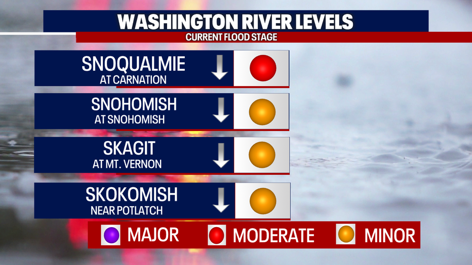
Area rivers are slowly receding tonight, and flood stages are slowly going down. As of 9pm, most of the area's rivers were at minor flood stage.
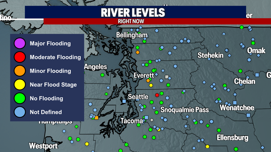
The major rivers we have been watching are currently at MINOR flooding. Snoqualmie is expected to drop to minor flood stage tonight.
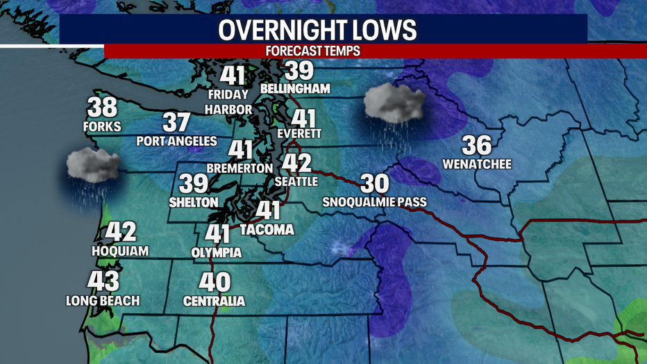
Scattered showers continue this evening with overnight lows staying mild, low 40s.
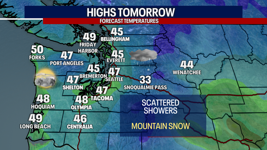
A weaker system will move in late Wednesday through Thursday. This will bring lowland light rain and mountain snow. Snow levels will drop to 2000-2500' by Thursday afternoon.
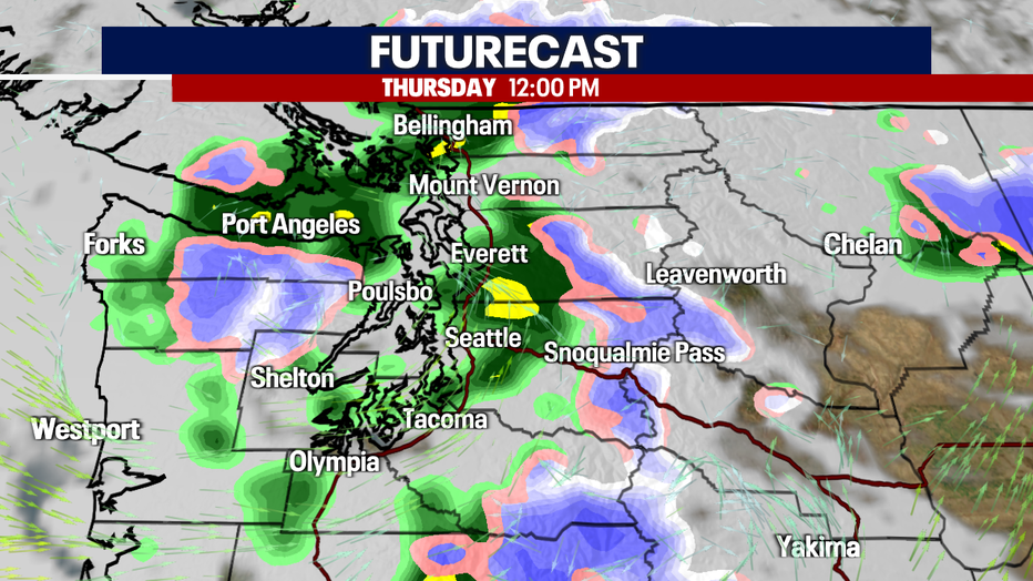
Highs Thursday will be in the mid to upper 40s. Showers will remain scattered through the evening hours.
Drier conditions will return Friday as an upper-level ridge of high-pressure builds. Mainly dry with clouds and sunbreaks. A stronger and wetter system will return for the weekend, bringing gusty winds to the coast, lowland rain, and mountain snow.