Poor air quality and potential record-breaking fall heat through the weekend

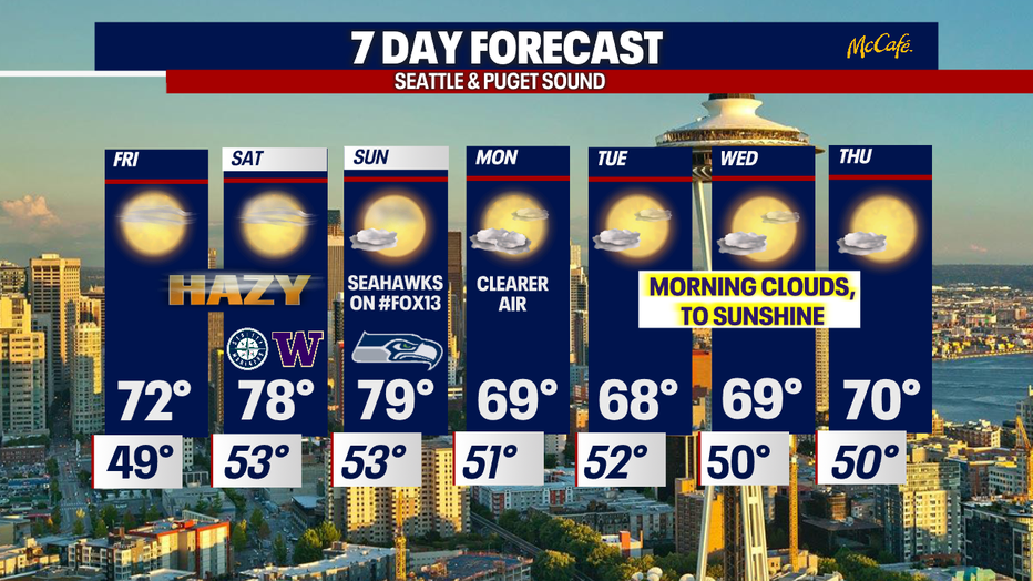
Hazy, sunny conditions continue
FOX 13 forecaster Erin Mayovsky gives the latest outlook for air quality, haze and sunshine this weekend and into the start of next week.
SEATTLE - A lot going on with the forecast folks…
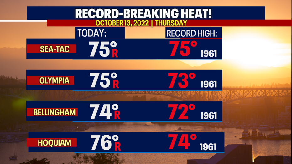
First, Thursday highs landed in record-breaking territory with several areas pushing 10-15 degrees above average. Normal for this time of year is now 61 and drops to 60 by Sunday.
Here's a look at where highs tied or beat records. Sea-Tac hit 75, tying the old record from 1961. In Seattle at the National Weather Service office, the temps also smashed the 76-degree record from 1961 with 78 degrees on Thursday.
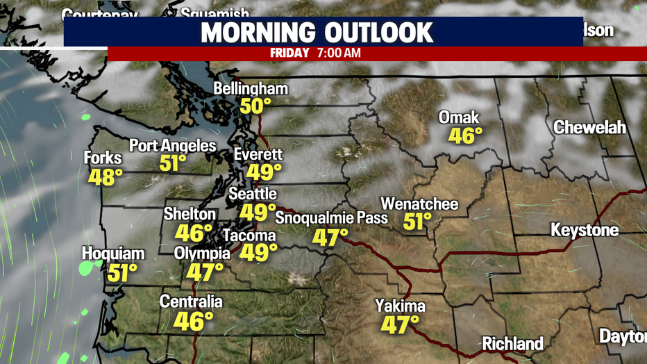
Overnight, hazy skies will hang with us along with some high clouds pushing into Puget Sound. Lows cool close to normal at 47.
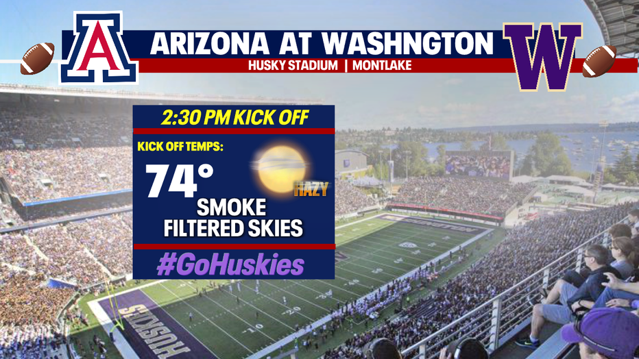
Unfortunately, smoke and haze will be with us through the weekend from Eastern WA to the foothills to the coast. Conditions will vary across the state with some of the worst air quality over the Cascades into Central WA.
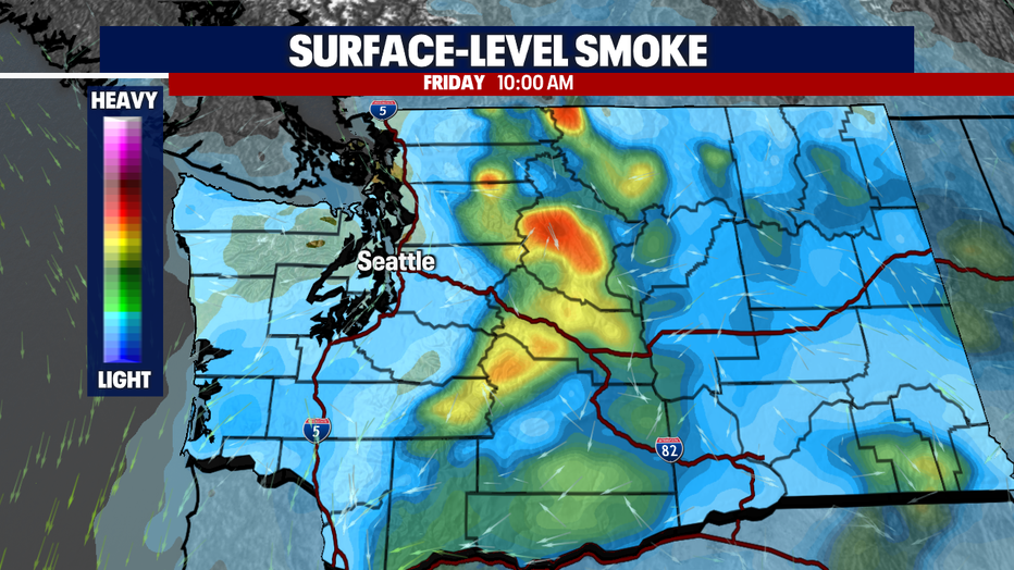
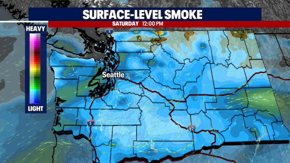
Friday evening will see a brief break from poor levels, but wind out of the east will push more smoke back into Western WA Saturday and Sunday.
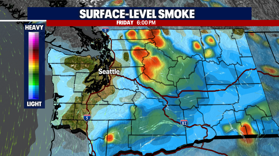
We're keeping a close eye on air quality, especially with so many outdoor events happening this weekend.
Saturday, air quality will push into the moderate to very unhealthy at times. Both the Mariners and Huskies are in town with midday games.
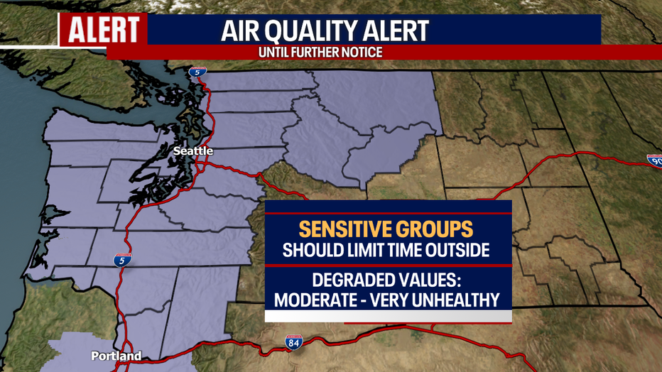
Air Quality Alerts for ALL of Western WA and some counties in North/Central WA will remain up until further notice. If you already suffer from allergies and upper respiratory issues, please limit your time outdoors.
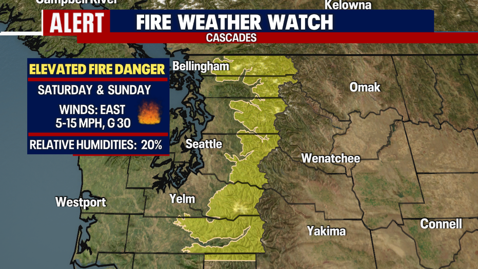
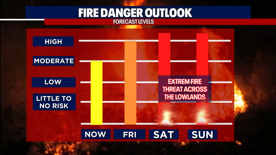
We are also monitoring the extremely dry ground conditions. A "Fire Weather Watch" for the mountains goes into effect Saturday morning lasting until Sunday afternoon.
We expect moderate winds to pick up along with relative low humidity (20%) through the Cascades. East winds may gust at times up to 30mph with sustained winds 5-15mph.
Mariners 1st pitch set for 1:07 p.m. Saturday under hazy skies with temperatures in the low 70s.

And just an hour and a half later at 2:30 p.m., the Huskies kick off with Arizona in town. Temperatures will continue to warm into the upper 70s throughout the game on Montlake.
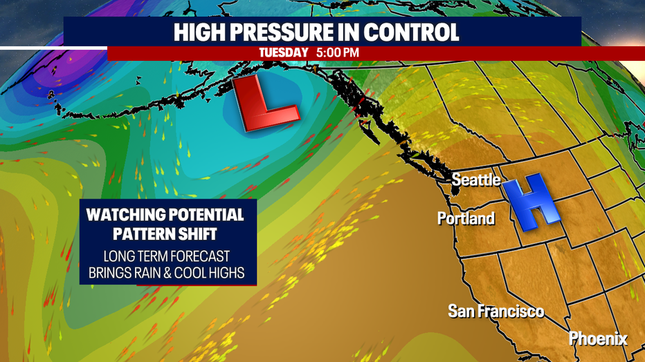
High pressure is blocking out most systems from pushing into western Washington, giving us this warm, autumn weather.
This strong ridge will finally start to break down and move east next weekend opening the door for cooler highs and rain to work back into the region.
Even though we cool some next week, we'll still run about 6-10 degrees above average with morning clouds and afternoon sunshine.
And as mentioned, models are forecasting a big pattern shift coming our way next weekend that will dramatically drop temperatures back into the mid to upper 50s. Plus, rain chances look a bit more promising… finally! Stay tuned!
Have a great rest of the week all! ~Erin Mayovsky, FOX 13 Forecaster
