

Record rain, gusty weather likely in Seattle due to atmospheric rivers

Seattle weather: Atmospheric river moving in
FOX 13 Seattle Meteorologist Abby Acone has your latest western Washington weather forecast!
A pair of atmospheric rivers is taking aim at Western Washington Sunday to Tuesday. There will likely be record rain and gusty weather in Seattle and Puget Sound region the next few days.
Highs today will sag below average, only topping off in the upper 50s to low 60s. You can plan on cloudy, murky skies and ongoing rain this afternoon and tonight.

Temperatures Sunday afternoon will be below normal. (FOX 13 Seattle)
We're tracking two atmospheric rivers (which are corridors of super moist air in the sky). The first arrives today. The second follows Monday night to Tuesday: the former will be stronger.
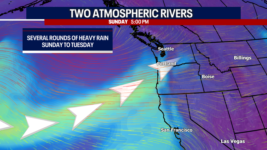
A corridor of moist air in the atmosphere will dump heavy rain in Western Washington through Tuesday. (FOX 13 Seattle)
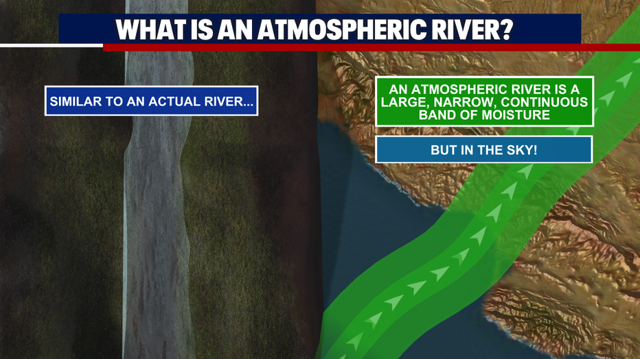
This graphic explains the definition of an atmospheric river. (FOX 13 Seattle)
Gusts between tonight and Tuesday could range between 15 and 30 mph, but some isolated gusts to 35 mph are possible for the typical spots. Winds will be the strongest Monday.
Rain turns more hit-or-miss Monday and Tuesday. However, it could remain an issue in spots.
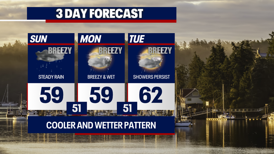
Get ready for rounds of rain and gusty weather in Seattle through Tuesday. (FOX 13 Seattle)
With this type of weather pattern, we're concerned about a few things. Firstly, many area rivers will be rising quickly, potentially hitting record highs for water levels this time of year. Many rivers will reach "action stage," but only a few spots will reach flood stage. The rivers with the best likelihood for nearing minor flood stage are the Snoqualmie and Skokomish Rivers. Stay tuned!
Where there's poor drainage and heavy downpours, we can't rule out hyper-localized, minor street flooding either. We also need to monitor local burn scars for any flooding issues, particularly the highway along the Bolt Creek burn scar.
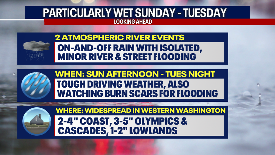
On-and-off rain is forecast for Western Washington with isolated, minor street and river flooding possible. (FOX 13 Seattle)
Sea-Tac Airport could get a month's worth of rain in just a couple days. The average rain totals for June at Sea-Tac is 1.45 inches. We'll likely tie or exceed that mark today through Tuesday.

We could see a month's worth of rain at Sea-Tac Airport in just two to three days. (FOX 13 Seattle)
Below is a look at forecast rain totals compared to the records for daily rainfall today. You'll notice that Sea-Tac, Bellingham and Olympia have the chance of tying or exceeding the record (by the way, these records were rounded to the nearest ten).

Sea-Tac, Bellingham and Olympia could either tie or exceed the record for daily rain today. (FOX 13 Seattle)
There's a Flood Watch in effect below.
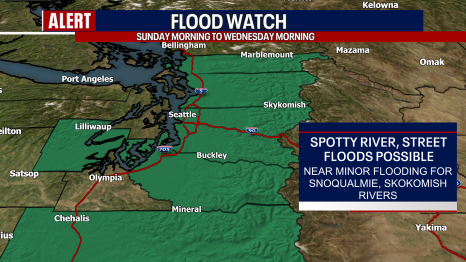
A Flood Watch remains in effect until Wednesday morning. (FOX 13 Seattle)
Drier and quieter weather resumes Wednesday. Thursday through next week looks sunny, dry and even hot. The low to mid 80s are possible in Seattle on Saturday. Stay tuned for any changes!
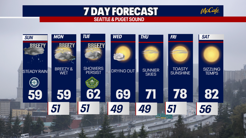
Below-average temperatures Sunday will give way to the 80s next weekend. (FOX 13 Seattle)
Take care,
Meteorologist Abby Acone
Follow me on Facebook (Meteorologist Abby Acone), Instagram @abbyaconewx, TikTok @abbyaconetv