

Scattered rain, breezy, and cool Sunday
seattle - An approaching cold front will continue to bring rain and breezy conditions across Western WA today. Highs will be on the cool side, near 47°.
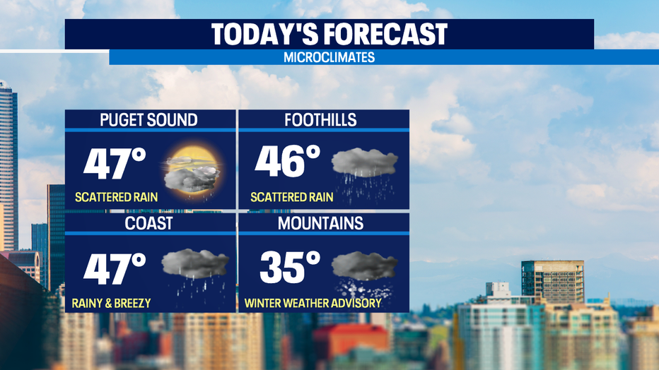
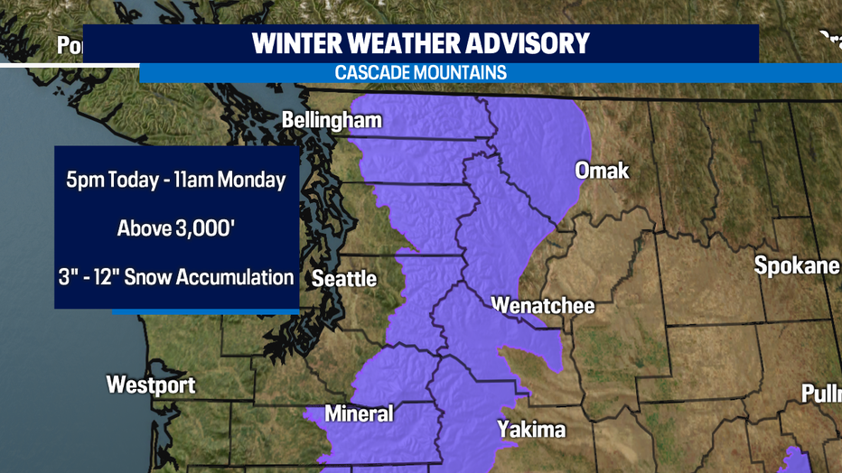
Snow levels will be around 2,000' today and as the front pushes inland this afternoon, it will make for difficult travel conditions on our passes. A *Winter Weather Advisory* kicks in at 5pm this afternoon and lasts through 11am on Monday. Snow totals can range from 3" to 12" through Monday morning. Check road conditions before heading out.
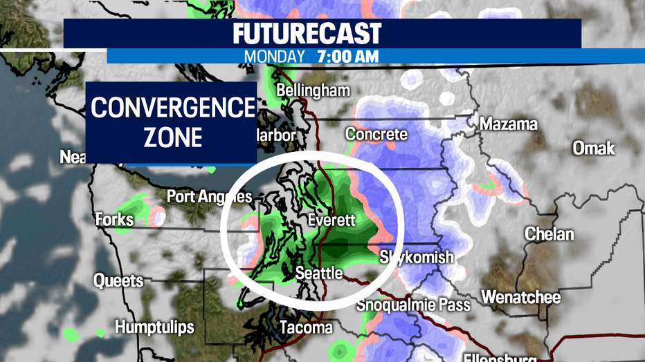
Showers will linger into Monday. In fact, models are pointing at a convergence zone setting up as early as the morning commute so you may need to use your windshields! Scattered rain is possible throughout the day too.
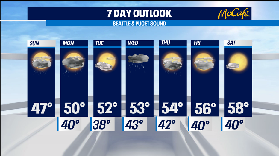
On Tuesday, expect a brief break in the rain and maybe some sunbreaks. Another system arrives Wednesday bringing rain into Thursday. We'll finally dry out and see some sun just in time for Friday and Saturday! Highs on Saturday will be near 60°- now there's the spring weather!!
Have a great day!
-Q13 Meteorologist Grace Lim