

Seattle Weather: 2 more dry days before cool showers and mountain snow return
Two more dry days before cool showers and mountain snow return
FOX 13 Meteorologist Brian MacMillan says temperatures are cooling down as lowland rain and mountain snow returns to Western Washington.
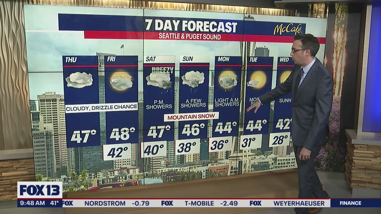
SEATTLE - Thursday will bring overcast skies and a few light showers over the northern Washington Cascades. We are tracking rain and snow set to arrive this weekend, bringing rain to the lowlands and heavy snow to the mountains.
Thursday will be much cloudier than yesterday, with highs in the mid 40s and some patchy drizzle in spots. Friday's weather looks very similar with mostly cloudy skies and a few more sunbreaks.

On Saturday, a strong weather system will sweep through the area bringing breezy wind, lowland rain, and mountain snow. The best chance for heavy precipitation will be on Saturday night into early Sunday morning.

While rain totals will be between .25-.50" in the lowlands, the Cascades will get hammered with 12-24" of snow through Sunday night. Convergence zone areas will have closer to 24" with more widespread totals around one foot.

Temps will be noticeably cooler early next week as a cold air mass pushes into the Northwest. This may bring the coldest temps we've seen since the winter break. Temps will drop below freezing for most spots Monday night, but we will run out of moisture, so I don't expect any widespread lowland snow as a result.

Starting Tuesday, the cool temps will also be joined by sunny skies. The ridge of high pressure will nudge back over the Northwest late next week raising temps back closer to average.
