

Seattle weather: 2nd consecutive day of record heat
Seattle weather: record heat on the way
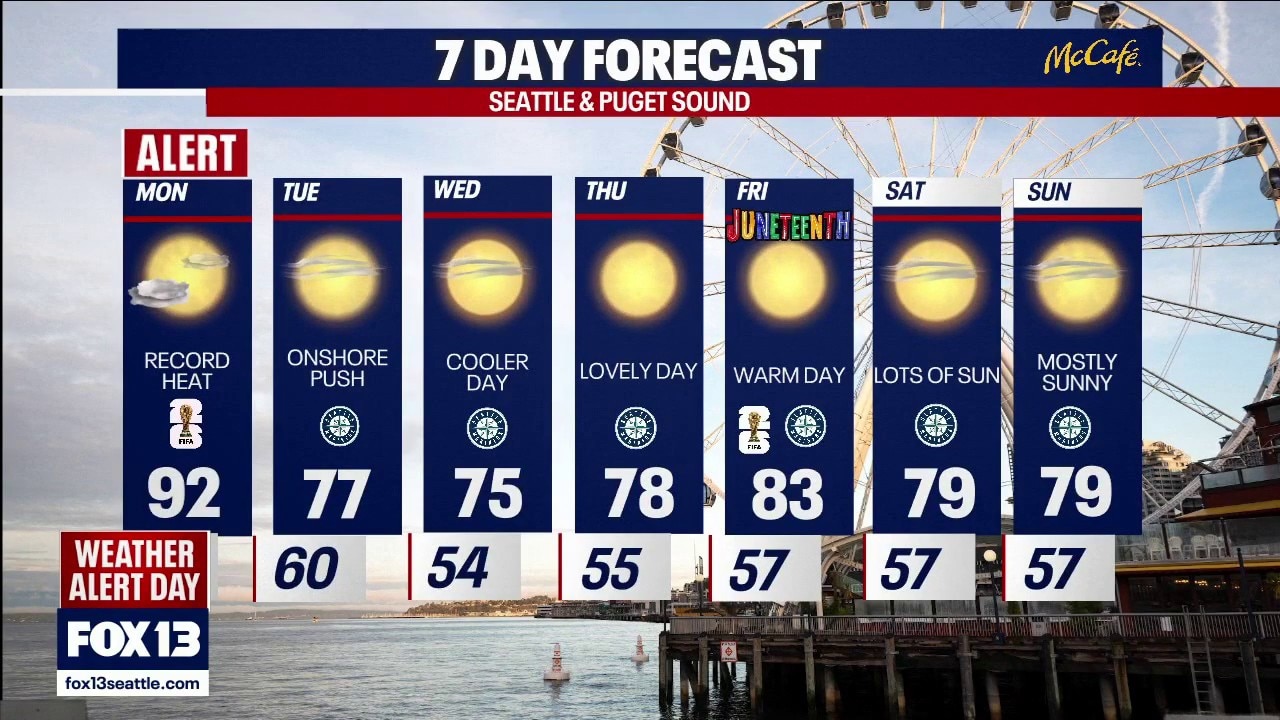
FOX 13 meteorologist Ilona McCauley has your seven-day forecast.
Seattle - Many spots around Western Washington tied or broke records on Sunday. We will see more record heat for the second consecutive day on Monday. The record high at Sea-Tac is 88 degrees, which has stood for more than 60 years. Some locations will even warm into the upper 90s by Monday afternoon. This will be the hottest day we have seen so far this year. The Heat Advisory will remain in effect through 5am Tuesday.

Hottest day so far this year. Record heat around much of the region on Monday.
Whether you are heading out to Monday's FIFA match, or to the many watch parties around the area, be prepared for the heat. Be sure to stay hydrated and take breaks in the shade if possible. Light colored, loose-fitting clothing will be a good choice for Monday.

A few clouds, and hot afternoon temperatures for Monday's match in Seattle.
Throughout the day, Monday, we will begin to see some clouds increasing as the onshore flow picks up during the day. While the coast will be cooler on Monday, it will take time for the cooler, marine air to filter into the Puget Sound lowlands.

Onshore flow will increase during the day Monday with more clouds by the evening.
Temperatures will feel far more comfortable throughout the rest of the week. We will see a brief warm up on Friday for Seattle's next FIFA match featuring Australia and the USA!

Cooling off by Tuesday with another brief warm up on Friday.
The Source: Information in this story comes from the FOX 13 Seattle Weather Team.