

Seattle Weather: Morning showers, breezy winds and cooler Sunday
The heaviest showers with this weekend's storm system will be overnight into early Sunday morning. We will slowly see showers decrease throughout the day as the upper level low moves eastward.
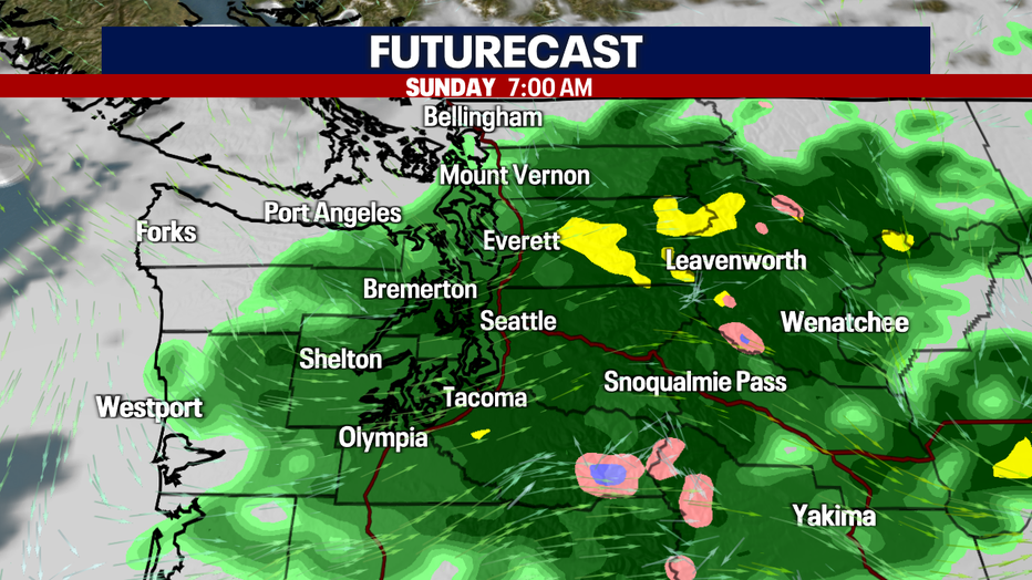
The heaviest showers with this weekend's storm system will be overnight into early Sunday morning.
Winds will start to pick up Sunday morning as the system moves through western Washington, with the strongest winds in the south sound. Wind gusts are forecast to stay mainly below 30 mph and will slowly decrease into Sunday evening.
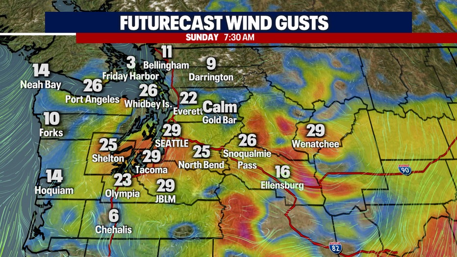
Wind will start to pick up Sunday morning as the system moves through western Washington, with the strongest winds into the south sound.
Sunday will be a cooler day with highs only reaching the mid to upper 60s. Highs will be almost 10 degrees below seasonal average for Seattle. We will start to see unbreaks into the afternoon and the skies will slowly dry out.
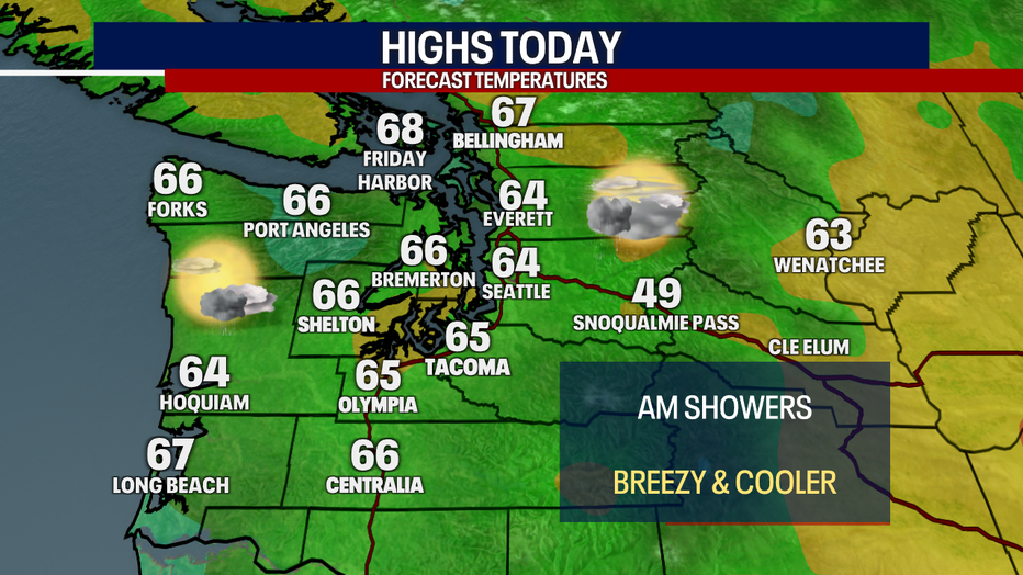
Sunday will be a cooler day with highs only reaching the mid to upper 60s.
Monday will be dry with a few sunbreaks and slightly warmer temperatures. Highs will slowly warm into the middle of next week as high pressure starts to build again, bringing more sunshine and temperatures into the upper 70s to low 80s.
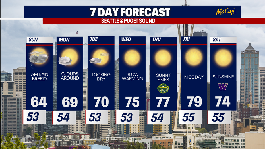
Monday will be dry with a few sunbreaks and slowly warming temperatures into the middle of next week.