

Seattle weather: Near-record warmth today, more rain, wind ahead
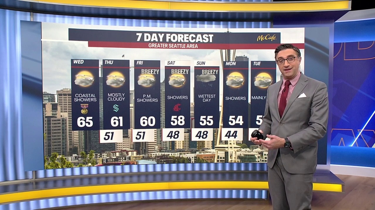
Seattle weather: Strong coastal winds, record warm temperatures
Seattle weather: Strong coastal winds, record warm temperatures
SEATTLE - After a very mild start to Wednesday, temperatures are expected to climb into the 60s this afternoon.
A warm front that moved through the region Tuesday has ushered in an unusually mild air mass. Some locations could challenge daily high-temperature records.
Winds will remain breezy to windy along the coast and across the North Interior, but conditions should gradually ease later this afternoon and evening. Tonight will be mostly cloudy and dry with mild temperatures overnight.
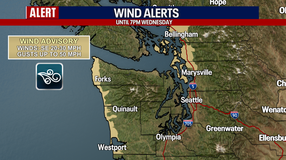
A Wind Advisory in effect for the coast and north interior starting 1pm Tuesday through 7pm Wednesday. evening. (FOX 13 Seattle)
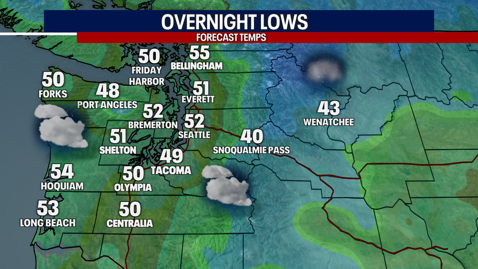
Mostly cloudy skies are expected Wednesday night in Western Washington. (FOX 13 Seattle)
Quiet Thursday, rain returns again Friday
Big picture view:
The stalled cold front will remain offshore into Thursday. That means another day with occasional light rain near the coast and Olympic Peninsula, while most inland communities stay mainly dry.
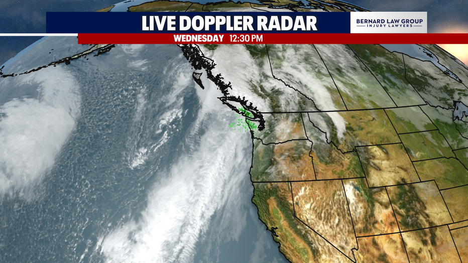
A weather system will stall off the Washington Coast through Thursday. (FOX 13 Seattle)
The next system approaches Friday. A front will push onshore during the day, bringing another round of widespread rain and breezy conditions. This will not be a big soaker for us, but it will usher in the start to a stormy weekend.
Friday’s storm will also generate large waves offshore. Seas of 20 feet or higher are expected to reach coastal waters again by Friday night, creating hazardous surf conditions along the coast.
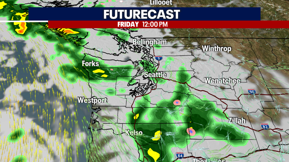
Rain and wind returns to Western Washington on Friday. (FOX 13 Seattle)
Another potent system targets the weekend
What's next:
Friday's system will be followed by another round of rain and wind Saturday night. This second system has a better potential to produce stronger winds, particularly along the coast. It will also bring heavier rain.
The Weather Prediction Center has highlighted a large part of the Olympic Peninsula for a marginal risk of excessive rainfall from Saturday morning into Sunday morning. That means locally heavy rainfall could create landslides and flooding concerns, especially in areas that receive constant rain.
Showers will continue behind the front Sunday, keeping the weekend soggy for much of Western Washington.
Next week is looking drier by Tuesday and Wednesday.
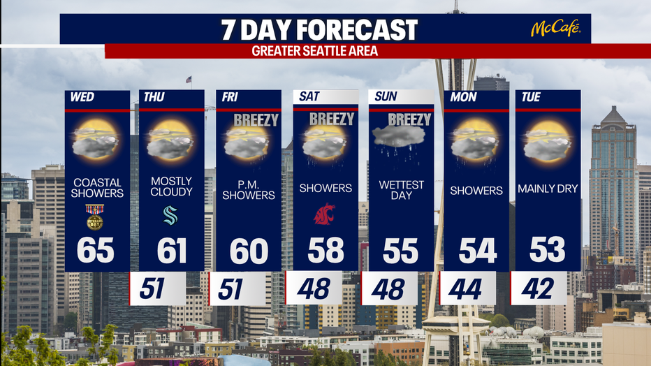
Wednesday and Thursday will dry out and warm up in Seattle before the next round of storms. (FOX 13 Seattle)
MORE NEWS FROM FOX 13 SEATTLE
Boeing layoffs: 5% of staff cut as company 'resets pace of production'
Seattle Public Schools authorizes legal action against transgender school sports ban
15-year-old found dead during Cle Elum arrest operation
Family of gas station manager killed in Seattle speaks out on loss
Fed up with delivery costs, Seattle restaurant owner starts his own service
To get the best local news, weather and sports in Seattle for free, sign up for the daily FOX Seattle Newsletter.
Download the free FOX LOCAL app for mobile in the Apple App Store or Google Play Store for live Seattle news, top stories, weather updates and more local and national news.
The Source: Information in this story comes from weather models interpreted by the FOX 13 Seattle weather team.