

Seattle weather turns cool with Saturday thunder chances
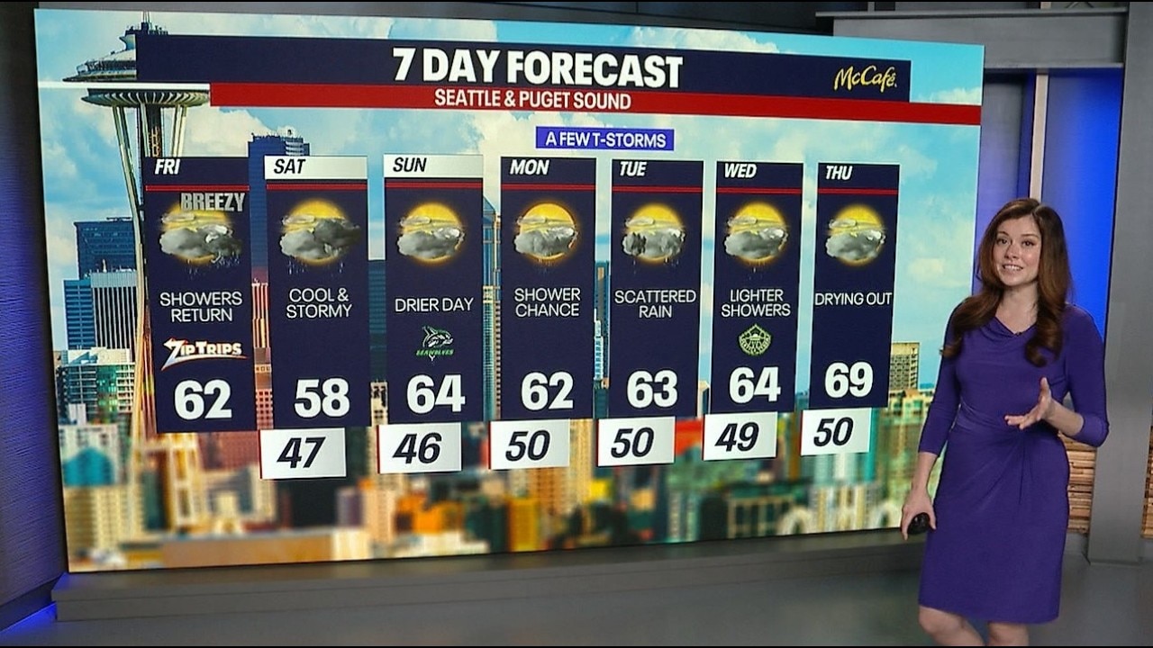
Today brought mostly cloudy skies, a cool breeze and temperatures that struggled to climb out of the lower 60s across much of western Washington. A few isolated showers developed during the day, but many neighborhoods stayed largely dry. Our weather team has been watching for isolated thunderstorms.
Thunderstorms possible in western WA this weekend
The bigger forecast change arrives Saturday as an upper-level disturbance swings through the region. Rain chances will increase somewhat, and scattered showers could be accompanied by a few thunderstorms during the afternoon and evening hours. While a few storms may produce brief downpours, small hail, or gusty winds, the activity is expected to remain spotty rather than widespread. Because of that hit-or-miss nature, no formal weather alert has been issued at this time. Still, anyone with outdoor plans should stay weather aware and be prepared to move indoors if thunder is heard.

Seattle weather will not be a washout, but stay ready to head indoors quickly if thunder develops. (FOX 13 Seattle)
Saturday’s unusually cool pattern could also make it one of the coldest June 6ths on record at Seattle-Tacoma International Airport, with highs likely remaining well below average.

Seattle weather turns somewhat drier Sunday with highs climbing back into the middle 60s. (FOX 13 Seattle)
Conditions will improve on Sunday as showers taper off and temperatures recover into the middle 60s. Another weak disturbance may bring isolated showers and a slight chance of thunderstorms again on Tuesday before rain chances gradually diminish through the second half of the week. By Thursday, drier weather is expected to return with fewer showers overall.

Seattle weather gradually dries out next week, although another isolated round of showers and thunder could return Tuesday. (FOX 13 Seattle)
Take good care,
Meteorologist Abby Acone and the FOX 13 Weather Team
The Source: Information in this story comes from the FOX 13 Weather Team.