

Seattle Weather: Scattered Showers & Mountain Snow to Start Week
Seattle - A chilly, damp night ahead for Western Washington. Cold air pushed in behind this afternoon's front keeping our lows in the 30s in many spots tonight.
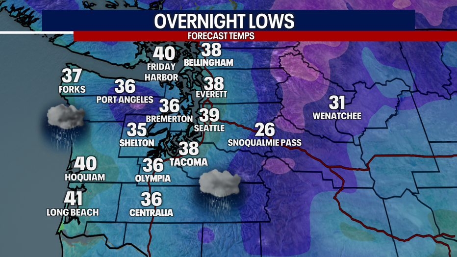
A chilly night across Western Washington with lows dipping into the 30s.
Snow levels will remain low overnight with our Cascade passes picking up more snow overnight. Travel will continue to be difficult well into Monday. Cold, unstable air will keep scattered showers and even a possible isolated thunderstorm in the forecast in the lowlands tomorrow.
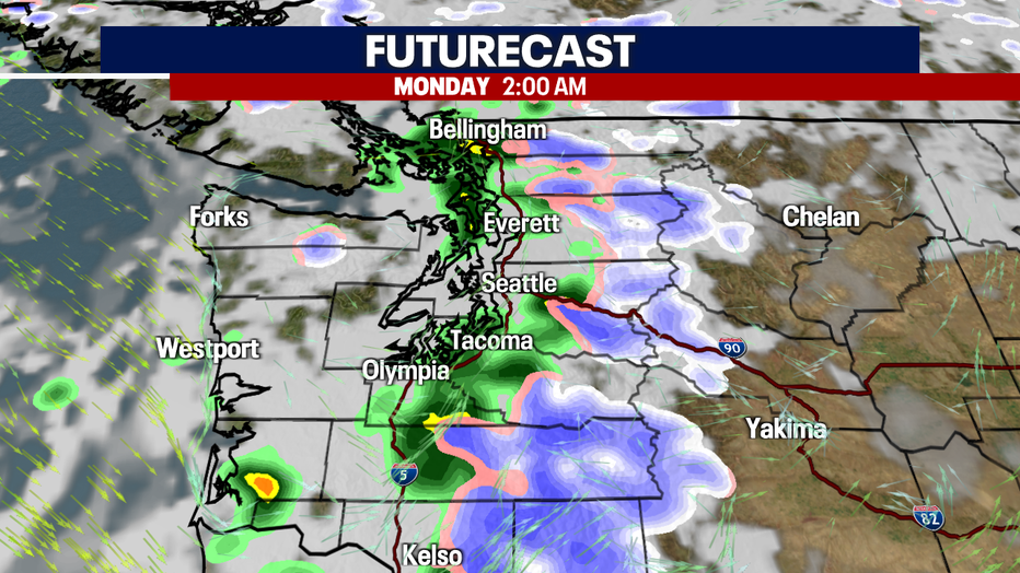
Scattered showers overnight with more heavy snow overnight. (FOX13 Seattle)
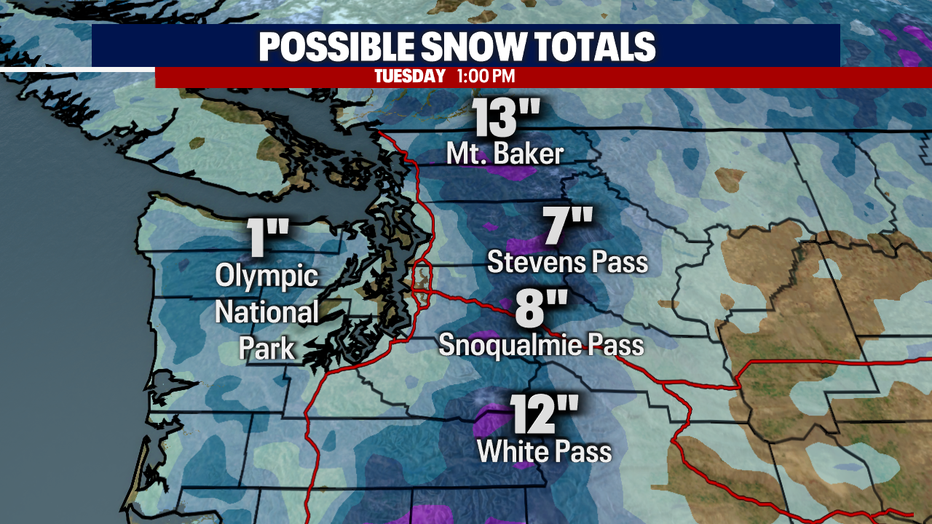
If you can avoid traveling over the passes tonight, it is advised. Heavy snow will fall into Monday morning with reduced visibility and some slick roads. A Winter Storm Warning will remain posted till late Monday morning. Some locations may see an additional foot of snow, especially around Stevens Pass where a convergence has been set up most the day.
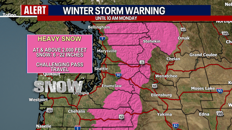
The Winter Storm Warning continues overnight in our Cascade Passes.
The heavy snow will continue to fall overnight with totals nearing an additional foot.
Keep your warmer coats around as Monday will be cool with highs below normal only warming into the 40s.
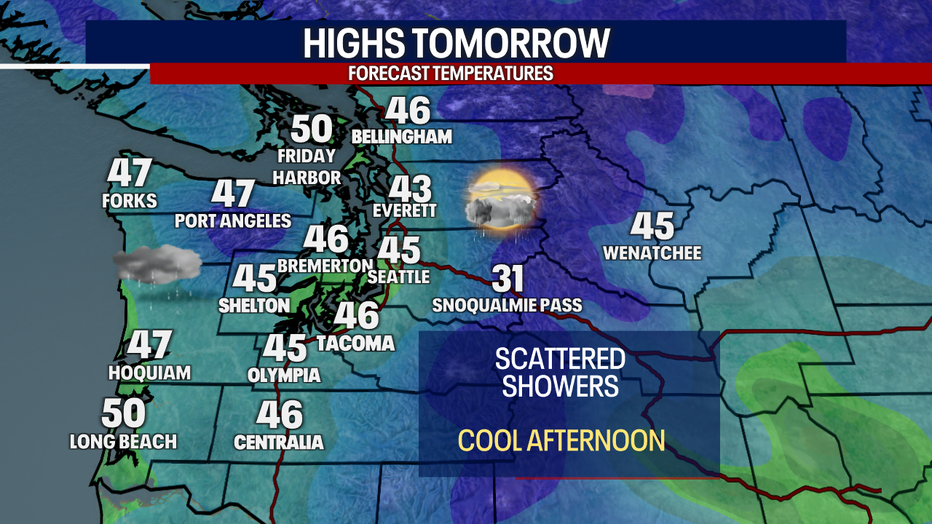
Another cool day is forecast for Western Washington on Monday.
Western Washington is bracing for another stormy evening on Tuesday as a strong area of low pressure moves onshore. This will bring windy conditions to our foothills and Cascade gaps. Rain will again be widespread in the lowlands with another round of mountain snow.
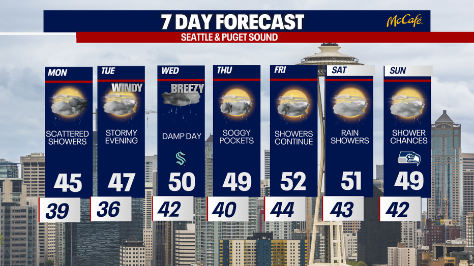
Rainy, breezy weather is forecast in Seattle this week.