

Some parts of Western Washington wakes up to snow; sun and warmer temps ahead
Parts of Western Washington saw snow Thursday morning
Some neighborhoods saw light snow early Thursday and temperatures will be a little warmer later in the day.
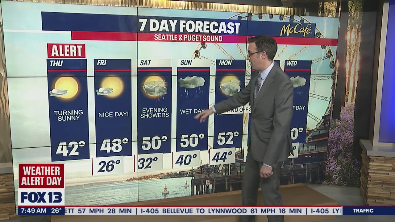
SEATTLE - A weak system early Thursday brought just enough snow to Western Washington to make for a messy morning commute. The sun is back today and streets will thaw by late morning.
Snow has pushed south into Oregon this morning, but the damage has been done. It took less than an inch of fluffy powder to make things very icy on the roads this morning around the Puget Sound area.

Later this morning, most areas will be under mostly sunny skies with warmer afternoon temperatures in the low 40s.

Friday will bring another very chilly morning with overnight lows in the 20s, however the afternoon looks warmer with sunshine and highs in the upper 40s and low 50s. It should be a very nice day.
The next wet system arrives on Saturday morning for the Washington Coast. Widespread precipitation will push inland through the day bringing rain to the lowlands and snow to the mountains.

As showers continue through early next week, the snow will pile up at the ski resorts. We could see 1-2+ feet over the Cascades through Tuesday evening.

For the lowlands, it will be a wet start to March after an extremely dry February. Temperatures will be close to average for this time of year in the low to mid 50s.

MORE FROM FOX 13 WEATHER:
DOWNLOAD: FOX 13 Weather and News Apps
WATCH: Forecast and Radar
READ: Closures and Delays
CHECK: Latest Weather Alerts and Live Traffic Map
INTERACT: Submit your Weather Photo
DAILY BRIEF: Sign Up For Our Newsletter
FOLLOW: Lisa Villegas, Erin Mayovsky, Brian MacMillan, Abby Acone and Scott Sistek