

Slightly damp and unsettled pattern in Seattle

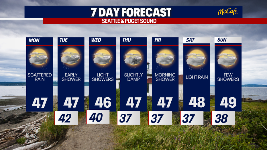
Seattle weather: Scattered rain, daily rounds light mountain snow
Seattle weather: Scattered rain, daily rounds light mountain snow
After enjoying a lovely weekend of weather, we're returning to regularly-scheduled programming with cloudier skies and the chance for scattered rain today.
Today will be remembered as cloudy with times of wet weather. The rain will mostly be focused in the South Sound and in Southwest Washington, but some showers could drift as far northward as the Kitsap Peninsula and Snohomish and Skagit Counties.
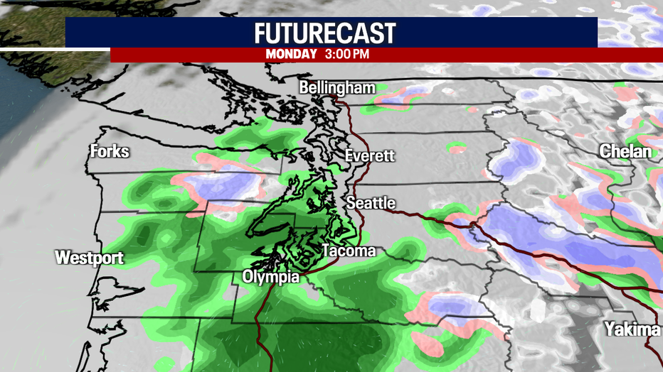
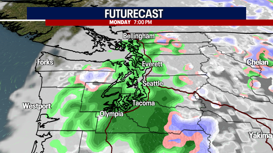
Pack a rain jacket and wear waterproof shoes today!
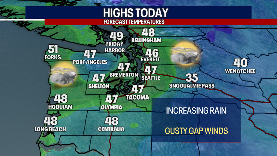
Highs will reach the mid to upper 40s for most. For some perspective, our average high at Sea-Tac Airport today is 49 degrees. Some of the Cascade "gap" communities (e.g. North Bend and Enumclaw) could be breezy today with gusts in excess of 30-35 mph. However, the winds won't be strong enough to warrant any official wind alerts.
A light passing shower is possible early Tuesday along with mostly cloudy skies. Sunbreaks will reappear tomorrow afternoon.
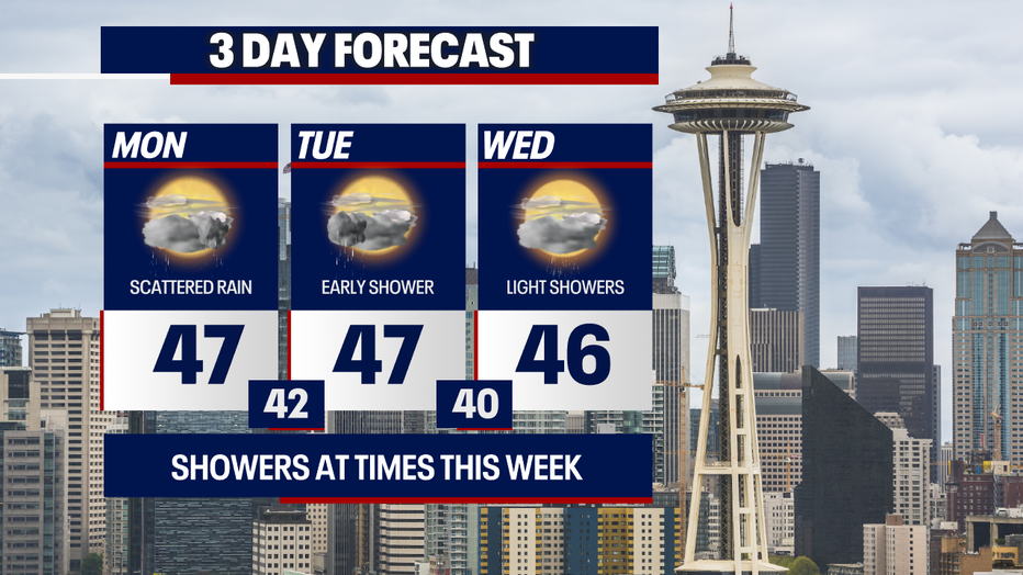
Slightly damp weather is on tap thereafter from Thursday to next weekend. We'll be alternating between spotty showers and glimpses of the sunshine for the next several days.
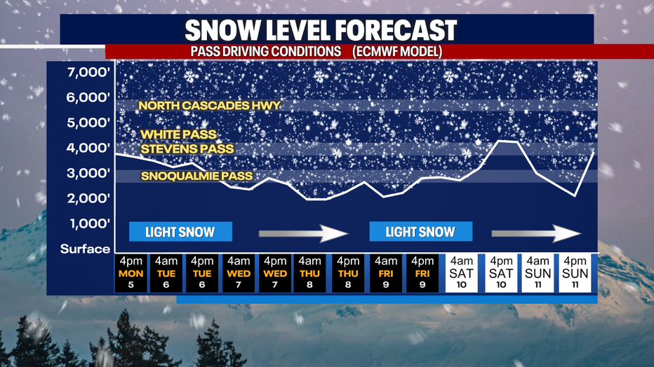
Snow levels remain somewhat low this week, hovering around the elevation of Snoqualmie Pass if not below that threshold. At least a few inches of snow are in the forecast daily this week over the passes. This is just enough to freshen up the ski slopes though the resorts could use much more. If you have plans to traverse the mountains this week, make sure to check WSDOT conditions before you go.
Take good care,
Meteorologist Abby Acone
Follow me on Facebook (Meteorologist Abby Acone), Instagram @abbyaconewx and TikTok @abbyaconetv