Seattle weather: Stormy weather ahead for Wednesday

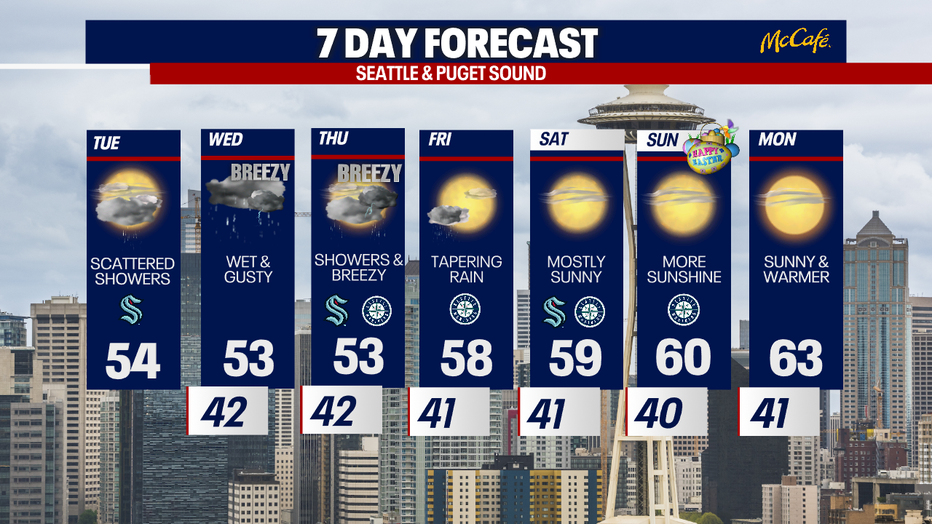
Tuesday to start cloudy with few showers
Tuesday will start cloudy with a few showers around. There will be more sunbreaks on Tuesday with rounds of light to moderate rain through the evening. Mountain snow for the higher mountain passes will continue.
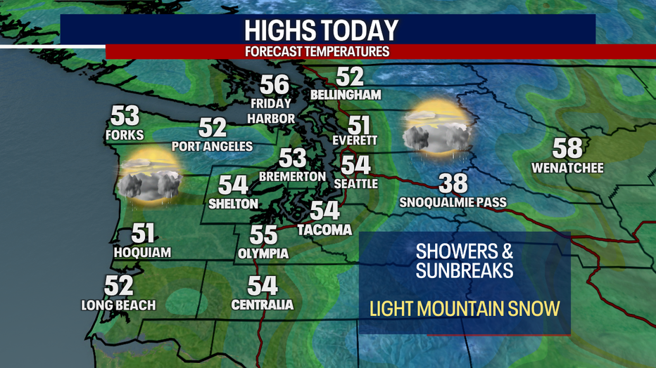
SEATTLE - Tuesday will bring scattered showers, clouds, and sunshine to Western Washington, with stormier weather set to hit early Wednesday morning.
More sunshine is expected in the mix Tuesday, especially in the afternoon hours and high temperatures will be slightly warmer than Monday. Puget Sound Convergence Zone showers may linger in Snohomish County through the afternoon.
The next storm system will hit early Wednesday morning, bringing widespread rain to the Western Washington lowlands, gusty wind at times, and additional snow to the mountains.
The heaviest rain will fall on the Coast and southwest side of the Olympic Peninsula. Winds will be breezy to gusty in some of the usual areas, but we are not expecting widespread power outages. The cold front will pass through midday leaving the Puget Sound area with on and off showers Wednesday afternoon and evening. We could see some isolated heavy downpours and a potential for thunderstorms Wednesday afternoon.
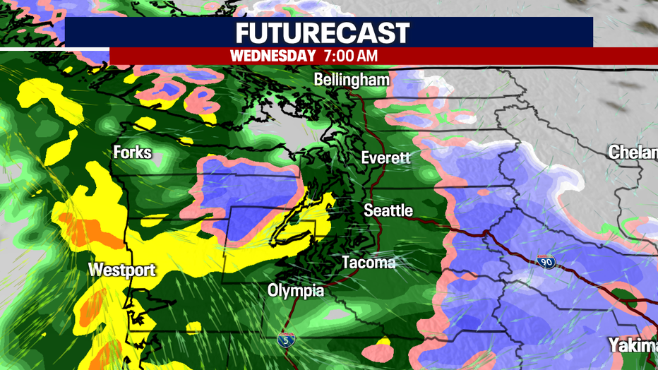
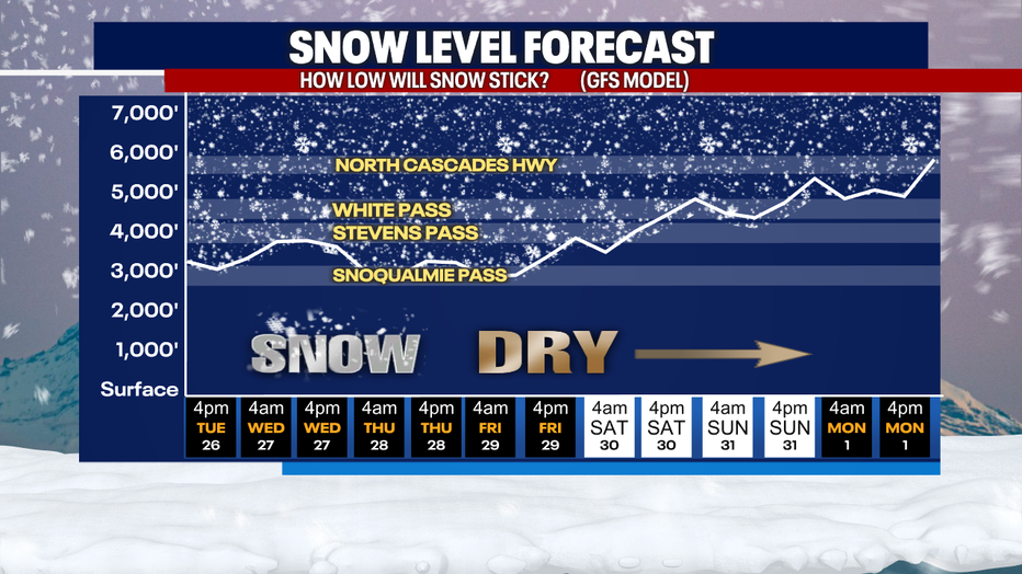
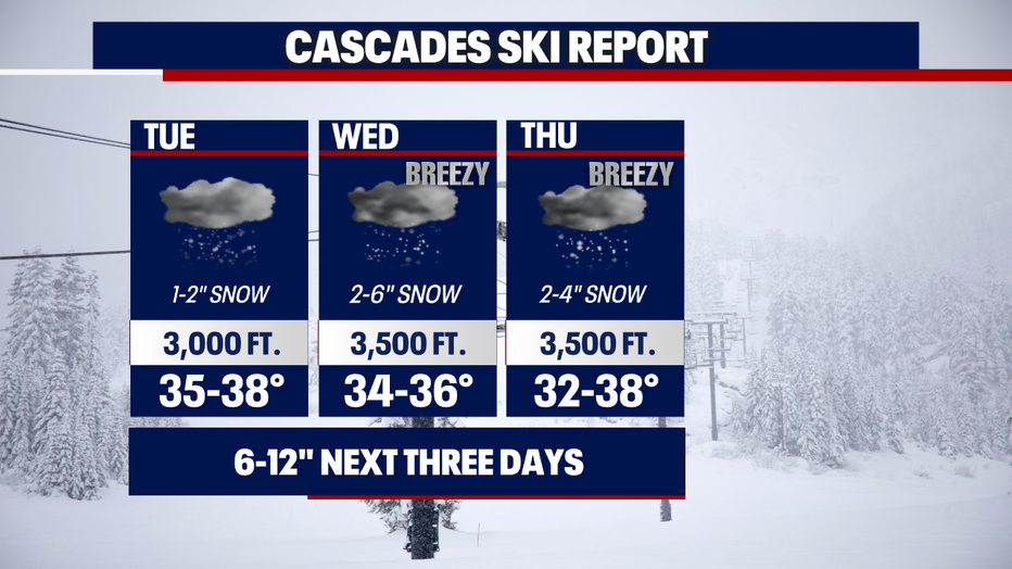
Snow levels will remain below White and Stevens Pass through Thursday, so expect snowy roads Wednesday and Thursday. Snoqualmie Pass will also be snowy at times.
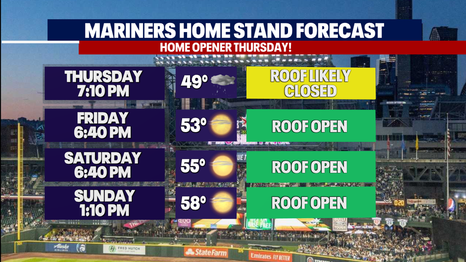
The Mariners will open their season against the Boston Red Sox this Thursday night. The roof will likely be closed for that game due to showers and it will also be cool, with temps in the upper 40s at first pitch.
After we get through Thursday's rain showers, high pressure will take over just in time for Easter weekend. Temps will be back into the 60s by Sunday and Monday.