

Seattle weather: Cold start to Thursday morning ahead of evening showers
Scattered showers to end out the week
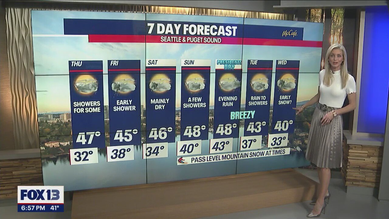
Temps will remain in the mid to upper 40s throughout the week, with Saturday seeing mainly dry conditions.
SEATTLE - Highs on Wednesday landed below average again. Seattle hit 47 at the National Weather Service office on Sandpoint Way while the Sea-Tac Airport only warmed to 44.

Get ready to layer up again as you head out the door tomorrow! We're looking at a frosty morning for sure.
Overnight, temps bottom out in the upper 20s to the south with near freezing for the metro area and slightly warm conditions to the north, in the mid-30s.
Overall, temperatures are cooler than the seasonal low norm of 38.

We'll start Thursday mainly dry, except the coast has a chance for a few light showers. Skies will remain mostly cloudy through the day as a weak front moves inland.

By the evening commute, showers spread from the west into Puget Sound. Areas to the south and north have the best chance for light showers.

Highs Thursday warm a few degrees above Wednesday's highs into the mid to upper 40s. The mountains will see temps climb into the mid 30s.

By late Thursday night into early Friday, rain stretches across portions of Western WA from the southwest coast into Seattle and up to the mountains where snow levels sit near 2,000 feet.

If you're keeping track of how much rain we have in the bucket at Sea-Tac, you know we're behind for the month so far and the year.
As of now, we only have 1.29" and that means we need another 2.47" to hit the average for the month of February. And as of Jan. 1 until now, we only have 4.38" which is well below where we normally are up to this point. (7.91")

Look for a few quick-moving early showers Friday, otherwise, skies clear out briefly for a partly to a mostly cloudy day. Highs are cool, near 45.

The weekend brings a chance for a few more showers in between dry periods. Highs hang in the mid to upper 40s under mostly cloudy skies.
By Presidents' Day, low pressure starts digging in bringing a chance for a more organized system to deliver widespread showers by the evening. Both highs and lows will land in the 40s.
Winds will become gusty at times with rain turning to showers by Tuesday.

The extended outlook gets a little interesting as cold air returns bringing temperatures back down to near freezing overnight with highs only near 40.
Snow levels drop as well and by Wednesday we're near 400ft. We may just see some snow flurries early Wednesday before drying out some. Stay tuned!
Have a great rest of the week all! ~Erin Mayovsky, FOX 13 Forecaster

*Coast Forecast

*Mountain Forecast

