

Christmas weekend forecast: Tricky pass travel Friday night into Saturday morning
Tricky travel over mountain passes
FOX 13 meteorologist Ilona McCauley has your Christmas weekend forecast
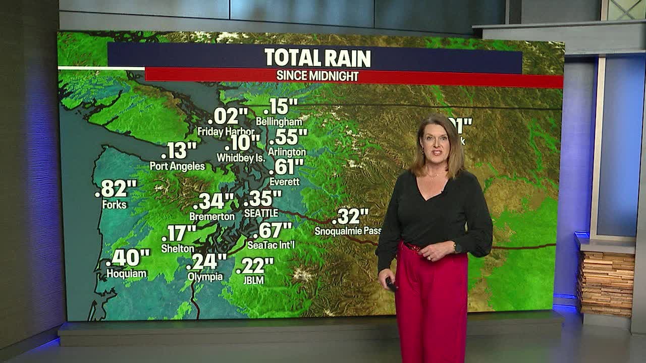
SEATTLE - A soggy day around much of Western Washington today with many spots picking up anywhere between .25" to .75" of rain. Snow in the passes made for tricky travel, with Snoqualmie Pass shut down for a period of time due to several spin-outs. Breezy winds through the pass also led to blowing snow, reducing visibilities down to around 0 miles at times.
Travel will remain difficult overnight into early Saturday morning.

Snowfall was heavy at times along I-90 as the convergence zone was set up along the interstate.

By early Saturday morning, the convergence zone is forecast to move northward into Snohomish County. This will increase snow chances along US2 and lowland rain around Everett. It will dissipate by late morning and much of Saturday is largely looking dry and pleasant.

As we look ahead to the Christmas holiday, another system drops in increasing rain chances by Monday night around Puget Sound and also could mean another round of mountain snow.

Much of the extended forecast is looking wet as a series of atmospheric rivers are set up to bring rain to the area.
