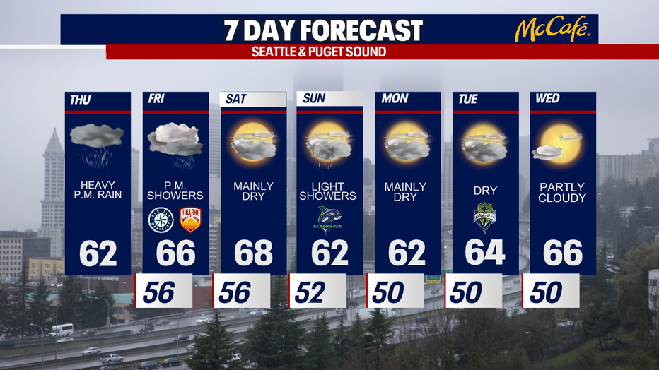
Unusual heavy June rain pounds Western Washington Thursday

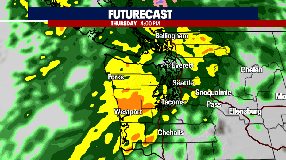
Heaviest rain will arrive Thursday afternoon, evening
This atmospheric river will move through the area through Thursday night, bringing heavy rain at times to the coast, Puget Sound area, and the Cascades.
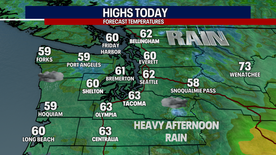
SEATTLE - Steady widespread rain will pick up in intensity Thursday afternoon as an unusually wet system pounds the Pacific Northwest.
This atmospheric river will move through the area through Thursday night, bringing heavy rain at times to the coast, Puget Sound area, and the Cascades. High temperatures will remain cool today, only topping out in the low 60s.
The heaviest rain will arrive Thursday afternoon and evening. Everett and Seattle (and surrounding areas) could get some protection from the rain shadow of the Olympics, with areas in the north sound and south sound likely getting hit harder.
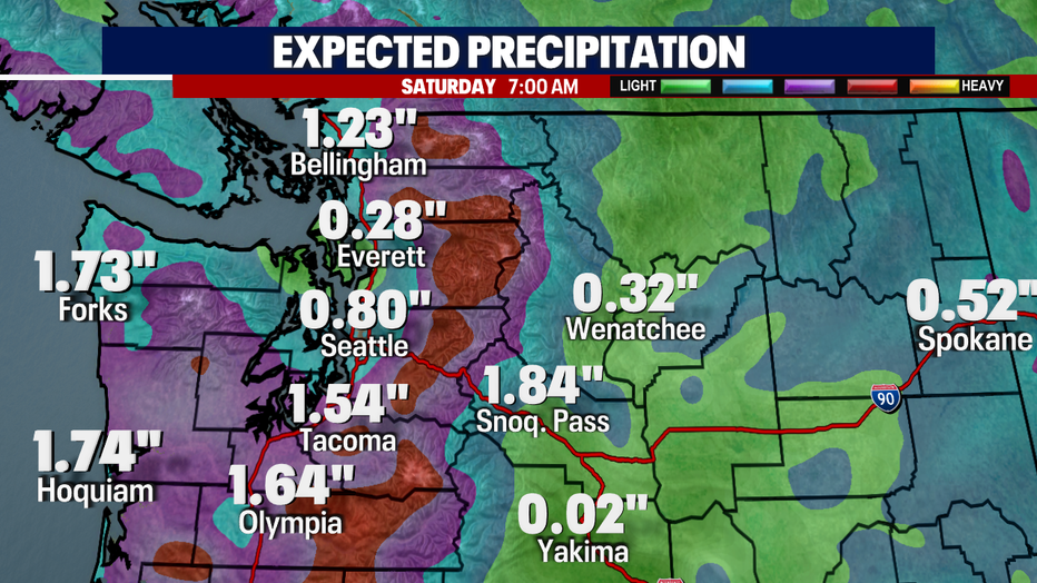
After today and tonight's rain, another band of showers will roll through on Friday afternoon and evening. In all, the south and north sound areas could see 1-1.5" of rain, while Snohomish and King counties could see 0.50-1" of total rain through Saturday morning. We will be keeping an eye on area creeks and rivers, but we are not expecting widespread flooding from this event.
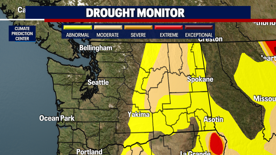
There is some good news today. The new drought monitor maps came out from the Climate Prediction Center. For the first time since March 2020, there are no areas of Eastern Washington in the "severe" drought category.
This weekend's forecast has improved, with only a few light showers expected on Sunday. Next week will be slow to warm, but should stay dry with highs in the 60s.