

Seattle weather: Warmer and mainly dry the rest of the week
Temps in the upper 60s as rain returns this week
FOX 13 chief meteorologist Lisa Villegas and forecaster Erin Mayovsky have the latest weather conditions.
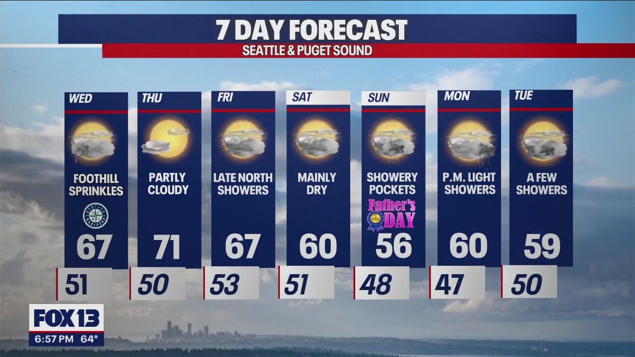
SEATTLE - A cool Tuesday with highs only in the mid to upper 60s instead of the low 70s. SeaTac hit 66 at the airport with warmer highs to the south.

Overnight expect cloudy skies with temperatures in the upper 40s to low 50s. Some areas, like the Coast, North Sound, and Foothills may see a little drizzle.

After a little drizzle Wednesday morning we'll transition back to fewer clouds and slightly warmer highs.

Highs Wednesday will run a few degrees warmer than Tuesday, but still fall short of average for the metro area. We're forecasting 67 for Seattle.

Thursday is the best day of the week to get out and enjoy our late Spring sunshine as highs land near our seasonal average of 71 for this time of year.

We're mainly dry Friday, but showers are on the way. Look for rain to move into the North Sound late Friday night. Highs cool Friday into the upper 60s.

Father's Day weekend features unseasonably cool highs in the mid 50s to near 60. Brr! These temperatures will feel more like early spring.
Saturday: Just a few lighter showers with highs near 60. This is the better day of the weekend.
Father's Day: Cloudy, cool, and showery at times. Highs only warm into the mid to upper 50s. Enjoy!
Have a great rest of the week all! ~Erin Mayovsky, FOX 13 Forecaster

*SeaTac Rain Almanac

*Coast Forecast

*Mountain Forecast

*Central WA Forecast
