

Seattle weather: Warmest day Saturday, highs in the 70s & 80s
Summer-like temperatures this weekend
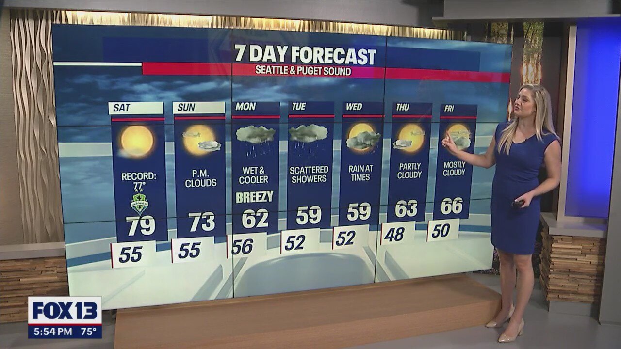
Near-record temperatures are expected the next two days with highs in the mid to upper 70s. Friday's daily record is 78 degrees (2014), Saturday's record is 77 degrees (2022).
Above average high temperatures around the Western Washington with highs in the 70s and 80s! After some areas of dense morning fog, the sunshine has returned for another summer like afternoon.

Tonight, skies will remain clear and mild after the warm day, overnight lows dropping into the mid 50s. A few areas of patchy dense fog Saturday morning, but not as widespread as the last few mornings.

High pressure remains dominate and moves onshore, with peak temperatures on Saturday. Highs will warm 1-5 degrees warmer than what we saw on Friday.

The warmest spots will be in the foothills and the southwest interior, with highs topping out in the upper 70s and low 80s.

We could see some record high temperatures for the PNW Saturday. Highs Friday were just below a record for SEA, but Saturday we are looking at breaking the record.

Clouds will increase Sunday as low pressure starts to move in along the coast. The upper-level low will bring more rain, wind and cooler temperatures for the start of the work week.
Looking past Monday and Tuesday, a few showers linger Wednesday, but most of the showers will move out and we could see some drier conditions to end the week.
