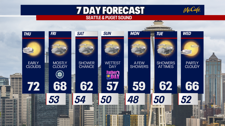
Seattle weather: Warming temps and more sunshine Thursday

Mainly dry before rain returns this weekend
By Friday afternoon you'll start to notice a change. Low pressure starts to make its way towards Western WA from the northwest increasing cloud cover and opening the door again for a chance of showers to return.
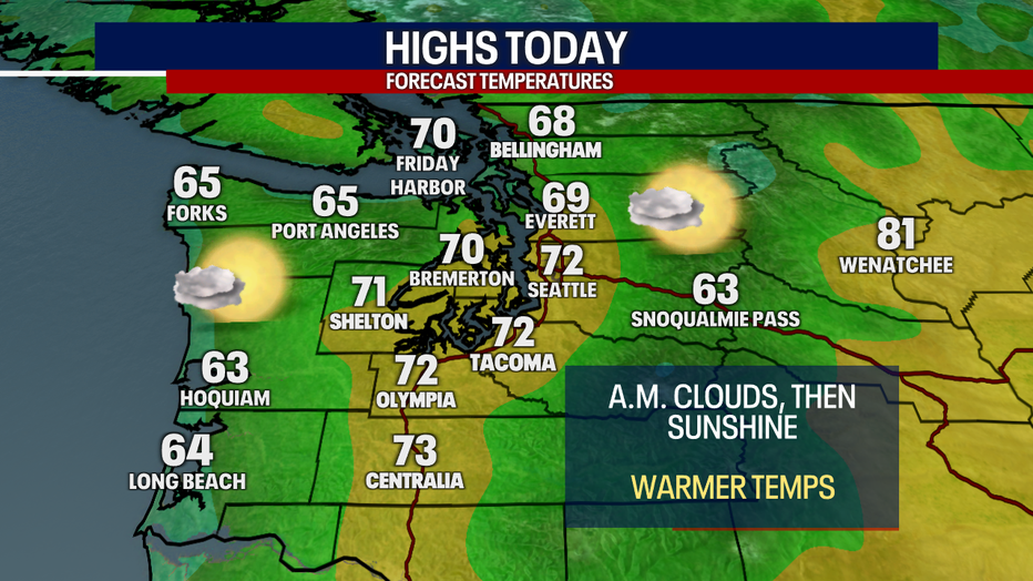
Seattle - An upper level ridge of high pressure will warm temps back into the 70s Thursday with increasing afternoon sunshine.
Expect morning clouds and afternoon sunshine Thursday with temps back close to average for this time of year. This will be the warmest day of the next week.
A shift in the weather pattern starts Friday as a weak cold front pushes through the area. This will bring mostly cloudy skies to Western Washington on Friday and a chance for some light showers Friday evening into Saturday morning.
The best chance for rain arrives on Sunday, where on and off showers are expected. In the mountains, snow levels will be dropping to around 4,500 feet. While most of the passes will be looking at just cold rain, some of the higher passes could see some snow.

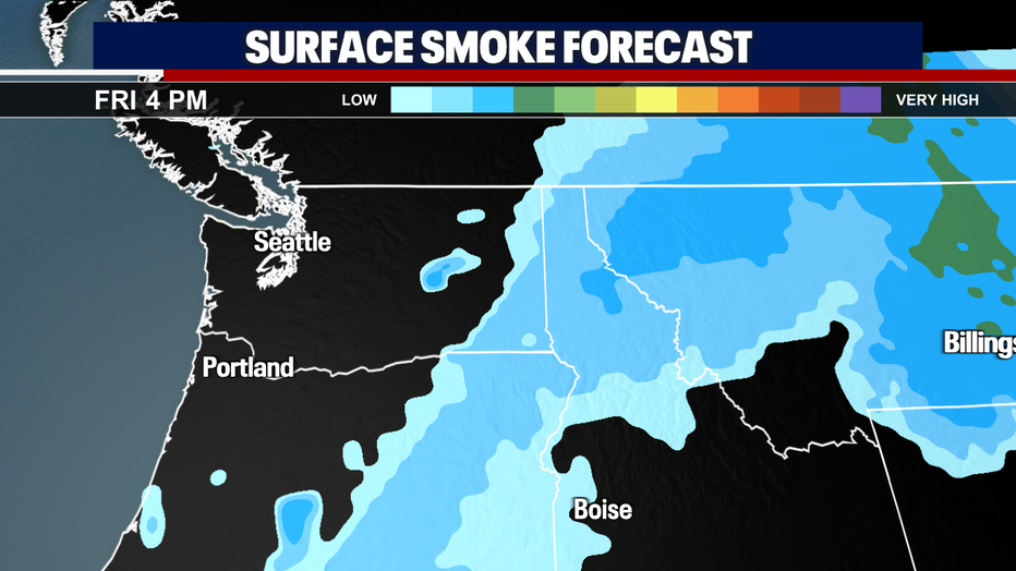
Surface smoke from Canadian wildfires will continue to stay east of the Cascades over the next few days as a westerly flow develops. Winds will push smoke out of the state by Saturday morning.
After a wet day Sunday, we'll be left with a few scattered showers Monday and Tuesday. Temps will slowly warm next week and drier weather should arrive by Wednesday.