

Weather Alert: Excessive Heat Warning for Washington state with record triple digit heat

Over 100 degrees expected by Sunday, Monday
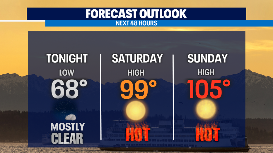
Heading into the weekend, be sure to take extra care of the pets as Western Washington will see nearly 109 degrees by Sunday and Monday.
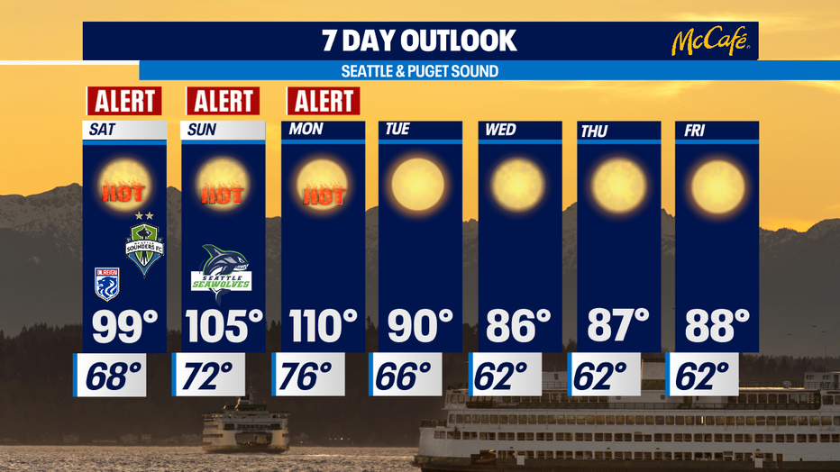
WASHINGTON - A historic weekend is on tap for the Northwest as the all-time record highs will be shattered with temperatures peaking Sunday into Monday!
Overnight low records could be broken as well with temperatures dropping into the low to mid-70s. Those lows will reflect our average seasonal highs for this time of year at 73-74 degrees. Normal overnight temps should land in the mid-50s this late in June.
RELATED: Tips for pet owners ahead of Washington's heatwave
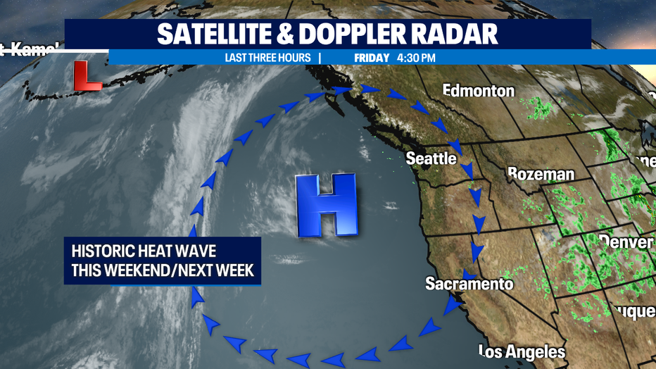
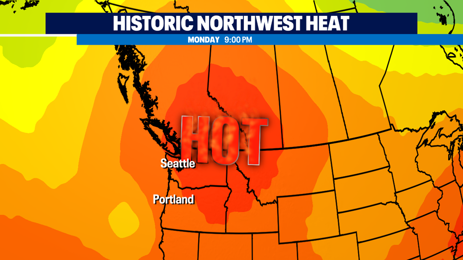
This all thanks to a very strong ridge of high pressure that will slide east of the region this weekend, creating a dome over the area. Temperatures at the coast will peak Sunday and then marine air will start to flow in over the beaches.
Fog and a marine layer will develop along the coast, but inland a thermal trough will remain in place and folks up and down the I-5 corridor will see temperatures spiking to an all-time record high. The mercury will land between 100-106 for most of Sunday with extreme heat Monday as temps soar between 106-112 for many spots.
This unusual early Summer heat wave will be especially difficult for those who already suffer from heat-related illnesses. Please remember we are all in this together and be sure to check on those who will need extra help trying to beat the heat. And don't forget about our furry friends the asphalt and concrete can scorch paws in a matter of minutes!
RELATED: 63 degrees atop Mt. Rainier!? Heat wave to bake the mountains, too

Have a safe weekend all! Stay hydrated and use plenty of sunscreen.
Q13 FOX WEATHER RESOURCES:
DOWNLOAD: Q13 Weather and News Apps
WATCH: Forecast and Radar
READ: Closures and Delays
CHECK: Latest Weather Alerts and Live Traffic Map
INTERACT: Submit your Weather Photo
FOLLOW: Lisa Villegas, MJ McDermott, Tim Joyce, Erin Mayovsky, Grace Lim and Scott Sistek