

Colwash Fire in Yakima County, WA, grows over 20K acres overnight
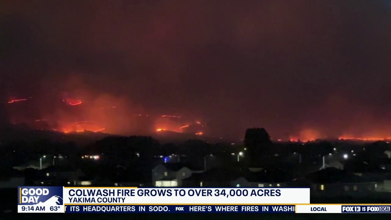
Multiple wildfires spread in Washington state
Wildfires are burning across Washington state, forcing evacuations in some counties. The Coal Wash Fire in Yakima County has scorched over 34,000 acres with zero containment, while crews battle several other wildfires near Snoqualmie Pass and Chelan County.
YAKIMA COUNTY, Wash. - A fire that began as a 25-30 vegetation fire in Yakima County on Saturday morning has ballooned to over 38,000 acres in a little over 24 hours.
The Colwash Fire, which is currently listed at 38,798 acres and 0% containment, has prompted Level 3 evacuation orders for residents in Yakima and Benton counties.
In Benton County, residents east of the county line, south of State Route 22, south and west of State Route 221, and north of Sellards Road should leave immediately, as this area faces imminent danger.
In Yakima County, residents in the area near Highway 22 from Glade Road to the county line, including Byron Hill Road, should also leave immediately.
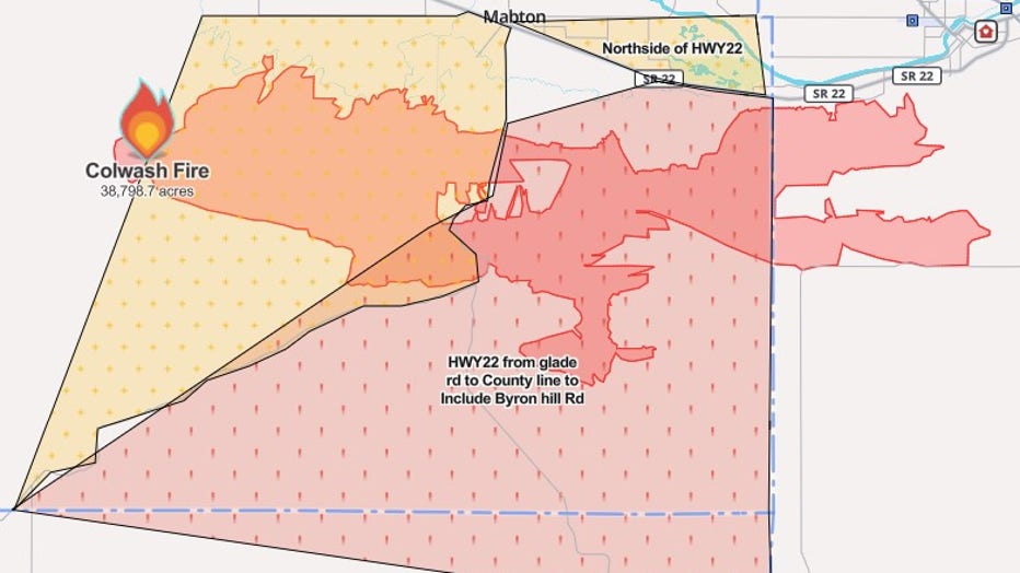
Colwash Fire more than quadruples in size in less than 24 hours
Timeline:
According to updates on Watch Duty, fire crews were at the scene of a 25–30 acre vegetation fire around 8:40 a.m. near the city of Mabton.
About four hours later, at 12:28 p.m., it was reported by the National Interagency Fire Center that it had grown to 700 acres.
The first Level 3 evacuation order was posted about three hours later at 3:44 p.m.
Officials said at 4:46 p.m. that the fire had begun to approach power lines, which prompted a second alarm response.
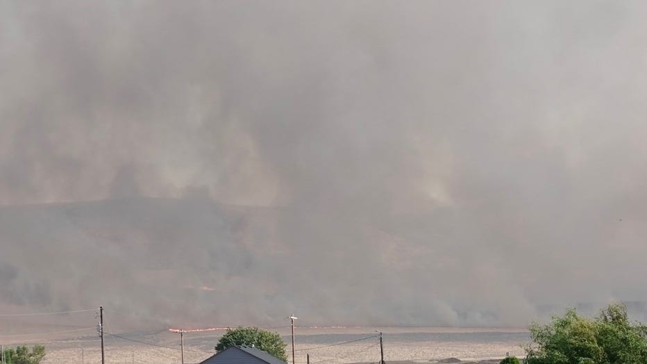
Anonymous user submitted photo showing the Colwash Fire approaching power lines and structures. (Watch Duty)
At 5:24 p.m., the fire had grown to about 4,000 acres.
Around 6:30 p.m., the fire had begun approaching Lincoln Road in Benton County, which caused law enforcement to shut down Sellards Road, beginning from Bert James Road and extending to the county line.
Around 7:52 p.m., the fire had doubled to 8,000 acres. The State Emergency Operations Center at Camp Murray was activated to "help coordinate state assistance."
The next acreage update was made at 11 p.m., which stated that the fire had grown to 34,733 acres.
Just after 1 p.m. on Sunday, the fire had grown to 38,798 acres.
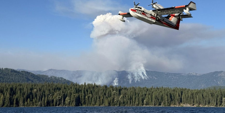
Here's where fires in Washington state are burning
The latest information on active and fully contained wildfires burning in Washington state.
Evacuation orders, shelters
What we know:
Benton County Emergency Services posted this map to social media around 9 p.m. on Saturday, which shows a more enhanced visual representation of the area under evacuation orders.
The agency also said a Red Cross shelter is set up at Prosser High School, 1500 Paterson Road.
Additionally, the Yakima County evacuation map can be found here.
The Source: Information for this story came from Watch Duty and social media updates posted by agencies in Yakima and Benton counties.
MORE NEWS FROM FOX 13 SEATTLE
1 dead, 3 injured in I-5 crash involving WA trooper
Family says crook stole $50K Nintendo collection in Pierce County
How to watch Seattle Seahawks preseason game against Tennessee Titans on FOX 13
Here's where fires in Washington state are burning
Tesla recalls nearly 3M vehicles over doors that may be difficult to open after crashes
To get the best local news, weather and sports in Seattle for free, sign up for the daily FOX Seattle Newsletter.
Download the free FOX LOCAL app for mobile in the Apple App Store or Google Play Store for live Seattle news, top stories, weather updates and more local and national news.