A cool and showery Mother's day across the Pacific Northwest
Seattle - Cool and showery conditions continue to be our theme. We only saw 55 at the airport today and that's 10 degrees below average.
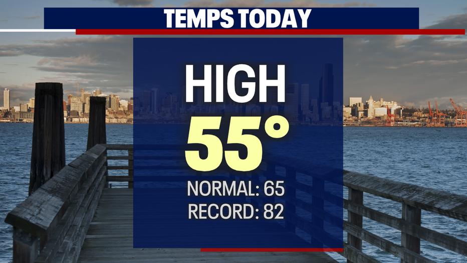
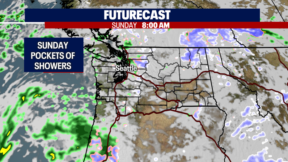
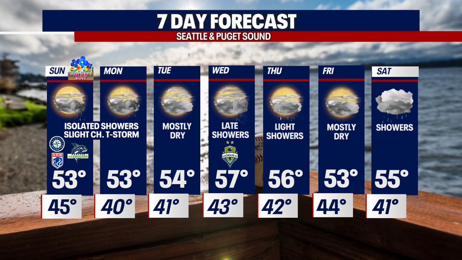
Mother's Day features pockets of showers and cooler highs in the low to mid 50s.

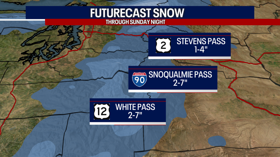
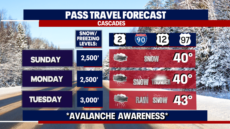
The mountains see lowering snow levels with a chance of showers and a slight risk of a thunderstorm. Know the roads before you travel the passes as roads will be slick.
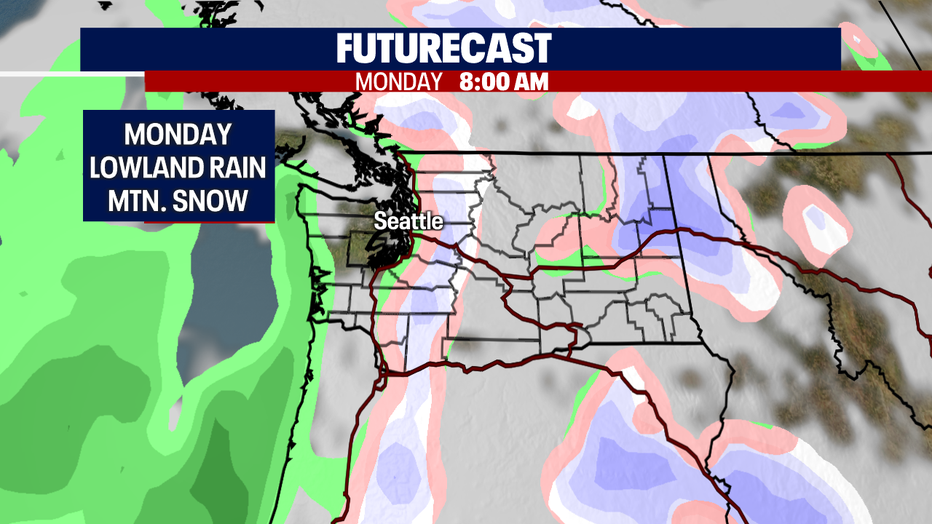
Monday looks mostly dry around Puget Sound except for a few showers north. We'll also see another chance of light snow over the mountains.
We're mostly dry Tuesday with highs near 54.
Wednesday remains mainly dry with showers arriving at the coast just after dinner and spreading inland into the area by midnight. Highs jump to the upper 50s.
Thursday we're forecasting light showers with highs in the mid 50s.
Look for a brief dry break Friday before showers return Saturday. Highs hang in the low to mid 50s.
The extended forecast has us warming up some and drying as we push into the middle of May.
Have a great Sunday all! ~Erin Mayovsky, FOX 13 Forecaster
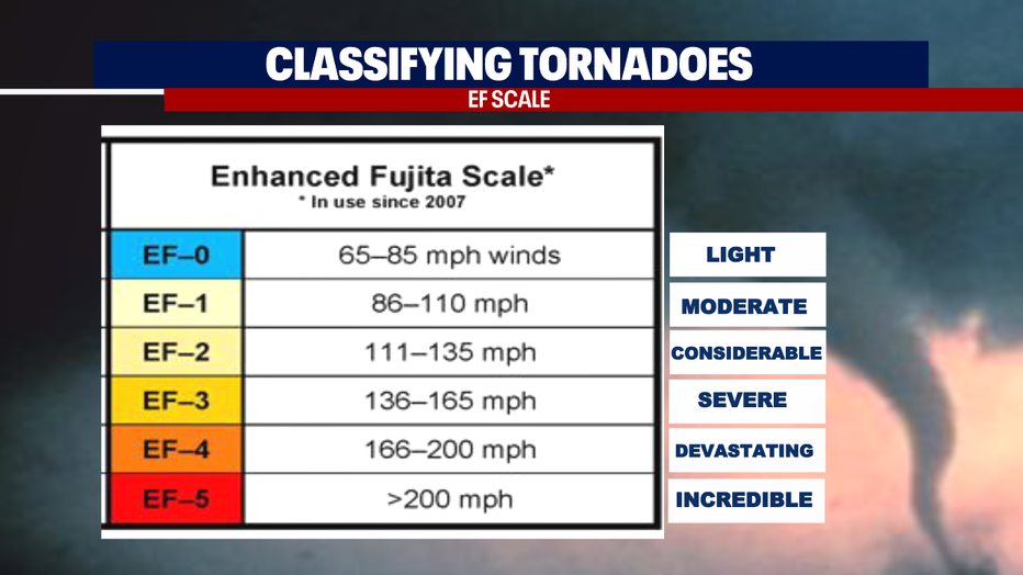
*More information on the Spokane Tornadoes Friday, May 6, 2022. The first touched down near Airway Heights with the second one hitting the ground in the Spokane Valley near Freya and Dishman Hills Recreation Area.