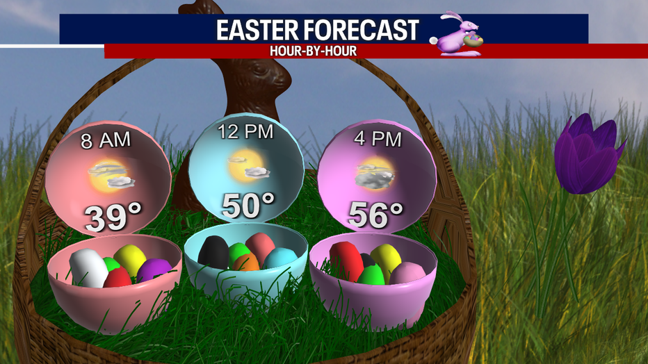
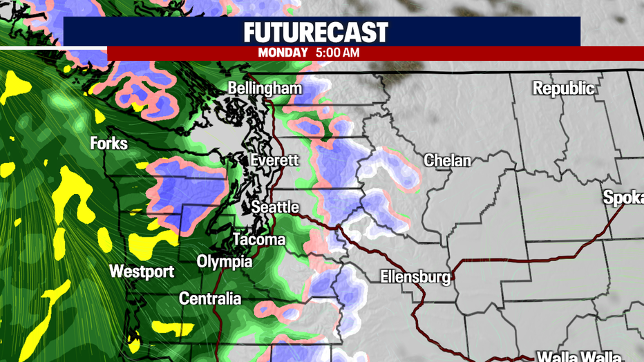
A dry Easter Sunday on tap with widespread rain returning very early Monday
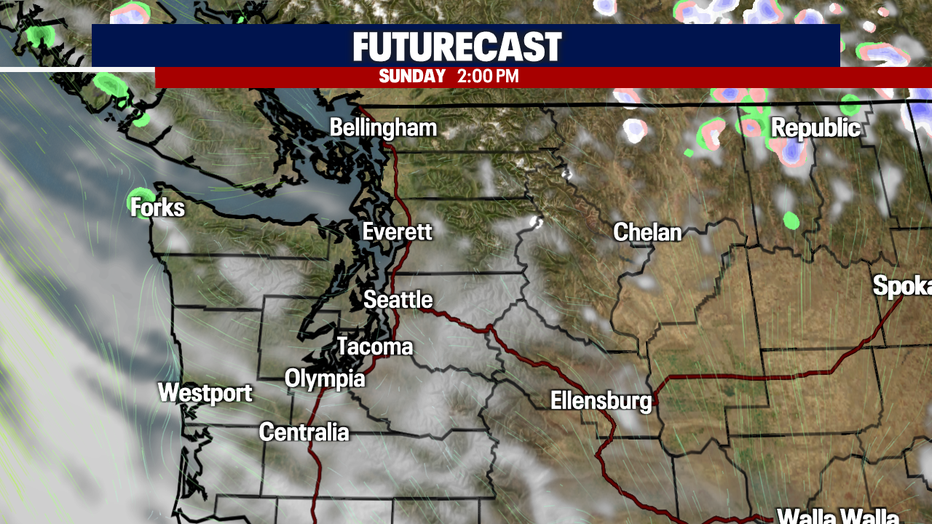
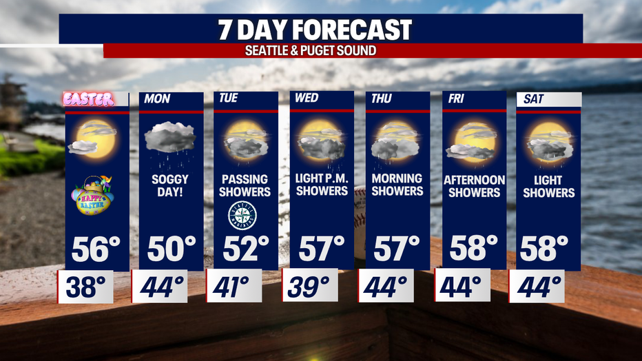
Seattle - Skies dry out and temperatures warm slightly for Easter Sunday. We start the day partly to mostly sunny with clouds increasing later afternoon.
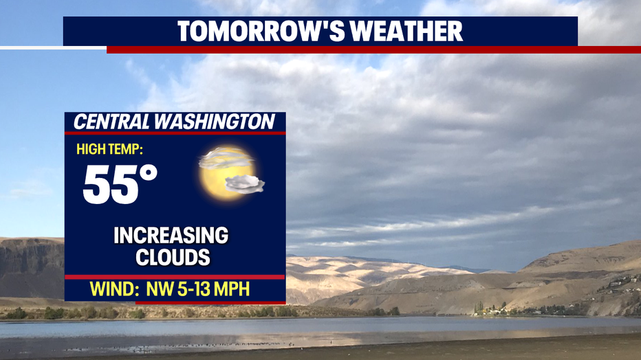
Highs warm up slightly with temps landing in the mid to upper 50s. Normal for this time of year is 59 and will climb to 60 on Monday.
The next system moves through early Monday into Tuesday. This one dropping widespread rain through Monday evening with a lingering convergence zone setting up just after 8pm. Showers linger into Tuesday with highs both days near 50.
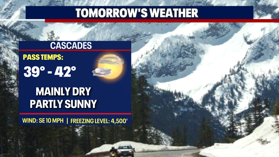
During this time snow levels will drop from 3,000'-4,000' Monday to 2,000' by Tuesday morning. We're forecasting up to half a foot of snow with breezing conditions. Know the roads before you go if you must travel through the mountains.
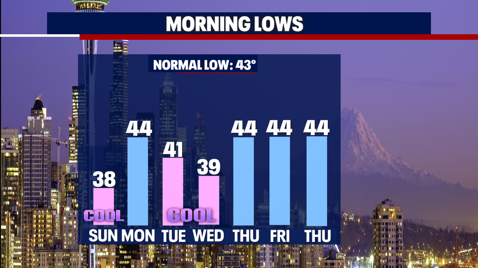
Over the next week lows will warm most days to near normal in the mid 40s. The average overnight temperature for this time of year is 43 soon to jump to 44.
Look for on and off showers as unsettled weather hangs with us through much of next week. Good news though… we do warm up! Highs land in the upper 50s close to average.
Happy Easter everyone! ~Erin Mayovsky, FOX 13 Forecaster
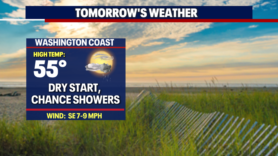
*Beach Forecast
*Mountain Forecast
*Central WA Forecast