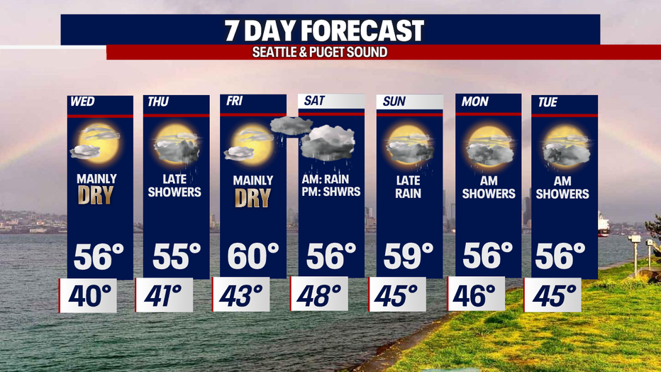
A few more showers Wednesday & Thursday before drying out Friday.

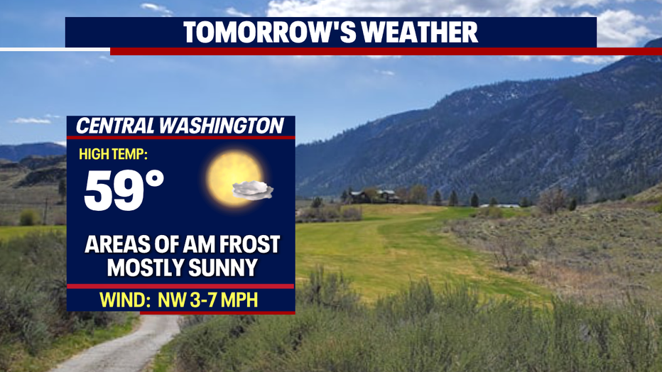
Mostly dry Wednesday with highs in the upper 50s
Friday is the next day we're expected to see 60 degree weather. FOX 13 chief meteorologist Lisa Villegas has the latest forecast.
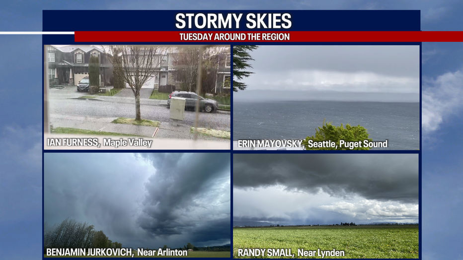
SEATTLE - What a day we saw across the region! Skies offered a variety of flare late in the day as pockets of heavy rain turned to bursts of hail in the North Sound.
Check out some cloud depth here as area photographers snapped away this afternoon.
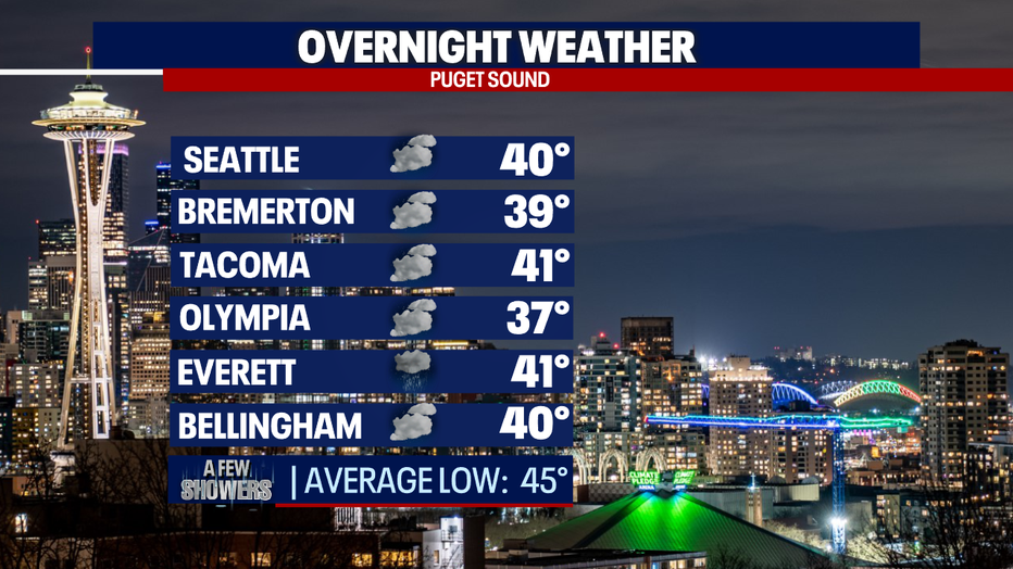
Showers will fall apart into the overnight hours, except for a convergence zone sticking around in the North Sound. We're running cool again too with lows only in the mid to upper 30s with some 40s. Normal for this time of year is now 45.
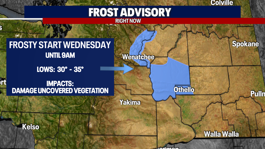
Temps cool even more for areas in Central WA. This is why a "Frost Advisory" is in effect overnight through 9 a.m. Wednesday for parts of Chelan, Douglas, and Grant Counties.
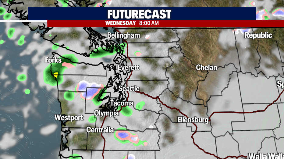
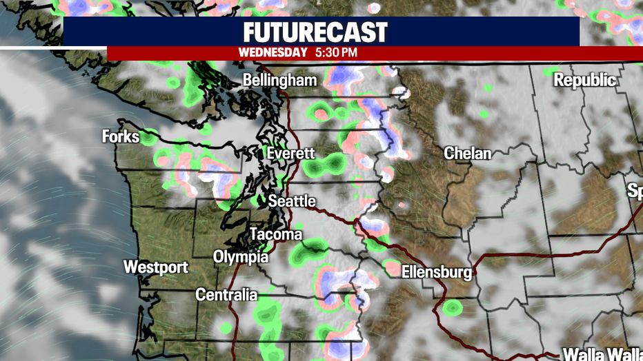
Just a few pockets of showers out there as you get out the door Wednesday. We'll see some clearing through the day with another shot for light showers during the evening commute. Highs landing on the cool side again, in the mid-50s. Normal for this time of year is now 62.
Friday looks nice and dry with highs jumping to near 60s, but rain returns late night into Saturday. Rain will taper to showers by the afternoon. Highs Saturday drop back into the mid 50s.
We're going mainly dry Sunday with partly to mostly cloudy skies. Highs warm into the upper 50s to near 60.
Next week features cooler highs with a few showers too.
Have a great week all! ~Erin Mayovsky, FOX 13 Forecaster
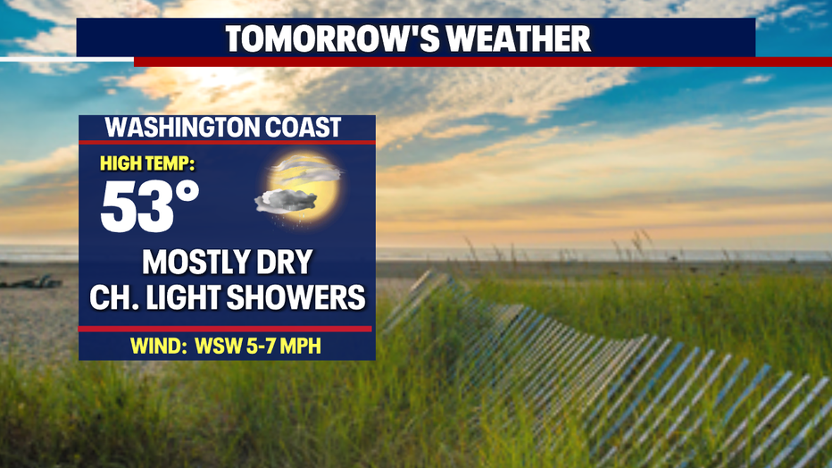
*Beach Forecast
*Mountain Forecast
*Central WA Forecast