Seattle weather: A warmer Saturday with cooler highs Sunday into next week

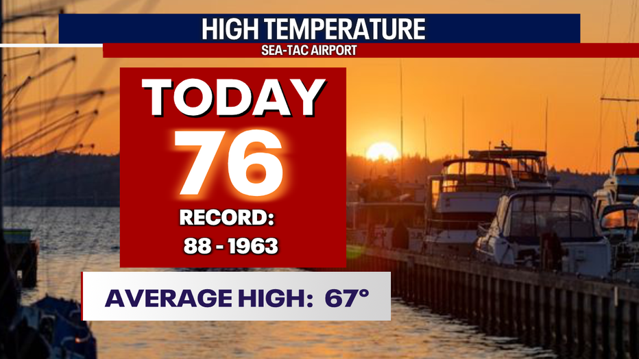
SEATTLE - Happy weekend everyone! Friday's highs went well above average again, no record breakers, but this was the 10th day in a row warmer than normal.
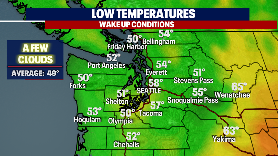
Overnight, the metro stays almost 10 degrees warmer than where we usually sit for this time of year.
We expect mainly clear skies with just a few passing clouds rolling in just in time for sunrise at 5:27 a.m.
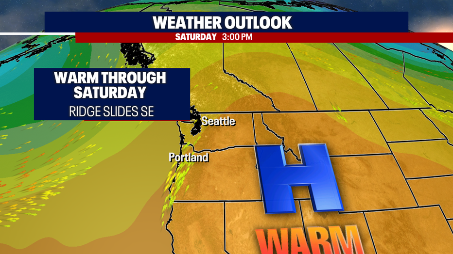
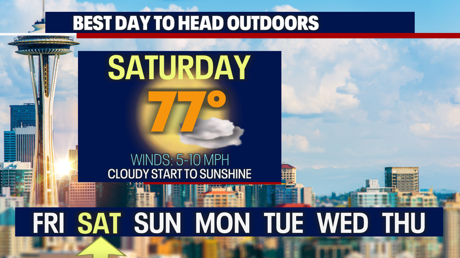
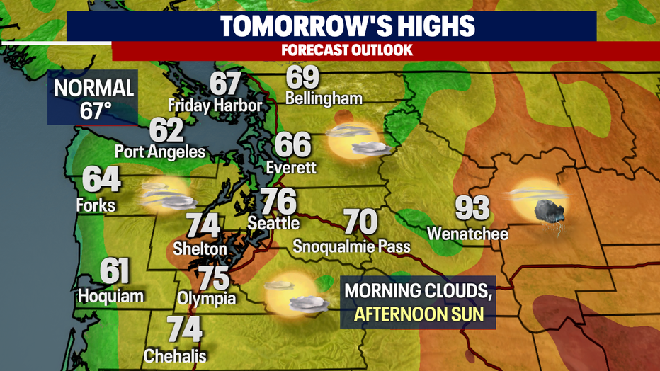
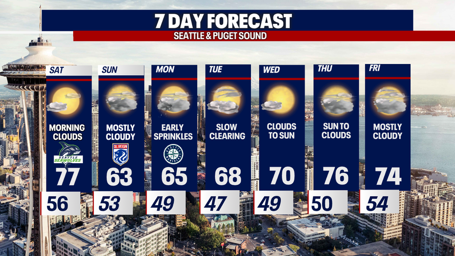
High pressure will help us see a beautiful Saturday with morning clouds and afternoon sunshine. Tomorrow is the better day of the weekend if you are looking for more blue sky and above-average highs.
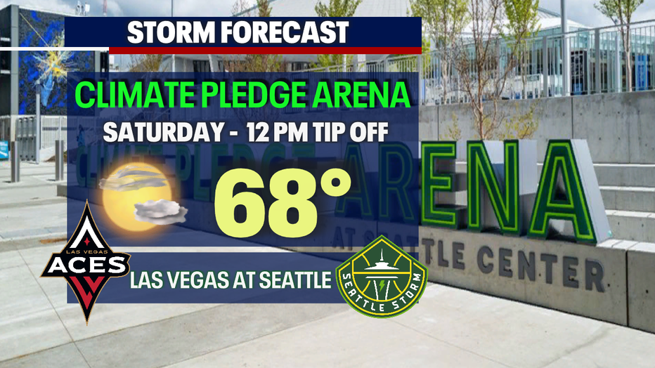
By 12 p.m. when the Storm tip off against the Aces of Las Vegas at Climate Pledge Arena, temperatures cruise into the upper 60s.
We'll push into the upper 70s by the end of the day. And although we're not forecasting showers in the lowlands there is a chance for a thunderstorm to fire up over the mountains. Some of those cells have a slight chance of making their way into Puget Sound, mainly for SW WA. The timing of this situation is fairly early Saturday.
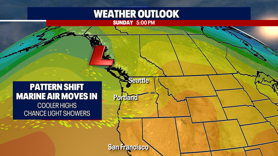
A pattern shift comes our way late Saturday into early Sunday when winds shift to a westerly flow pushing marine air inland of the coast. This will cool our temperatures down to below normal.
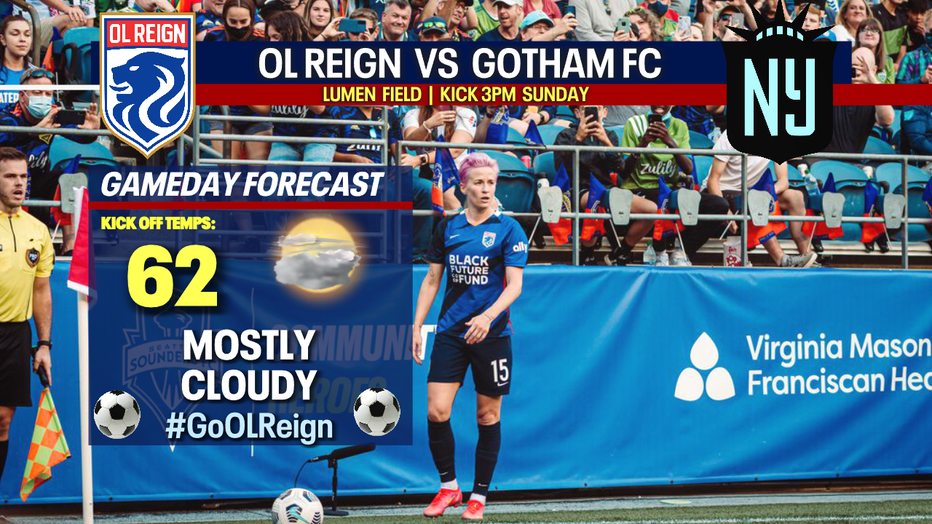
If you're heading out to Lumen Field Sunday for the OL Reign match, bring a sweatshirt as temperatures are in the low 60s for the 3 p.m. kick-off against Gotham FC of New York.
Skies stay cloudy as we start the work week with highs riding close to normal in the mid to upper 60s. There is a slight chance of early sprinkles on Monday otherwise we're looking mainly dry.
The rest of the week features more spring sunshine with highs rebounding back into the 70s. Enjoy!
Have a great weekend! ~Erin Mayovsky, FOX 13 Forecaster
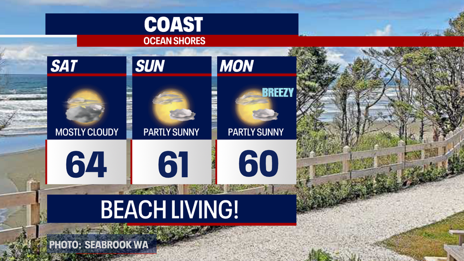
*Coast Forecast
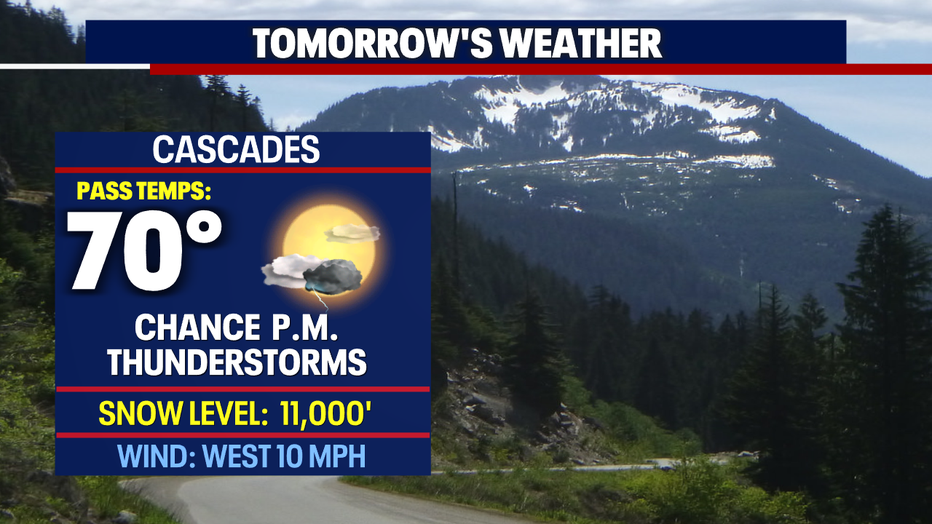
*Mountain Forecast
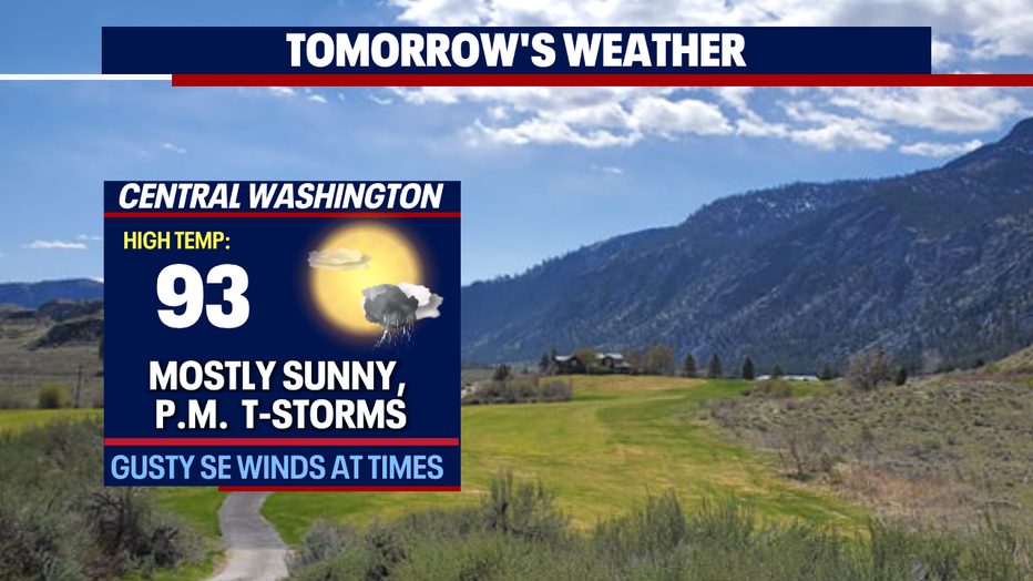
*Central & Eastern WA Forecast
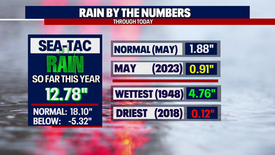
*Rain Almanac SeaTac
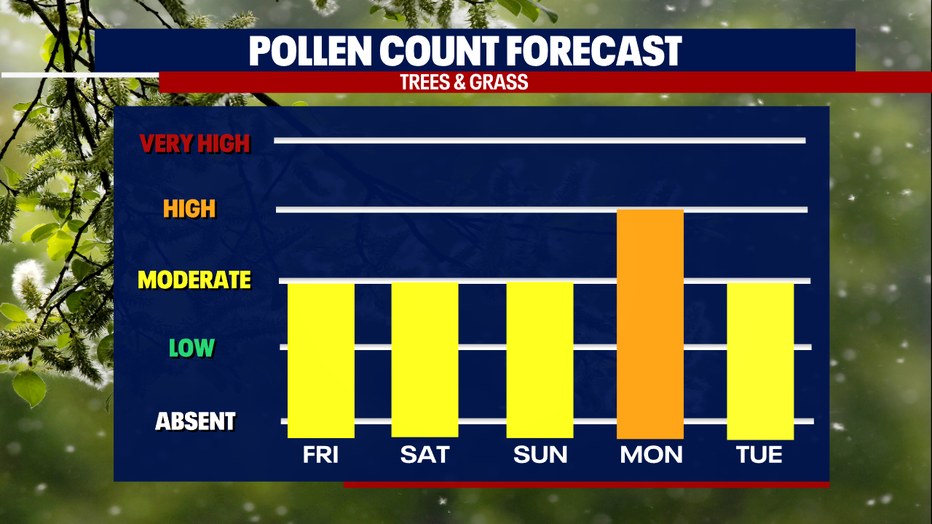
*Pollen Forecast