

A wet weekend with record warm temps by Sunday
A wet weekend with record warm temps by Sunday
Showers and warmer temperatures are expected around the Puget Sound region
Seattle - A series of very wet and mild storm systems will impact Western Washington over the next several days, with record high temperatures expected.
A slow moving warm front is moving north through Western Washington Saturday morning. Widespread morning rain will turn into on and off showers Saturday afternoon. Temperatures will also begin to warm. Highs will be in the mid 50s.

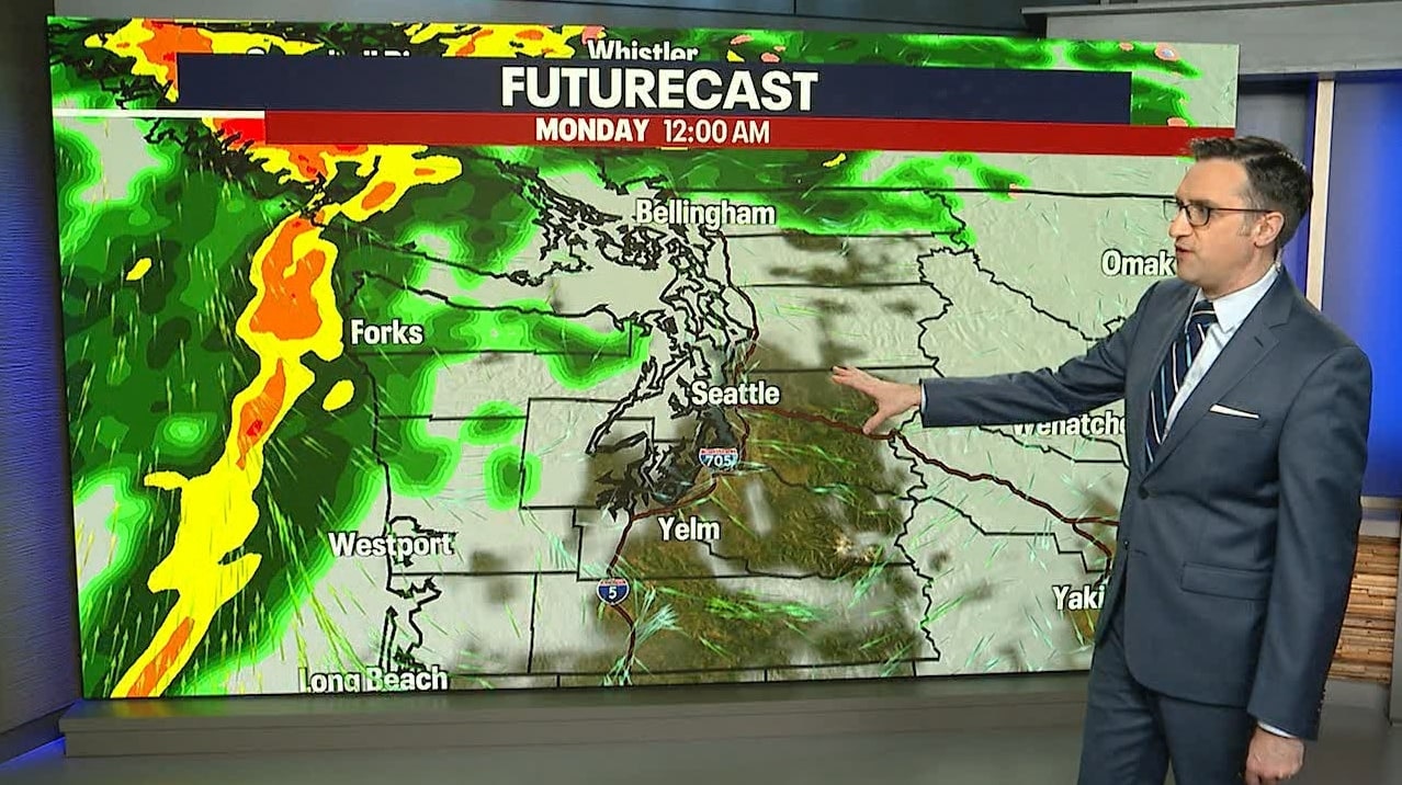
Saturday morning through Monday morning will bring an impressive one to one and a half inches of rain to the Puget Sound area. The northern Washington Coast and Olympic Mountains could catch the worst of it as the next atmospheric river takes aim at the peninsula and Vancouver Island Sunday night into Monday morning. Two to four inches is possible there. Two to four inches of rain is also possible in the Cascades over the next 48 hours.

Snow levels will stay very high over the next five days which will mean precipitation will fall as rain, not snow, over the mountain passes. Snow runoff will cause area rivers to rise through Sunday and Monday. We will be watching those rivers closely.

One river already under a Flood Warning is the Skokomish River at Potlatch. The Skokomish is expected to reach moderate flood stage.

Sunday and Monday, temps could soar into the 60 bringing record setting high temperatures to the area. If Seattle hits 60 degrees, it would be the first time that's happened in January in four years.

This is the 12th consecutive day with measurable precipitation in Seattle. We will likely add another seven days to that wet stretch, with no dry days in the forecast for at least the next week.
