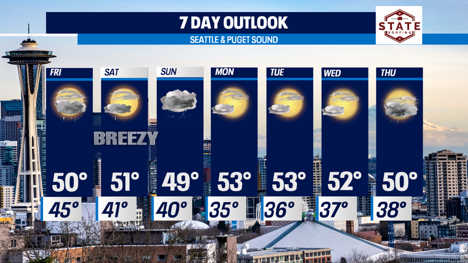
After a quick break from the rain yesterday, showers will hang with through the weekend

SEATTLE - Happy Thursday!
Rain is here and it sticks around through the weekend. We'll see breaks at times, but overnight some areas, like the coast and Olympics will see heavy rain.
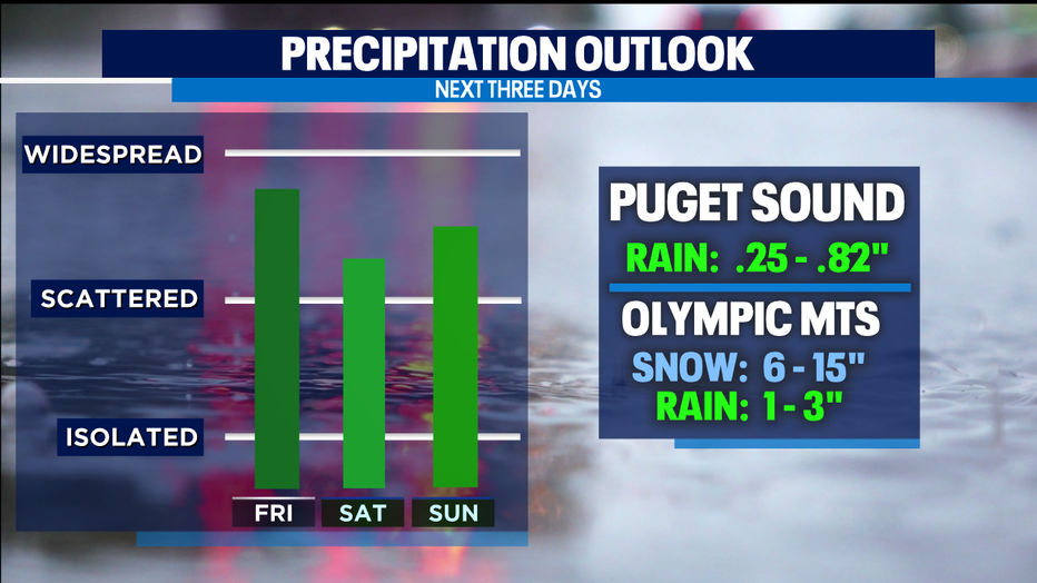
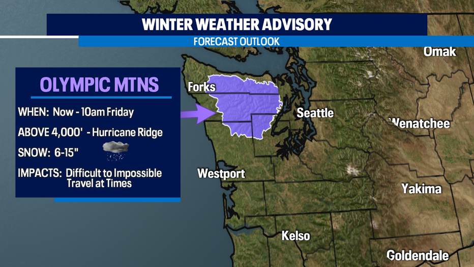
The Olympics also will see heavy mountain snow above 4,000ft. A "Winter Weather Advisory" is now in effect through 10am Friday for 6-15" of snow.
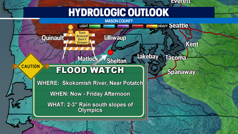
With so much rain and snow falling over the Olympics there is a "Flood Watch" in effect through Friday afternoon for Mason County's Skokomish River near Potlatch. This area of the river could reach its banks pretty quickly and cause minor flooding.
Several weather systems will push into the region over the next few days. We may see some associated thunderstorms pop up mainly along the coast tomorrow as one front passes through. Otherwise mostly cloudy and showery for the rest of us.

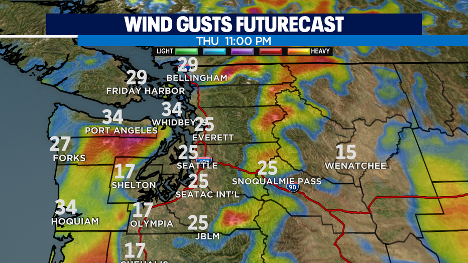
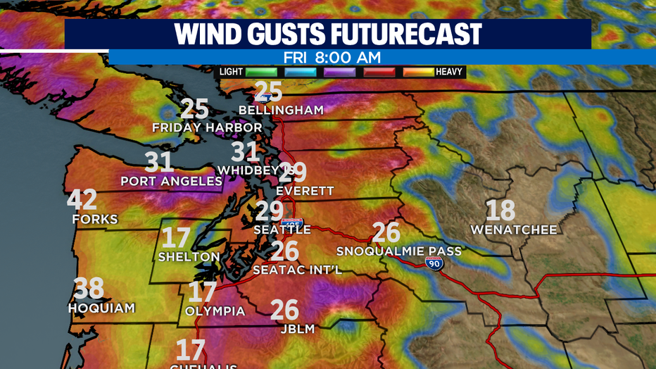
Winds could get a little gusty too. The usual places like the coast, through the Strait and North Sound will see gusts from 20-40mph, with less for the Central Sound.
Temperatures around the area will hang near our seasonal average of 52 for the next week or so. By the end of March normal highs climb to 56 and I know a lot of us will look forward to that number!
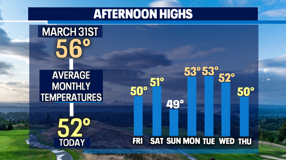
Another front will pass through Sunday delivering more rain, but as we look to the extended forecast models are in some agreeance that we'll dry out Monday - Wednesday with only a slight chance of showers for the region.
Have a great night! ~Erin Mayovsky, Q13 Forecast