

Seattle weather: Drier and warmer Wednesday with rain returning into the weekend

Spring-like weather on Wednesday before cooling down for the weekend
FOX 13 chief meteorologist Lisa Villegas has the latest forecast.
SEATTLE - A nice day across Puget Sound with highs soaring into the mid-60s in the north with cooler temps to the south.
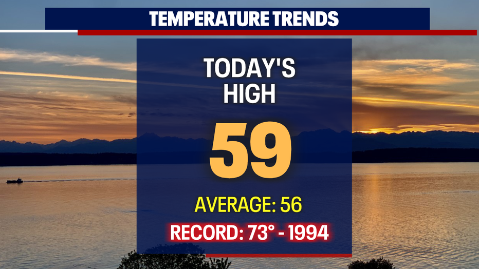
Sea-Tac hit 59 at the airport Tuesday under partly to mostly cloudy skies.
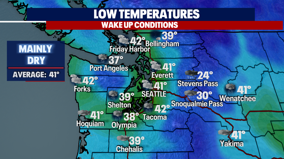
Most of us will stay dry overnight under clearer skies north of Everett. Temperatures bottom out in the upper 30s to low 40s. Some of us to the south may see a few showers as a low off the southern Oregon/ northern California coast spins some precipitation up our way.
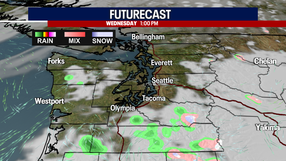
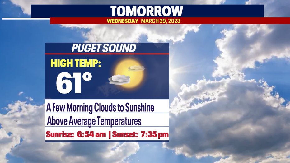
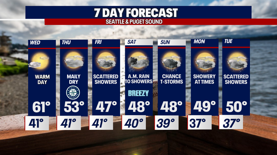
The morning commute Wednesday will feature some clouds, mainly for neighborhoods south of Tacoma with a few spotty showers. Otherwise, skies will clear for a partly sunny day with highs in the low 60s all thanks to high pressure. Normal for this time of year is now 56.
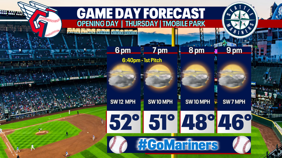
Everyone seems to have their eye on Thursday this week with the Mariners back in town for the Home Opener! Right now, the forecast looks promising for a dry first pitch.
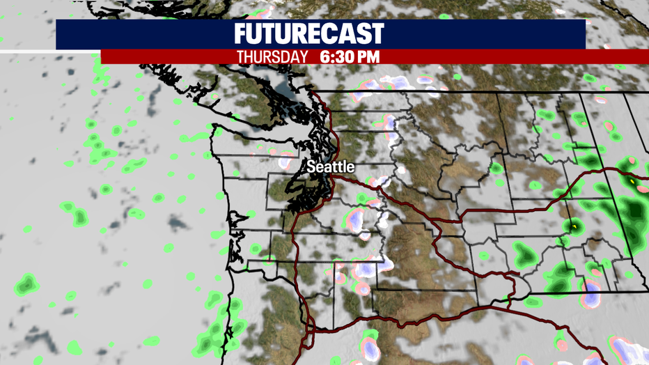
Skies Thursday will cloud up throughout the day and by first pitch look for mostly cloudy conditions.
Temperatures for Opening Day at T-Mobile drop from the low 50s to the mid 40s by the end of the game.
And don't worry if you can't make it out to the ballpark…we have you covered leading up to the start of the game vs the Guardians. Our FOX crew will be live from T-Mobile!
Don't get used to the warmer highs and drier days because cooler temps, along with rain and breezy winds, will return by Friday. Highs cool into the upper 40s.
Saturday starts off pretty sloppy with rain turning to showers with the threat of thunderstorms firing up across the Sound. This weather will stay with us through Sunday before we start to calm down some into the start of the work week.
Have a great week all! ~Erin Mayovsky, FOX 13 Forecaster
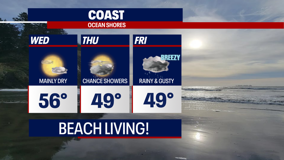
*Coast Forecast
*Mountain Forecast
