Lowland snow turns to rain overnight before drying out, but winds are gusty into Wednesday morning

Slightly warmer temps on Wednesday with morning rain mix
FOX 13 chief meteorologist Lisa Villegas and FOX 13 forecaster Erin Mayovsky have the latest conditions and forecast.
SEATTLE - What a wild weather day folks! Lowland snow, rain, and wind created problems across the Sound for many trying to navigate the day.
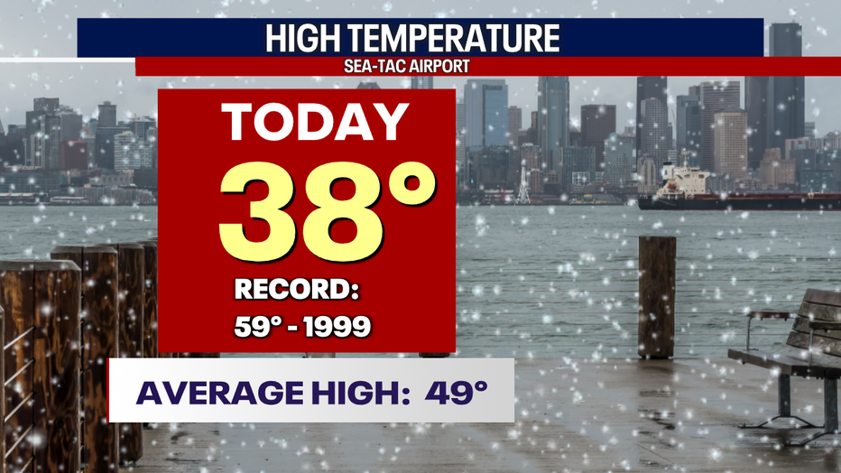
Seattle saw high temperatures much colder than average, landing in the mid to upper 30s this afternoon. SeaTac hit 38 around 2:36 p.m. and then cooled off into the low 30s again before warming back up.
Temperatures overnight are all over the place, with the warmest areas along the south coast and Pierce County. The North Sound will flirt with near-freezing lows. Do be careful getting out the door tomorrow as there will be plenty of neighborhoods experiencing slick roads.
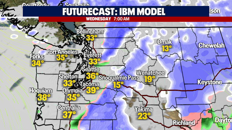
While most of us wake up to drier conditions, there may be a few areas seeing light, spotty rain/snow showers early, but those will fall off by mid-morning. Snow will continue over the Cascades to the north and south.
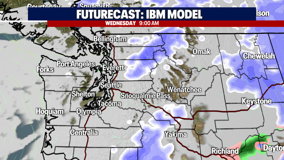
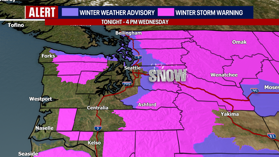
With colder air in place and more precipitation on the way later in the afternoon Wednesday, a couple of alerts will stay in effect through 4 p.m. for the lowlands and mountains.
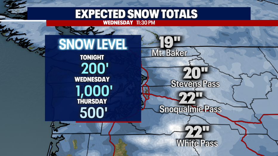
Here's a look at projected snow totals for the high country through late Wednesday night. By tomorrow at 11:30 p.m., most passes will have picked up a couple of feet of snow.
This is exciting news for snow enthusiasts patiently waiting for resorts to open, but not so great for pass travelers.
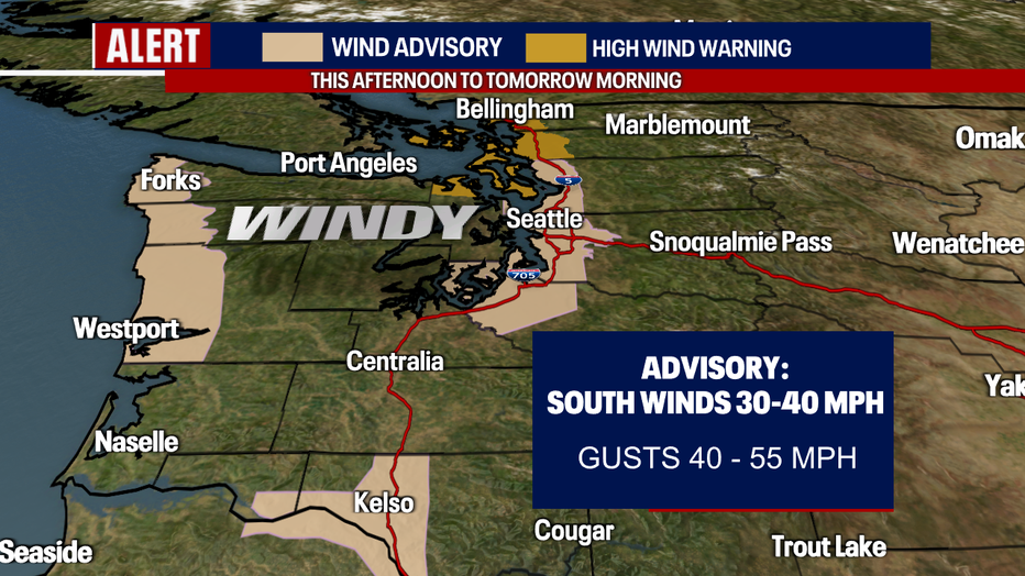
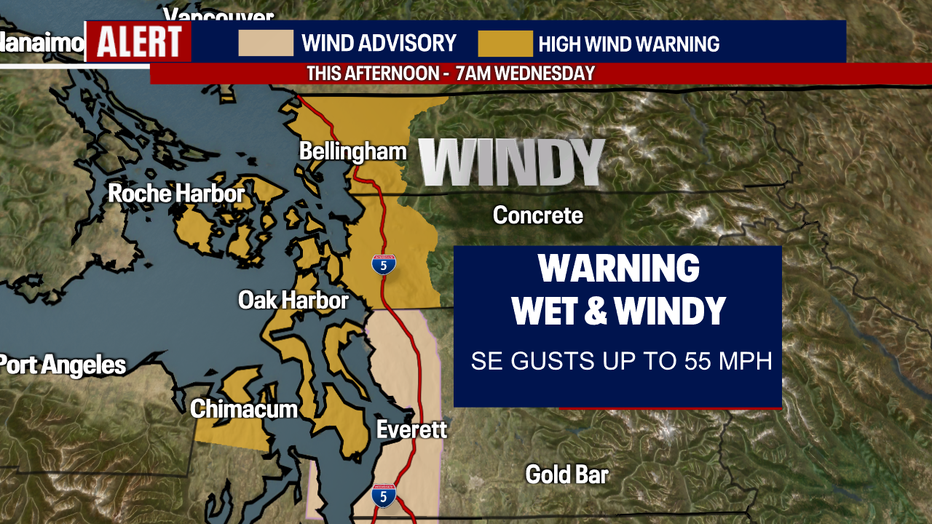
Another interesting contributor is the winds. Peak winds hit close to 60 mph through the Island Wednesday evening. Wind gusts that high certainly gave us a "feels like" temperature about 5-10 degrees colder.
Winds start to relax overnight into early Wednesday and that is when our "Wind Advisory & High Wind Warning" will expire. The lowlands will then become just breezy at times.
After a mainly dry Wednesday, showers come roaring back out of the south during the evening commute tomorrow. By 7:30 p.m, a rain-snow mix pushes into Pierce County and will continue to ride north through Puget Sound dropping anywhere from a trace to a couple of inches before drying out.
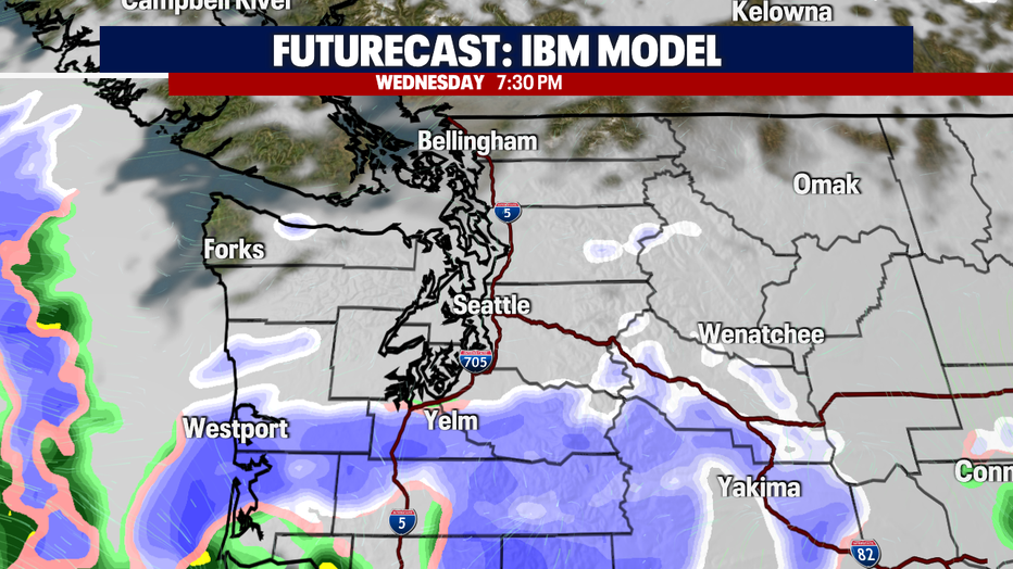
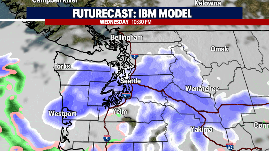
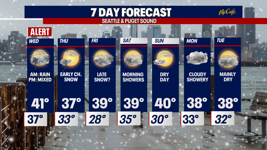
Thursday looks mainly dry after an early chance of snow. We may even see a partly sunny day, but highs will remain well below normal as cold air stays in place through early next week. Thursday's highs only warm into the mid to upper 30s.
The next round of weather hits Western Washington Friday. With cold air still hanging around, there is the potential for more lowland snow. Showers push in on the coast first and finally, find their way into Puget Sound by dinner time. Models are keeping rain at the coast with a wintry mix to just snow inland into early Saturday morning before changing over to plain old rain again by mid-morning.
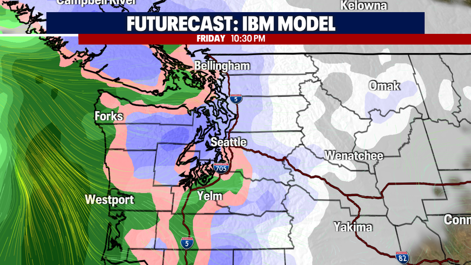
This week's forecast is a bit tricky and very fluid. Each day as models shift, don't be surprised if you see a little more or less around your neighborhood.
Highs over the next week only warm to near 40, which is about 10 degrees colder than normal for this time of year.
Have a great week all! ~Erin Mayovsky, FOX 13 Forecaster
