

Seattle weather: Melting snow and cool rain showers Thursday
Wintry mix into Thursday morning
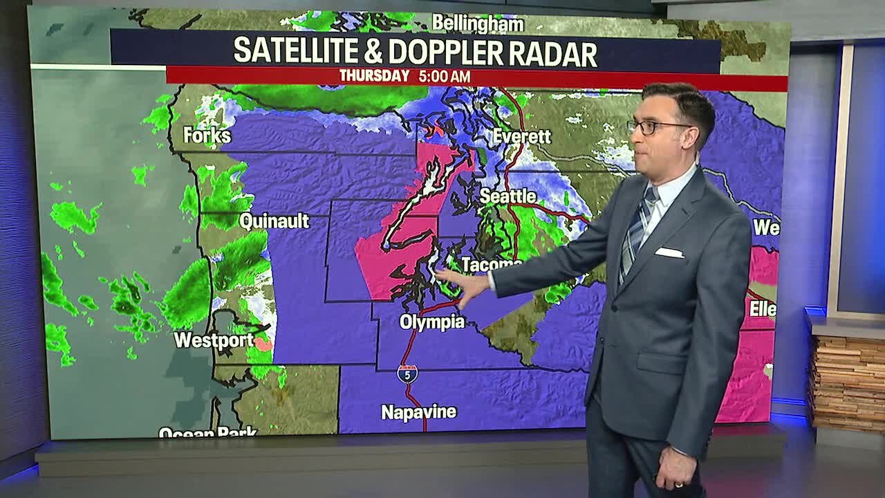
Snow totals through Thursday morning look relatively light, especially for the Seattle Metro area, which will likely see trace amounts of snow
SEATTLE - Warming temperatures and rain showers will help melt snow in areas that received a few inches overnight.
This is what it looked like around 4:00 AM in Olympia and Sequim. Both areas saw several inches of snow early this morning.


A regional Weather Alert was issued by the FOX 13 Weather team to start the day with slushy conditions in Thurston & Lewis Counties, Mason County, the Kitsap Peninsula, Hood Canal, and parts of the Olympic Peninsula.
The snow will continue to melt for most by midday. Areas around the Hood Canal and western Kitsap Peninsula may take until the afternoon to melt.

As of 7:00 AM, here were some of the snow totals:
- Seattle: Trace
- Seabeck: 4 inches
- Silverdale: 3 inches
- Port Orchard: 3 inches
- Bremerton: 2 inches
- Port Angeles: 2 inches
- Aberdeen: 1 inch
- Centralia: 1.5 inches
- Shelton: 2 inches
- Dupont: 1 inch
- Tacoma: Trace
- Littlerock: 4 inches
- Lacey: 3 inches
- Olympia: 3 inches
More accumulated in some areas since then and official snow totals are still coming in.
Scattered showers will continue through the rest of the day with a wintry mix turning back into cool rain showers. Highs will be in the mid 40s.

We will run out of moisture tonight after the evening commute. There is a chance that some outlying areas will be icy early Friday morning, but most spots should be above freezing to start the day. It depends on which spots see clear skies overnight. Friday will be mainly dry and mostly cloudy with a slight chance of showers in the morning for the south sound.

Looking ahead, the forecast will bring a chance of showers each day through the holiday weekend with highs back in the 50s. No big storms are ahead for at least the next week for Western Washington.
