

Seattle weather: More heat on the way, but a cooldown is in sight
Temperatures in the 90s until Sunday before a cooldown next week
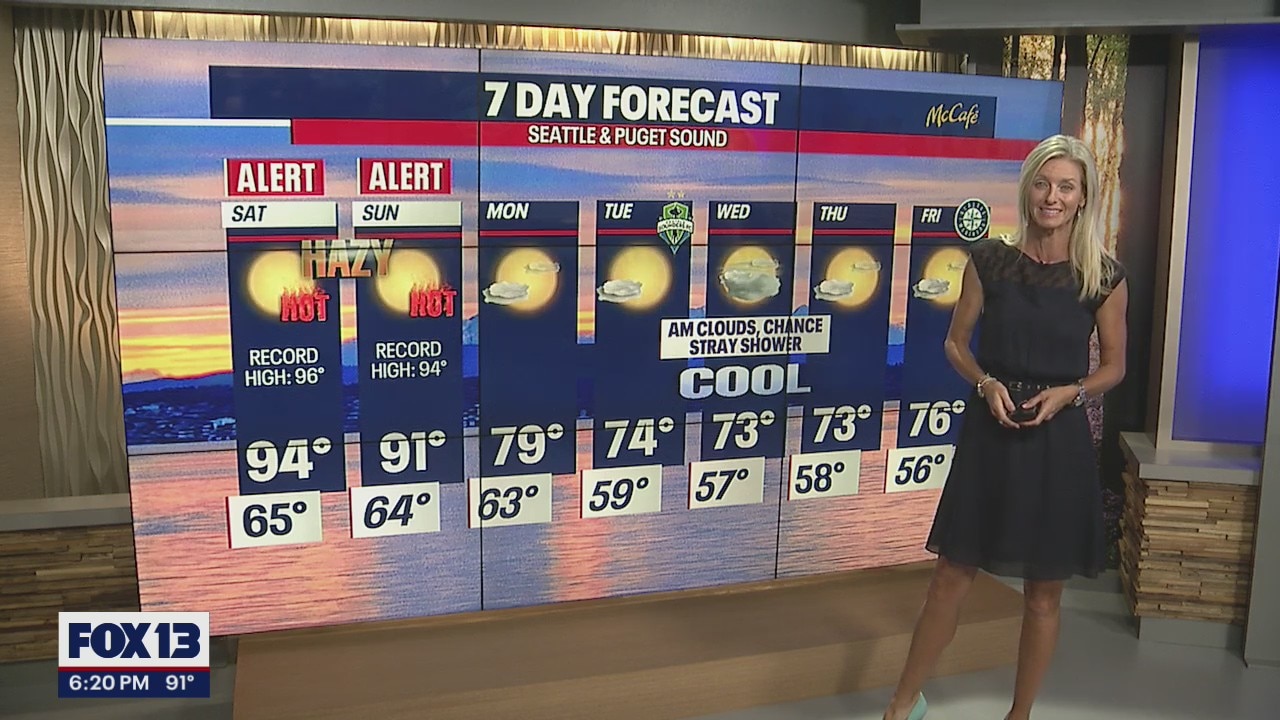
The heatwave was extended yet again, this time, until Sunday. FOX 13 forecaster Erin Mayovsky has the latest.
SEATTLE - Add another day to the stretch! We are now have four days in a row at 90 degrees or above… one more day and we tie the longest streak record for consecutive 90+ days.
Temperatures Friday soared into the 90s again around Puget Sound with a handful of records set across Eastern WA. Pasco hit 112 today!

Overnight temps fall about 30 degrees at Sea-Tac with a forecast low of 64. Normal for this time of year is 59.

High pressure continues to persist over the region, keeping us extremely hot and dry. We can expect reduced air quality for the Cascade Foothills through the weekend as the ozone builds.

Most of the NW stays under either extreme heat warnings or heat advisories through Sunday at 9pm. Make sure to stay hydrated, limit time outdoors, and wear sunblock as the skin can burn in minutes with our UV Index very high.

With highs hanging in the 90s we expect many folks to take to area waterways. Please remember the rules of wearing a life-jacket and swimming with a partner. Water temperatures have warmed with most lakes now in the 70s. Puget Sound and rivers are still very cold in the mid to upper 50s.

Saturday, we're expecting another scorcher for sure! Look for mid 90s across the Central Sound with even hotter conditions for the South Sound. We'll be slightly cooler for the North Sound, landing in the mid 80s with the Coast the coolest in the upper 60s after morning fog burns off.

Forecast models finally bring temperatures back to a more comfortable zone in the mid 70s next week! Until then… stay cool!
Have a great weekend all! ~Erin Mayovsky, FOX 13 Forecaster

*Beach Forecast

*Foothills, Mountains, & Central WA Forecast
