Seattle weather: More strong wind gusts, rain ahead for Friday

Scattered showers continue Thursday
Expect a few showers Thursday with mild afternoon temperatures. The next round of wind and rain will move in by the end of the week.
SEATTLE - Thursday will be the calm between storms as the next round of rain and wind takes aim at the Pacific Northwest later tonight and into Friday.
Showers continue in western Washington on Thursday morning, but the wind and rain are significantly calmer than yesterday.
The bomb cyclone responsible for Tuesday night’s storm is now well offshore and continues to slowly push its way west, but it is still managing to impact our weather today. More showers are possible in the central and south Puget Sound areas this afternoon, but there will be a lot of dry time as well.
The next low pressure system will sweep up the Pacific coast Friday with rounds of wind and widespread rain.

Widespread rain will hit the Pacific Northwest Friday morning. (FOX 13 Seattle)
This next system does not quite meet the criteria of a "bomb cyclone," which is when the pressure drops 24 millibars or more in 24 hours. However, it will still be strengthening as it moves north offshore.
Widespread rain will hit western Washington overnight with a half inch to an inch of precipitation expected in the lowlands through Saturday morning.
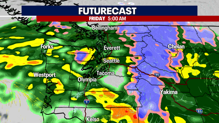
Widespread rain and higher level mountain snow hit early Friday morning. (FOX 13 Seattle)
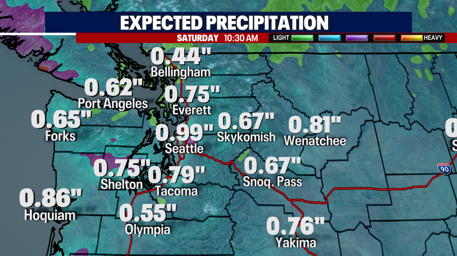
The Puget Sound area could see a half inch to an inch of rain through Saturday morning. (FOX 13 Seattle)
A Wind Advisory has been issued for the Washington Coast and the Cascade foothills and eastern Puget Sound lowlands from late Thursday night to early Saturday morning. These are areas that were slammed with high winds on Tuesday and where thousands of homes are still waiting to get power back on.
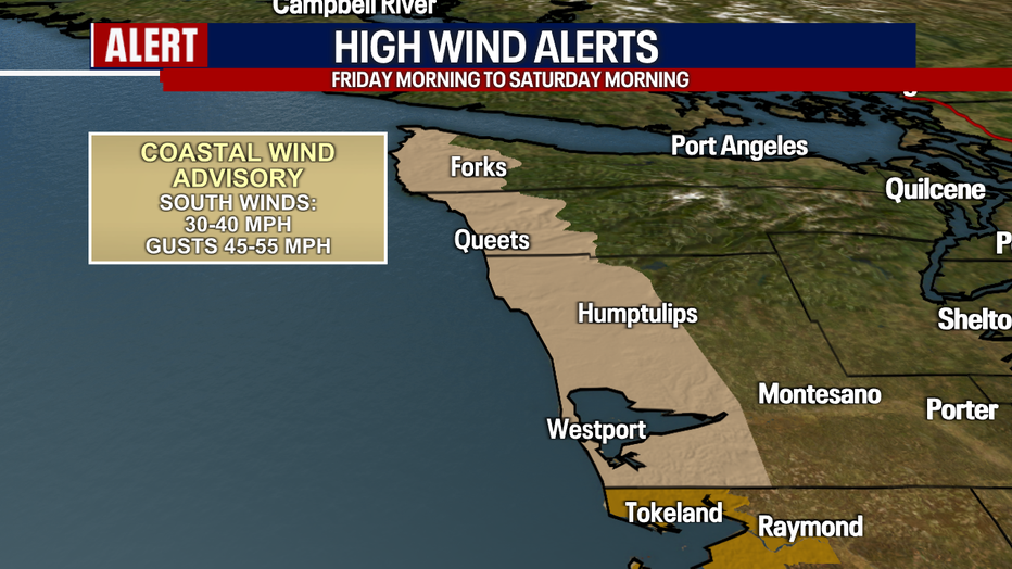
A wind advisory is in effect Friday morning through Saturday morning on the Washington Coast. (FOX 13 Seattle)
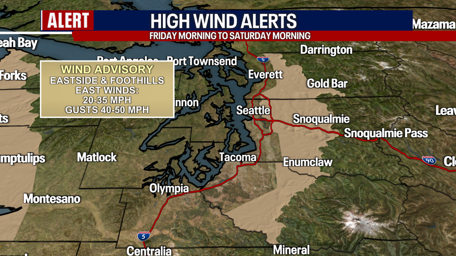
A wind advisory is in effect Friday morning through Saturday morning in the Cascade foothills. (FOX 13 Seattle)
Winds are not expected to be as strong as they were on Tuesday night. They will start blowing early Friday morning as easterly Cascade gap winds and won’t be as widespread as Tuesday's storm.
Winds will then switch to southerly heading into Friday midday. Those winds will be felt more widespread.
Winds on the coast could have gusts as strong as 45 to 55 mph. The Eastside and foothills could see gusts in the 40 to 50 mph range early. For the afternoon hours, most areas of the Puget Sound lowlands could see gusts in the 30 to 40 mph range, while the usual gusty spots in the north Puget Sound could see gusts over 50 mph.
After we get through this storm, we will be looking at a calmer, showery weekend with rain at times. Drier weather returns by the middle of next week.
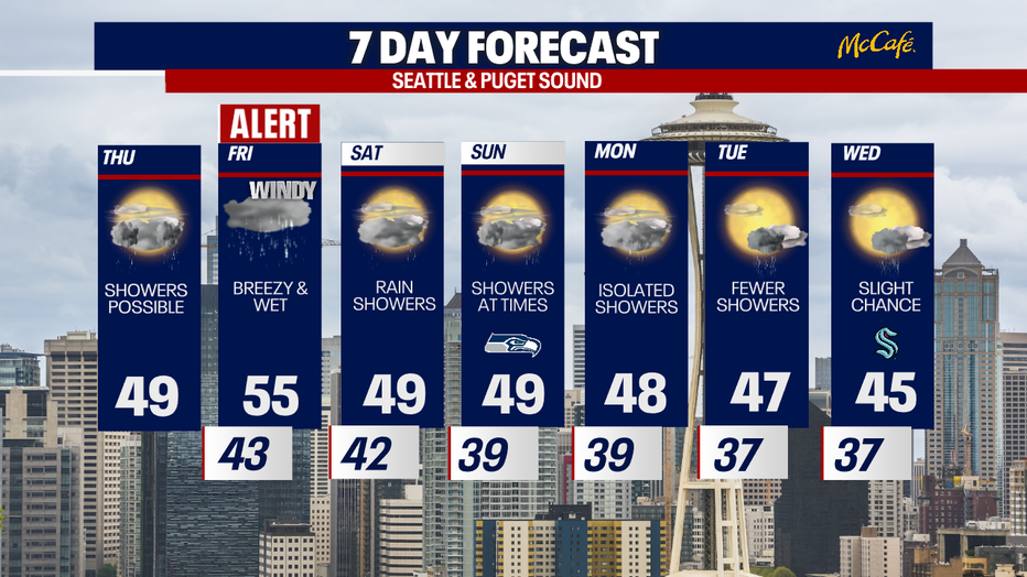
Another weather alert is set for Friday as strong wind and rain hit the area. (FOX 13 Seattle)
MORE NEWS FROM FOX SEATTLE
How long will the power outages last in WA? Here's what we know
School closures: Track closings, delays in western Washington for Thursday, November 21
Deadly storm slams western Washington, topples trees, kills 2
Many flock to King County warming centers after losing power
Judge keeps death penalty a possibility for man charged in killings of 4 Idaho students
To get the best local news, weather and sports in Seattle for free, sign up for the daily Fox Seattle Newsletter.
Download the free FOX LOCAL app for mobile in the Apple App Store or Google Play Store for live Seattle news, top stories, weather updates and more local and national coverage, plus 24/7 streaming coverage from across the nation.

