

Seattle Weather: Atmospheric river brings possible river flooding
Seattle weather: Pineapple Express brings warmer, wetter days
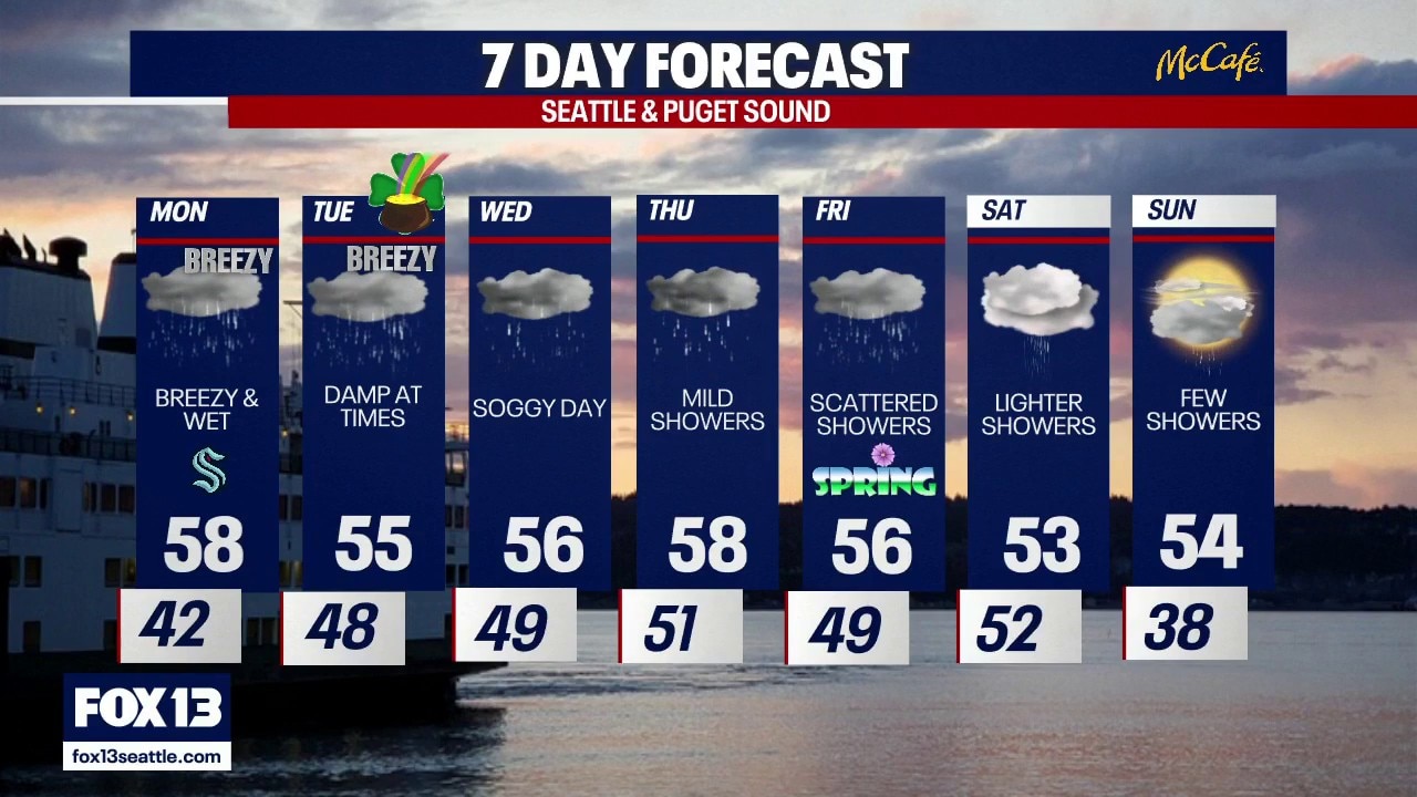
FOX 13 meteorologist Ilona McCauley has your seven-day forecast.
SEATTLE - A warm front arrived Sunday night and will continue to cross through the region during the day on Monday, increasing rain in the lowlands and rising snow levels to around 8000 feet. As the snow transitions to rain, there will be a short window of freezing rain possible in the mountain passes Monday morning. Keep an eye on conditions as it may be icy in sports. Breezy winds are also expected both Monday and Tuesday.

A warm front will increase rain beginning Sunday night into Monday.
Moderate to heavy rainfall combined with higher snow levels will lead to rises on the rivers flowing off the central and northern Cascades. Several rivers are forecast to reach Action Stage and a few rivers will be close to flood stage. Rivers will continue to run high through the end of the week then recede over the weekend.

Periods of heavy rain and melting mountain snow will increase river levels.
After a cool, wet stretch of weather for much of last week, the mild air will warm afternoon highs into the upper 50s to even a few spots in the low 60s.

After a cool stretch, afternoon highs will warm to near 60 degrees.
An atmospheric river will bring periods of rain and breezy conditions for much of the week. By the weekend, rain chances will taper some with cooler overnight lows and some chances of mountain snow returning.

An atmospheric river will bring periods of rain and breezy conditions for much of the week . (FOX 13 Seattle)