

Seattle Weather: Chilly start to Tuesday, increasing showers in the afternoon

Chilly night with a few more snowflakes possible into Tuesday
FOX 13 meteorologist Claire Anderson is tracking the latest conditions across western Washington and Puget Sound.
It was an active weather day for the Pacific Northwest! Snow, hail, graupel, gusty winds and lightning! Showers have tapered this evening, but convergence zone snow showers will continue into early Tuesday for the Snohomish County line.
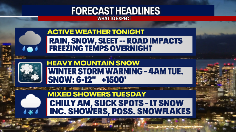
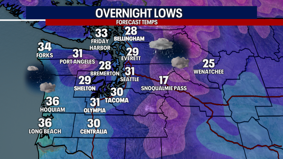
Temperatures will freeze tonight for most locations, which will make for a slick morning commute where any wet spots do freeze overnight.
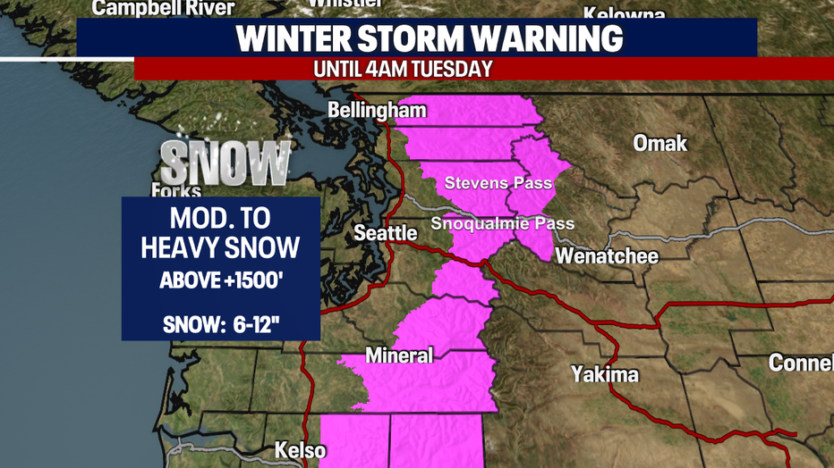
Heavy mountain snow is expected through Tuesday morning. A Winter Storm Warning for the Cascade Passes for 6-12" of new snow.
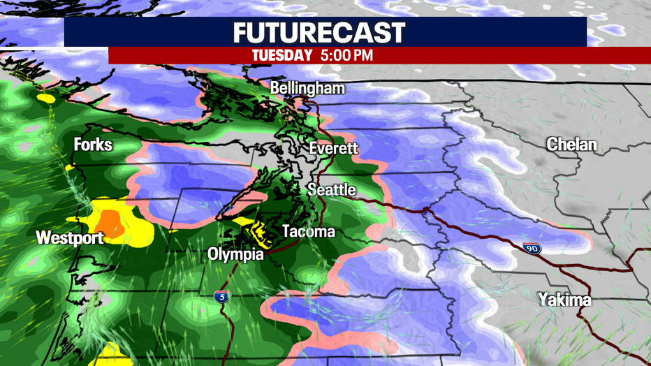
A chilly and clear start to Tuesday, with a dry start to the day. Showers will be mainly along the coast.
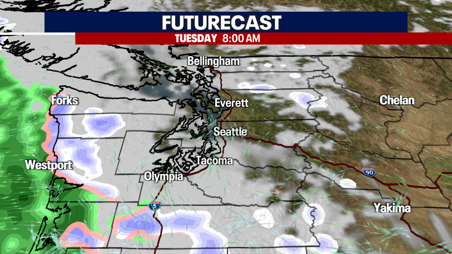
By the afternoon, showers will have moved into the south south, and slowly make their way east of I-5. The next round of steady showers returns by Tuesday evening, with more mountain snow in the forecast.
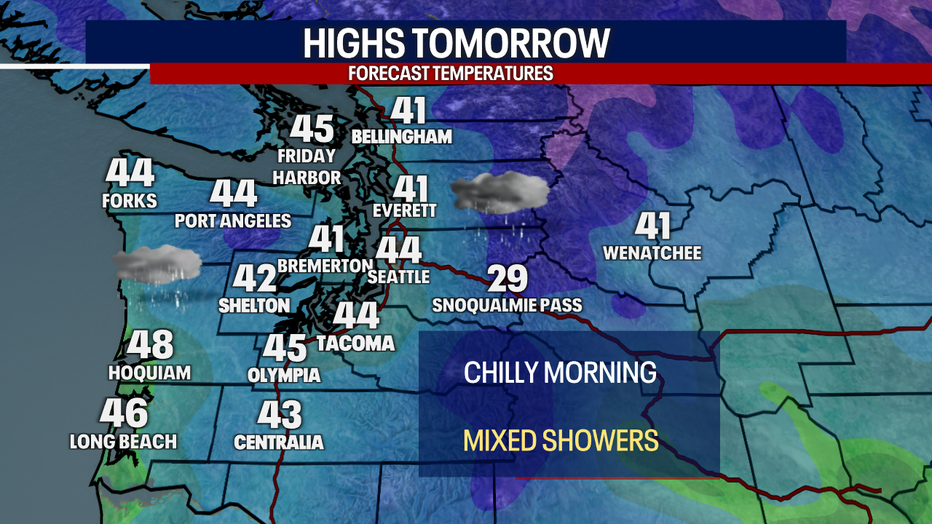
High temperatures on Tuesday will be in the 40s, so any rounds of winter weather will melt off quickly for the lowlands.
More rain and gusty weather will return by midweek along with more snow for Casacades. Watching for potential flooding concerns with the rain on the way.
