

Seattle weather: Spotty rain/snow mix Monday for Western Washington
Seattle weather: Rain, snow mix to begin the workweek
Seattle weather: Rain, snow mix to begin the workweek
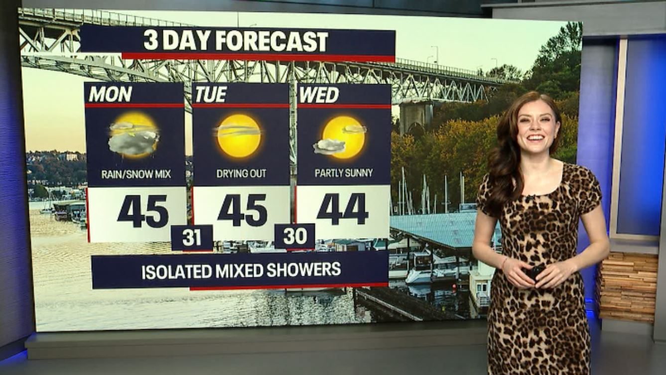
SEATTLE - It was an eventful morning for a few backyards in the North Sound: places like Whidbey Island, Mount Vernon, Bellingham and Stanwood experienced some light snow. For the rest of the day today, we can't rule out an additional rain/snow mix. For the most part, this will be focused in Southwest Washington.

Highs today remain below average, only reaching for the mid 40s. Due to an area of low pressure overhead, it'll be a somewhat strange weather day. There could be times of sunshine and other moments where heavy rain develops. In some of these showers, there could be a mix of snow, small hail or sleet.


In the lower elevations during the daytime today, snow is unlikely to stick to the roads, but even if it does, it will melt quickly. As temperatures drop to or below freezing into early Tuesday, there could be icy spots where there's lingering moisture on the roads. A stray shower could overstay its welcome into early Tuesday, but much of tomorrow will be dry.
Here's a look at Futurecast. You'll notice a bullseye for showers over the Olympic Peninsula and the South Sound:


There's still a Winter Weather Advisory until 4 p.m. for eastern Whatcom and Skagit Counties. There's a similar alert in place for the Willapa Hills in Southwest Washington this morning.
Gorgeous sunshine is on tap Tuesday through Thursday, but highs will stay well below average.
Friday will be dry albeit cloudy. Damp weather surges back into Western Washington next weekend. There's a chance for mountain snow next Saturday and Sunday as well.

Warmly,
Meteorologist Abby Acone
Follow me on Facebook (Meteorologist Abby Acone), Instagram @abbyaconewx, and TikTok @abbyaconetv