Seattle weather: Staying warm with above-average temps into the weekend

Temps starting to cool down Sunday
After days of hotter-than-normal temperatures, things will feel a bit cooler come Sunday.
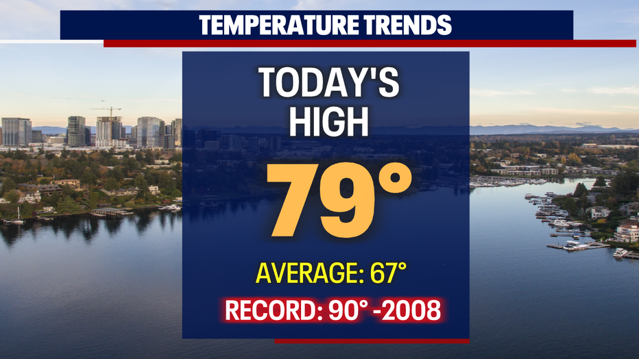
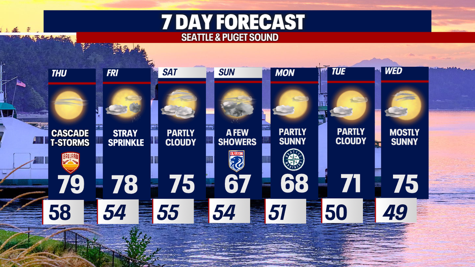
SEATTLE - The above-normal highs continue for Western WA. Sea-Tac Airport hit 79 on Wednesday with even warmer highs south and east of the city into the 80s.
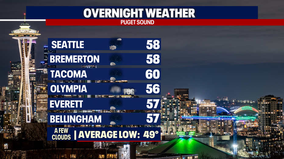
Overnight, skies are mainly clear with a few passing clouds. Our daytime heating will keep temperatures from cooling to average, but instead stay warm, landing in the upper 50s to near 60. The normal for this time of year is 49 degrees.
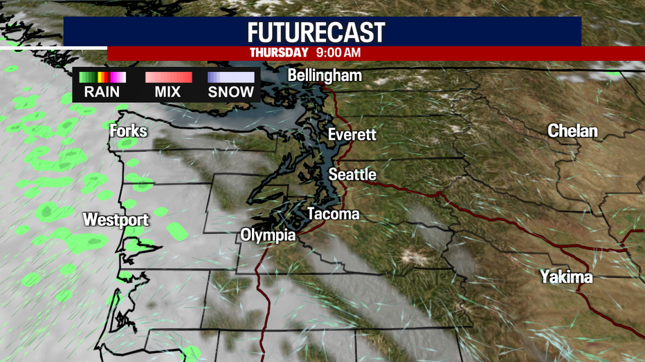
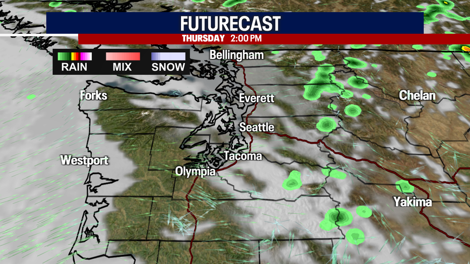
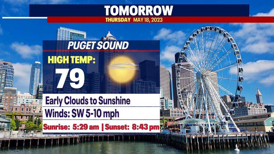
Thursday will look and feel very similar to Wednesday with some passing high clouds and then some haze from wildfires burning in Alberta, Canada.
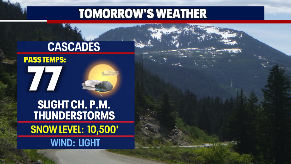
There is a slight chance of a few showers/thunderstorms rolling over the Cascades, but for the most part, we're forecasting drier conditions.
Highs Thursday around the metro area heat into the upper 70s again.
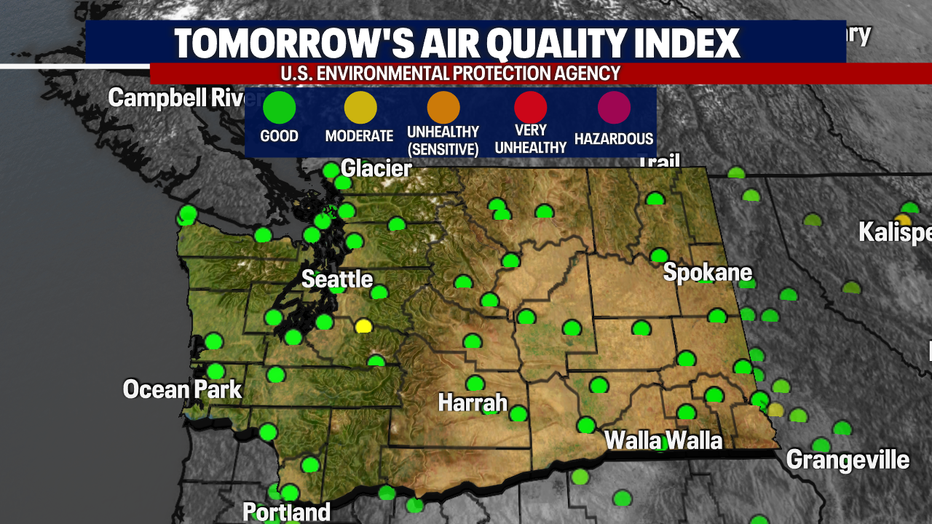
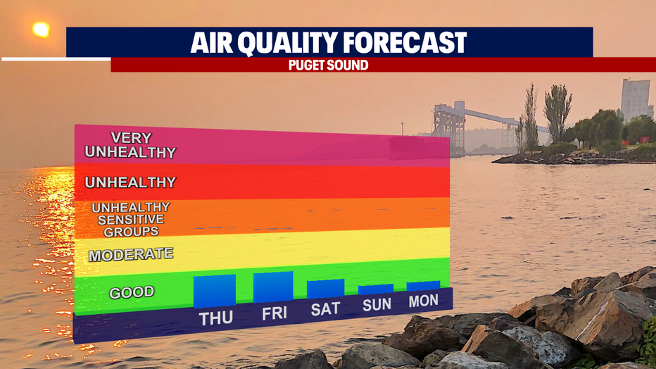
Air quality will remain in the good to moderate zones for most of the state from Thursday into the weekend.
By late Saturday into Sunday, onshore flow will return pushing marine air back inland. This will increase the cloud cover and give us a chance to see some showers on Sunday. Highs will also cool back down to near normal (67-68).
Drier and slightly warmer conditions swing back around by Tuesday next week! Enjoy!
Have a great night all! ~Erin Mayovsky, FOX 13 Forecaster
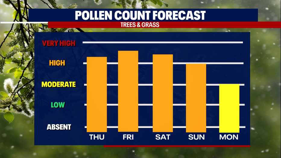
*Pollen Outlook
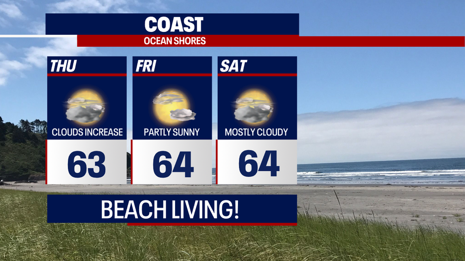
*Coast Forecast
*Mountain Forecast
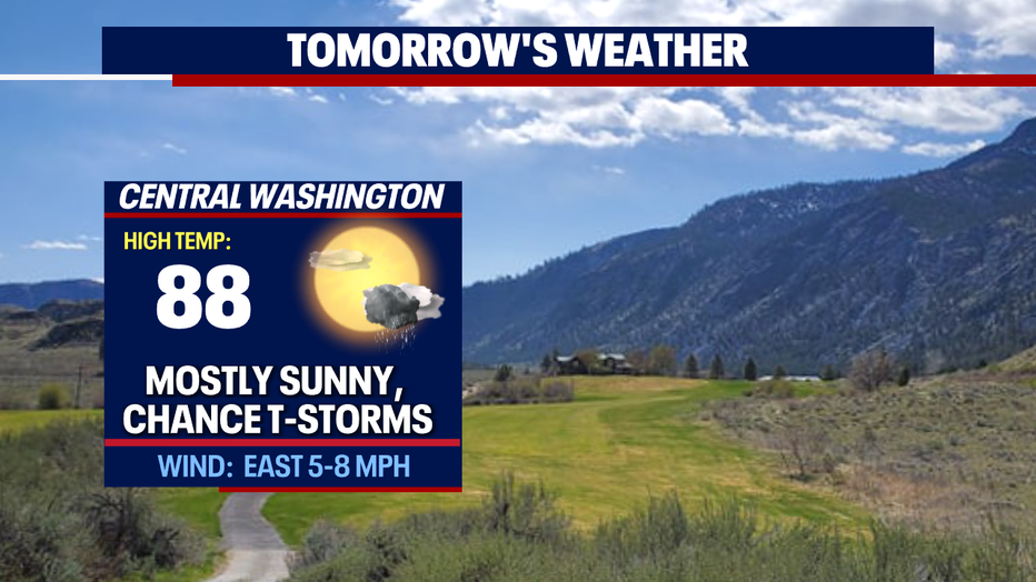
*Central WA Forecast
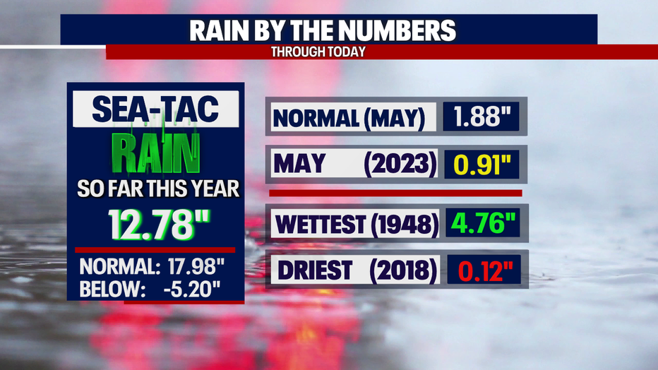
*Rain Almanac Seatac