

Seattle weather: Stormy weather ahead Friday and Saturday

Seattle weather: Showers move in on Wednesday
Light showers return Wednesday and will continue through the weekend.
SEATTLE - A low pressure system moving onshore in Northern California will spin light rain showers into Western Washington on Thursday.
Temperatures will be noticeably cooler on Thursday with highs in the mid 40s. Rainfall amounts will be light with snow levels above 3,500 feet in the Washington Cascades.

Light showers and cooler high temperatures expected in Western Washington Thursday. (FOX 13 Seattle)
On Friday, a much stronger system will impact the Pacific Northwest, with gusty wind at times, widespread lowland rain, and mountain snow.
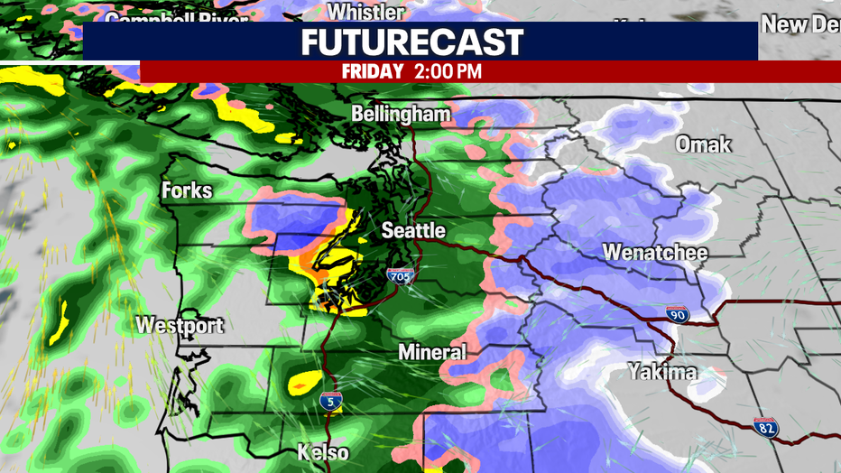
Widespread rain and breezy wind returns to Western Washington on Friday. (FOX 13 Seattle)
Friday’s rain will hit the coast in the morning hours and spread into the Puget Sound area by midday. Areas around Puget Sound could see 0.5 to 1.00 inches of rain through Saturday morning.

A half inch to an inch of rain is possible between Thursday morning and Saturday morning in the Puget Sound area. (FOX 13 Seattle)
Gusty winds will start to pick up on Friday morning. The coast, Admiralty Inlet, and north Puget Sound areas that are usually impacted by stronger winds could see gusts in the 30 to 40 mph range through Saturday.
Snow levels will stay around 3,500 feet through Saturday and will drop to around 2,500 feet by Sunday. Two to four inches of snow is possible over the higher mountain passes (Stevens, White and Blewett) through Sunday.
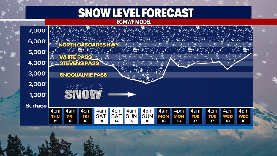
Snow levels will drop this weekend, but accumulations will be limited in the Washington Cascades to 2-4 inches. (FOX 13 Seattle)
Coastal flooding is also possible this weekend, especially during high tides.
Sunday afternoon will be drier, with a chance of showers back in the forecast early next week.

Wet and breezy weather returns Friday and Saturday, but early next week will be more dry than wet in Seattle. (FOX 13 Seattle)
If you’re hoping for a white Christmas in the Puget Sound lowlands, it’s not looking good — sorry kids! The Climate Prediction Center is forecasting warmer and wetter conditions than normal in the week leading up to Christmas. Long range forecast models show no signs of lowland snow for at least the next two weeks.
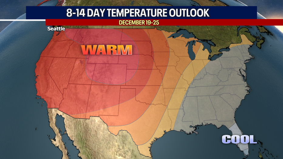
It will be warmer than normal in the Pacific Northwest in the week leading up to Christmas. (FOX 13 Seattle)
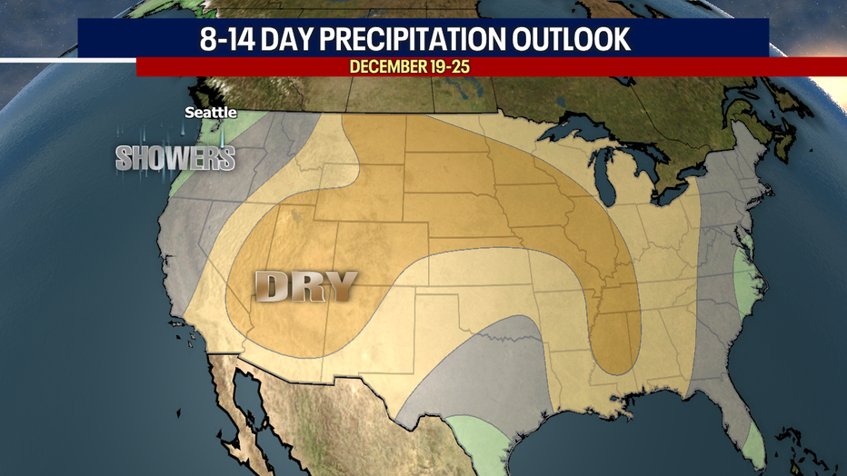
It will be wetter than normal in the Pacific Northwest in the week leading up to Christmas. (FOX 13 Seattle)
MORE NEWS FROM FOX SEATTLE
New 2025 WA laws include minimum wage increase, expanded paid sick leave
Albertsons gives up on Kroger merger, files lawsuit against grocery chain
Rumbles from WA's Mount Adams pulls scientists from ‘high-threat’ volcano
Seattle's housing market crisis unlikely to ease from 'silver tsunami'
Bomb squad responds to 'suspicious vehicle' in Bellevue, WA
To get the best local news, weather and sports in Seattle for free, sign up for the daily FOX Seattle Newsletter.
Download the free FOX LOCAL app for mobile in the Apple App Store or Google Play Store for live Seattle news, top stories, weather updates and more local and national coverage, plus 24/7 livestreams from across the nation.