Stormy weekend ahead, warmer temps late next week

Seattle weather: Breezy and wet weekend
Fox 13 Seattle Meteorologist Brian McMillan has your weekend weather outlook for the greater Puget Sound area!
Western Washington will have a stormy weekend ahead as a series of systems bring rain, wind, and mountain snow to the Pacific Northwest.
Better weather is on the horizon as temps warm up later next week.
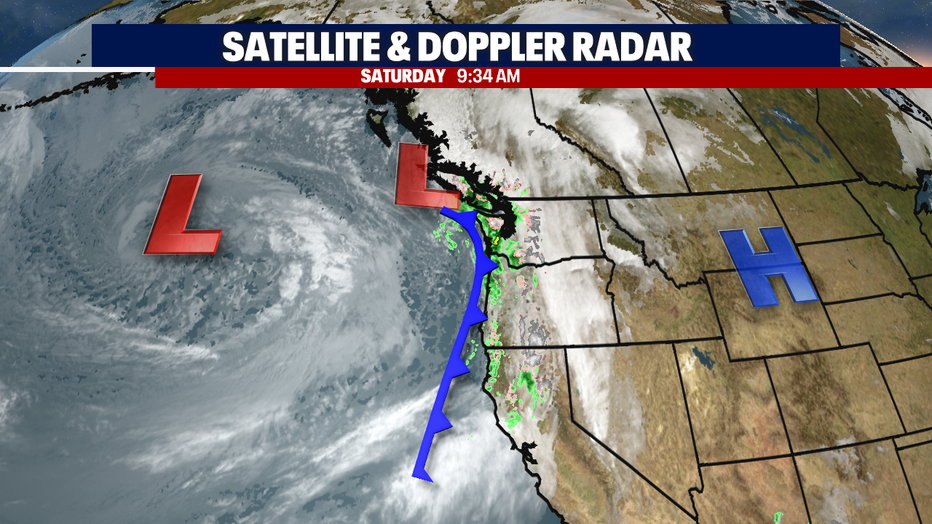
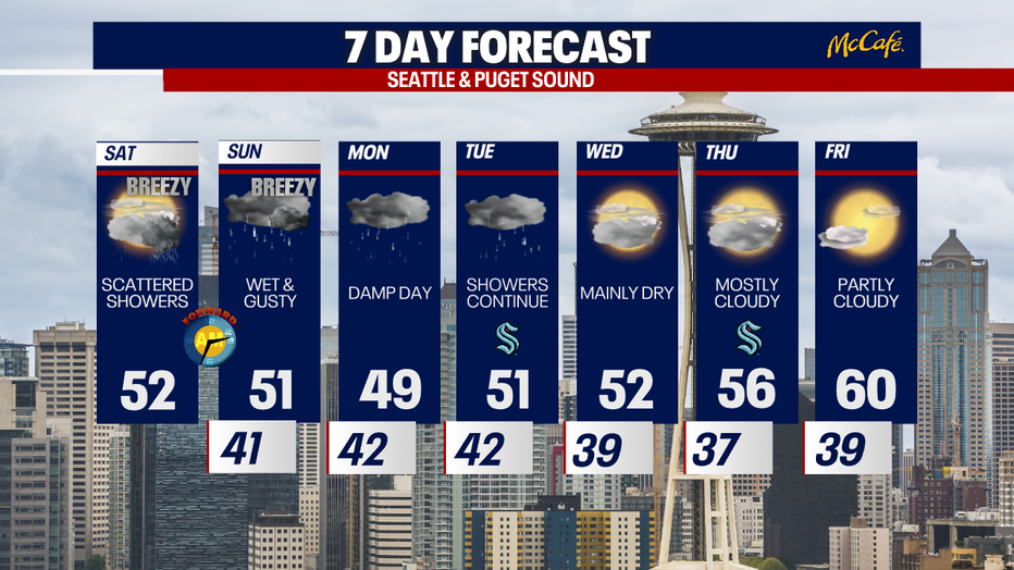
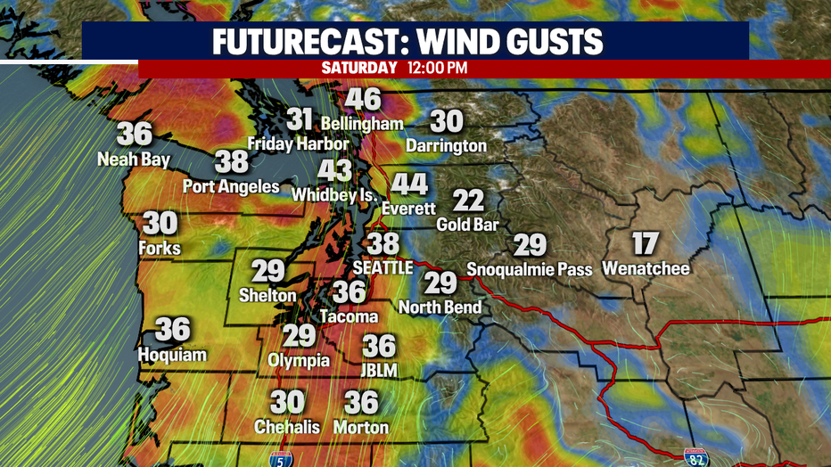
Expect on and off showers Saturday with gusty wind at times. Gusts could reach 40 to 50 mph in some of the usual windy spots like the north sound and Washington Coast. Gusts in the 35 to 45 mph range for most of the central and south Puget Sound areas. There is a slight chance of thunderstorms as well.

The strongest winds on Saturday will arrive midday. Power outages are possible in some scattered locations, so make sure you have your devices charged up and flashlights ready to go.
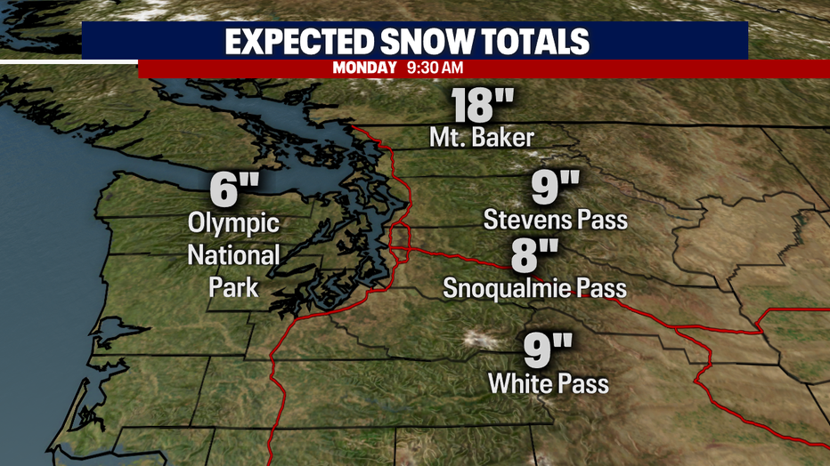
Snow levels will remain around 3,000 to 3,500 feet through Tuesday, which means you'll need to be prepared for winter driving conditions over the mountain passes.
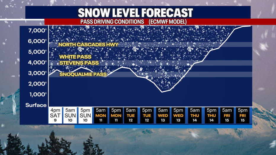
Six to 12 inches of fresh powder is expected over Stevens, Snoqualmie and White passes through early Monday morning. Mt. Baker could see a foot and a half of snow.
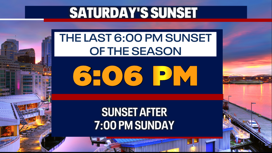
Don't forget! Daylight Saving Time starts early Sunday morning. That will mean we lose an hour of sleep, but we will gain an hour of daylight in the evening starting Sunday. This is also a good time to change the batteries in your smoke detectors.
Models are good agreement about a nice warmup late next week and into the St. Patrick's Day weekend. Temps could be in the 60s next weekend with lots of sunshine. Stay tuned as we get closer.