

Seattle weather: Temperatures jump up to near 70 this week with clear skies!

Temperatures to hit 70 degrees this week!
FOX 13 Forecaster Erin Mayovsky is tracking one glorious day this week—on Thursday, temperatures are going to get close to 70 degrees!
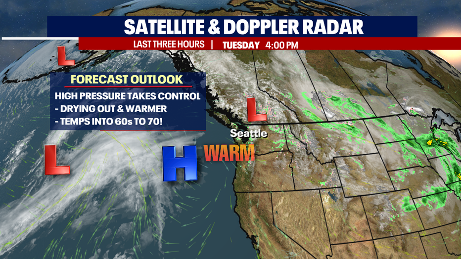
SEATTLE - After all the rain, wind, and heavy mountain snow we're going to flip the script!
Wednesday and Thursday feature warmer highs with plenty of spring sunshine for all! This all thanks to high pressure building back into the forecast.
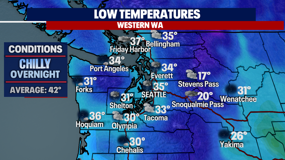
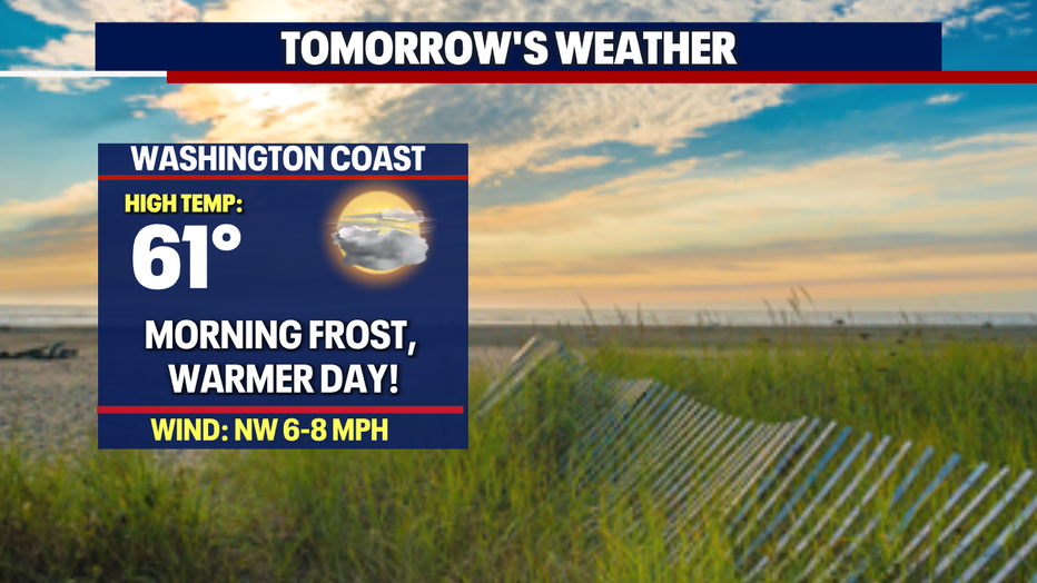
As high pressure strengthens, we'll see skies start to clear out leaving us with cool overnight lows. Some areas, like the Northwest Coast, Shelton, Olympia, Chehalis will see below-freezing temps. The metro area stays slightly warmer in the mid 30s, but still below average for this time of year. Look for a frosty morning commute for many spots tomorrow.
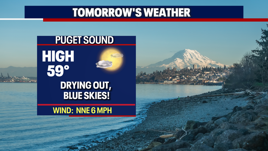
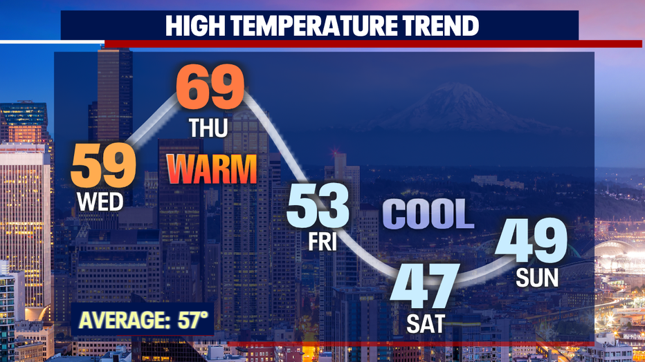
Highs will jump up above normal by a few degrees with Seattle landing near 60.
If you're heading out to cheer on our Sounders FC as they host NYC FC in leg one of Concacaf Champions League play, conditions look great! Temps drop into the mid 50s for the 7 p.m. kick off with low 50s by the end of the match at Lumen Field.

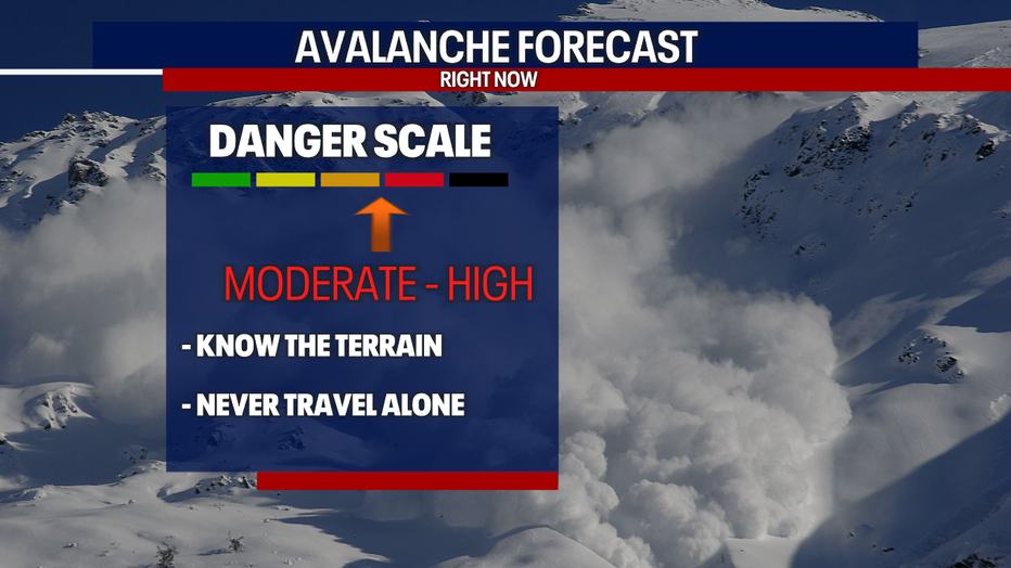
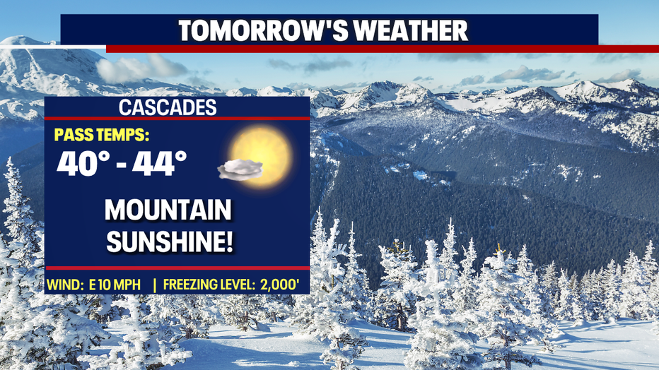
Dangerous avalanche conditions are expected Wednesday as we rapidly warm up. Strong sunshine will cause the snow to become unstable giving way to large natural avalanches. Know the terrain before heading up to the mountains.
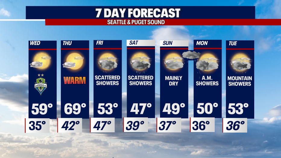
Our temperature trend this week has highs riding up through Thursday. We potentially could experience the warmest day of the year so far with a forecast high of 69. But as a weak front slides inland highs take a dive back down into the upper 40s.
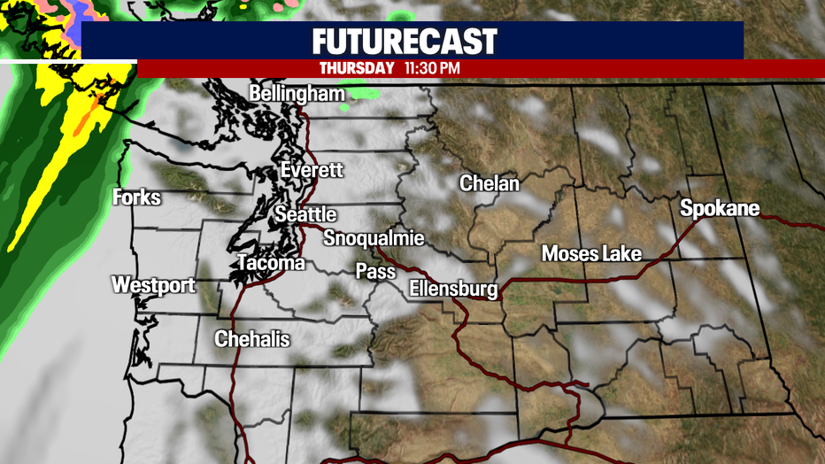
Here's a look at late Thursday night as we start to see the change off the Northwest Coast. Through the overnight hours this system will ride into Puget Sound.
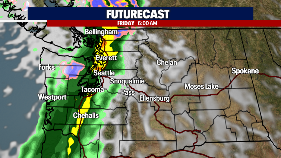
By the early morning commute rain becomes widespread stretching from southern Washington to the Canadian border. This system moves through pretty quick though, by midday most showers will run up into the Cascades.
Typical spring showers and sun breaks continue through the start of the weekend. Cool air remains in place too. By Sunday, we'll dry out some ahead of the next push for rain early Monday. The bulk of the precipitation happens overnight into the morning commute with showers tapering off by midday.
There's a chance for a few more showers around the region Tuesday, although most of the activity will hang over the mountains. Highs climb back into the low 50s. Enjoy!
Have a great night all! ~Erin Mayovsky, FOX 13 Forecaster
*Beach Forecast
*Mountain Forecast
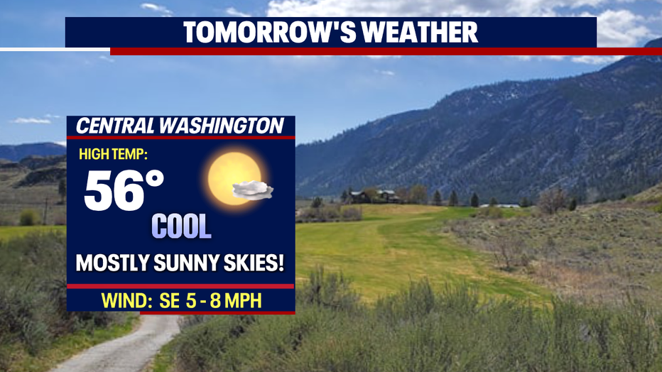
*Central WA Forecast
MORE FROM FOX 13 WEATHER:
DOWNLOAD: FOX 13 Weather and News Apps
WATCH: Forecast and Radar
READ: Closures and Delays
CHECK: Latest Weather Alerts and Live Traffic Map
INTERACT: Submit your Weather Photo
DAILY BRIEF: Sign Up For Our Newsletter
FOLLOW: Lisa Villegas, Erin Mayovsky, Brian MacMillan, Abby Acone and Scott Sistek