

Seattle weather: Clouds and sun breaks, showers into the weekend
Cloudy with showers into next week
Enjoy the sunny conditions while they last! FOX 13 Chief Meteorologist Lisa Villegas and Forecaster Erin Mayovsky are tracking lots of rain and clouds into next week, with some dry spots in the weekend.
SEATTLE - We saw a gorgeous day across the region Wednesday. Highs did warm into the low- to mid-50s for most, with 54 at the airport.
Our normal seasonal high for this time of year is 58 and will jump to 59 Thursday.

Overnight skies are mostly cloudy with cooler than average temperatures.

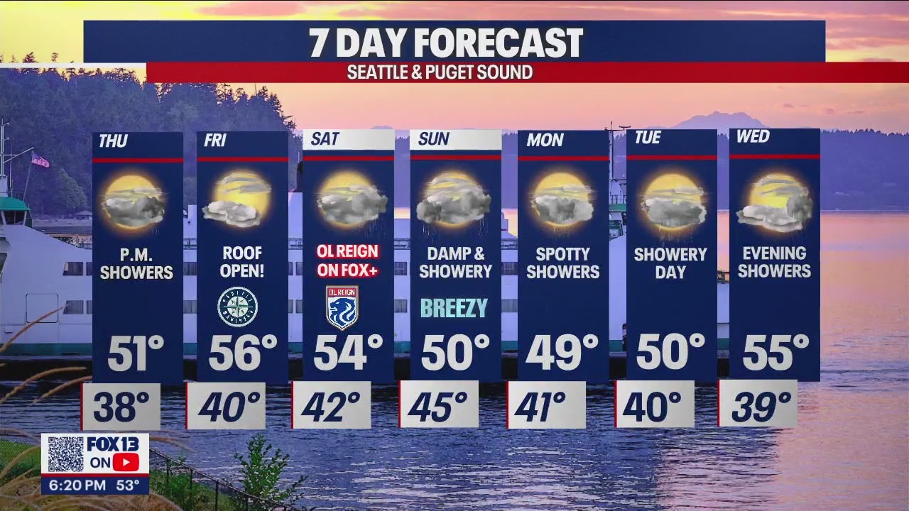
Thursday starts our dry and mostly cloudy, but a weak front will give us a chance for afternoon showers. Highs cool into the low 50s.


The best day of the week is Friday, folks! This is all thanks to weak high pressure building into the region. We'll enjoy partly sunny skies with highs landing in the mid 50s.

These sunny conditions are great for the Mariners as they return home to take on the Colorado Rockies Friday night. First pitch is set for 7:10pm at T-Mobile Park! Enjoy!

The roller coaster weather ride continues with another front riding in as we get into the weekend. Look for a mainly dry start inland with showers at the coast early. By the afternoon showers make their way into Puget Sound with highs in the mid 50s.

FOX 13+ has you covered if you can't make it out to Lumen Field to cheer on the OL Reign vs San Diego Wave FC. Kickoff is set for 7pm! #GoOLReign

Unfortunately, active weather is on tap Sunday into the start of the next week. Temperatures take a dip back down into the upper 40s to low 50s. Brr! Keep the winter coats handy!
Have a great week! ~Erin Mayovsky, FOX 13 Forecaster

*Coast Forecast

*Mountain Forecast

*Rain Almanac SeaTac
