

Will it snow more in Seattle? Record low temperatures possible this week
Record lows ahead this week for Puget Sound
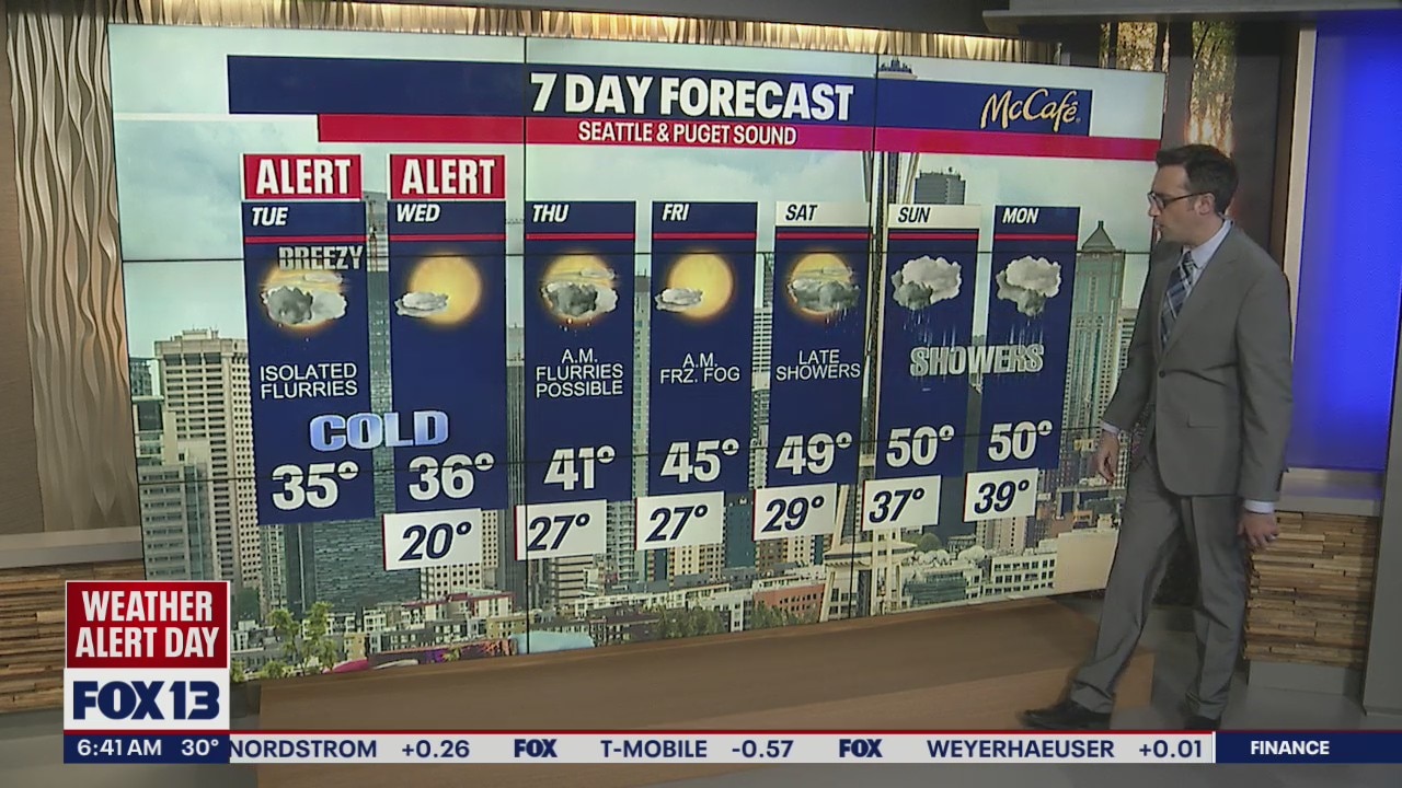
It's a Weather Alert Day. The temperatures are dropping, the winds are whipping, and the snow is falling.
SEATTLE - Many people in Western Washington woke up to a dusting of snow Tuesday morning. Record setting low temperatures are expected tonight into early Wednesday morning as skies clear.
Some flurries or light snow showers are possible through the early afternoon in Western Washington. High temps will only make it into the mid 30s around the Seattle area. In Whatcom County, the Fraser Valley outflow winds will stay gusty through the afternoon. Around 4:00 AM, we had a northeast gust of 60 mph in Bellingham. Winds should calm later this evening.
CHECK SCHOOL CLOSURES AND DELAYS HERE

Tonight, the bottom drops out on the temperatures as skies clear and winds calm. Temps will be down into the teens and low 20s overnight, potentially setting low temperature records in many locations, including Seattle.

SeaTac has hit 25 degrees or cooler six times already this meteorological winter. The average is four days during the winter months.

Wednesday afternoon looks nice and sunny with another slight chance for flurries on Thursday morning. Temps will slowly warm back to average by the weekend with showers hitting late Saturday and continuing into early next week.

MORE FROM FOX 13 WEATHER:
DOWNLOAD: FOX 13 Weather and News Apps
WATCH: Forecast and Radar
READ: Closures and Delays
CHECK: Latest Weather Alerts and Live Traffic Map
INTERACT: Submit your Weather Photo
DAILY BRIEF: Sign Up For Our Newsletter
FOLLOW: Lisa Villegas, Erin Mayovsky, Brian MacMillan, Abby Acone and Scott Sistek