Memorial Day Forecast in the Seattle-area

Seattle Memorial Day Weekend forecast
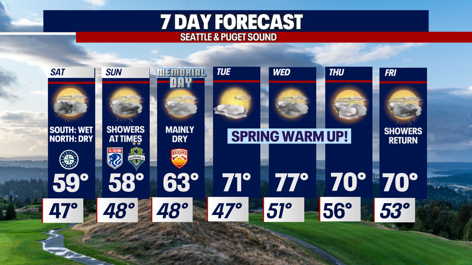
Areas can expect scattered showers over the weekend before drying out on Monday.
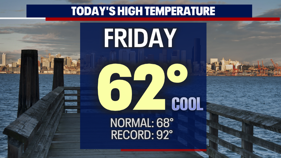
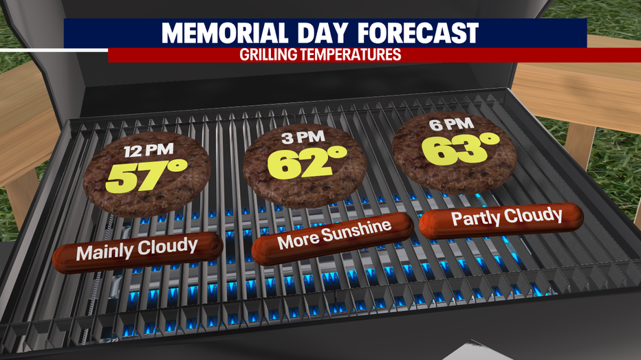
SEATTLE - Another cool day across the Northwest. Most of us landing in the upper 50s to low 60s. Normal for this time of year is 68, soon to be 69.
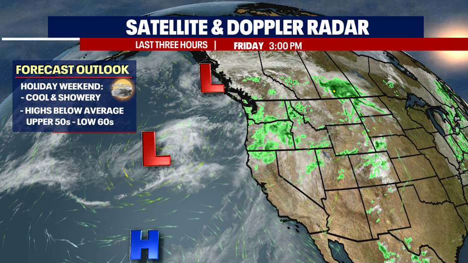
Before we see drier and warmer conditions, we must get through this weekend first.
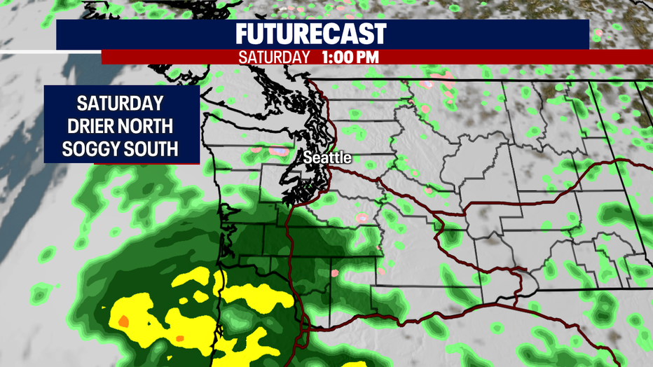
The next system will drop rain along the Coast and South Sound Saturday with light showers to the north. We expect snow in the higher elevations of the mountains as snow levels hang between 5,000'-6,000' the next two days.
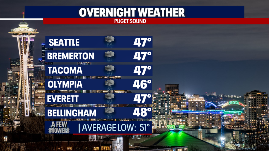
Overnight temperatures will run slightly cooler than average, landing in the mid to upper 40s with a chance for light showers.
Saturday morning showers will push in from the SW blanketing the SW WA Coast and South Sound. Most of us to the north will see light showers with dry periods. We're forecasting highs to only reach the upper 50s, which is about 10 degrees below normal.
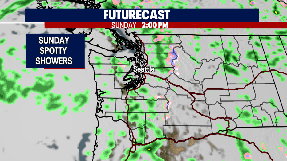
Showers let up some on Sunday to spotty at times with highs still below average in the upper 50s.
Monday starts our upward swing! Highs will jump into the low 60s with mainly dry conditions, but we can't rule out a few light showers throughout the day.
We say hello to the 70s again as ridging moves across the region keeping us mostly dry with highs soaring into the low to upper 70s! Enjoy!
Have a safe holiday weekend all! ~Erin Mayovsky, FOX 13 Forecaster