Beautiful skies across the region with more sunshine on the way for Sunday!
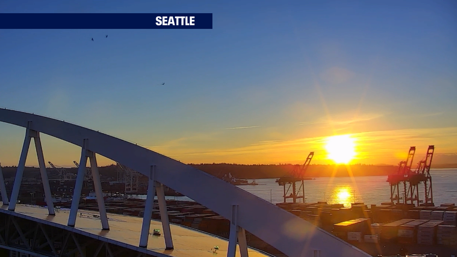
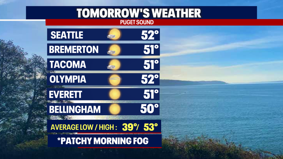
Seattle - Hello 6pm sunset! What a night… a gorgeous finish to Saturday after waking up to patchy fog around the region. It took a little longer to warm up and clear out, but when it did temperatures landing in the upper 40s to low 50s for most of Western WA.
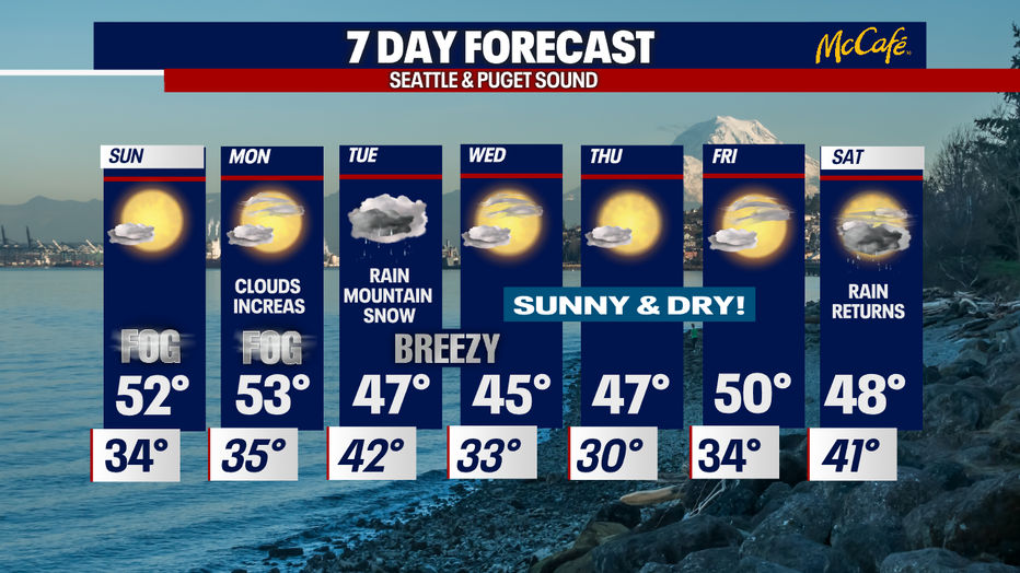
Skies will remain fairly clear overnight. Look for areas of patchy fog to develop near sunrise. Lows drop well below the norm to near freezing for some spots like, Olympia. Allow for extra time as you head out the door Sunday morning as some roads may be a little frosty out of the gate.
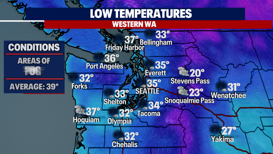
Fog will not be widespread, but instead expect pockets of low clouds through mid-morning. Most areas see fog lift before noon.

Our beautiful skies all thanks to high pressure just offshore in the Pacific. The high will keep systems out of Washington at least through late Monday into early Tuesday.
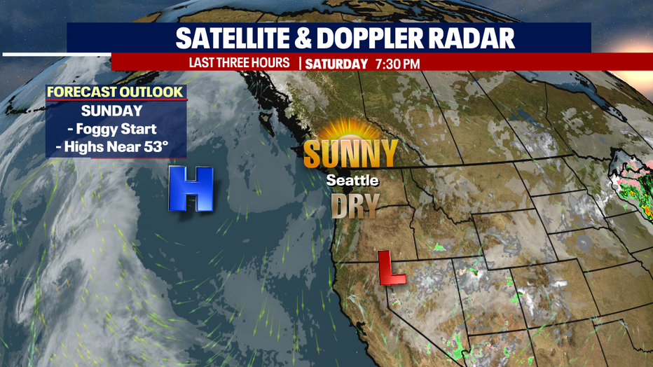
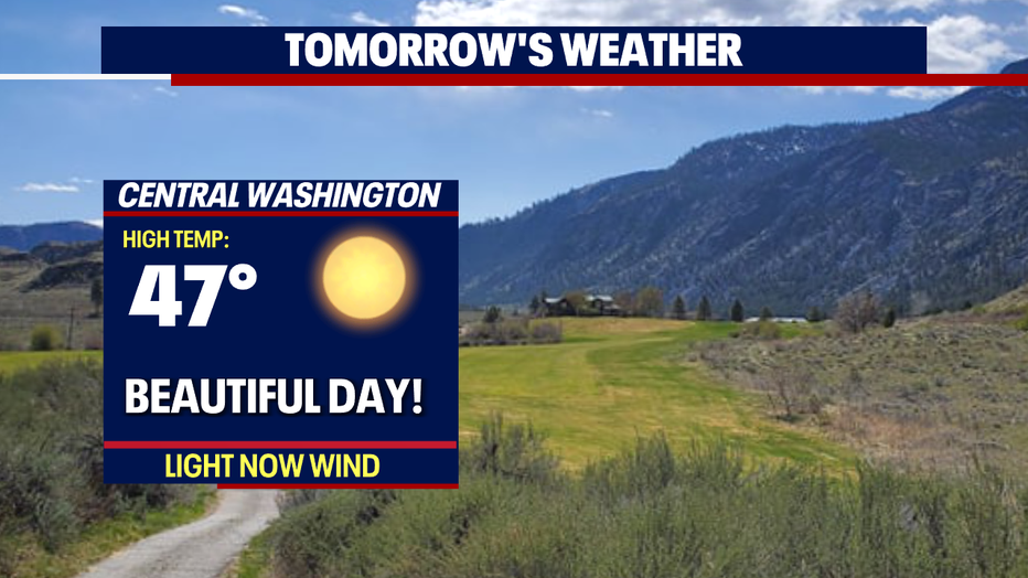
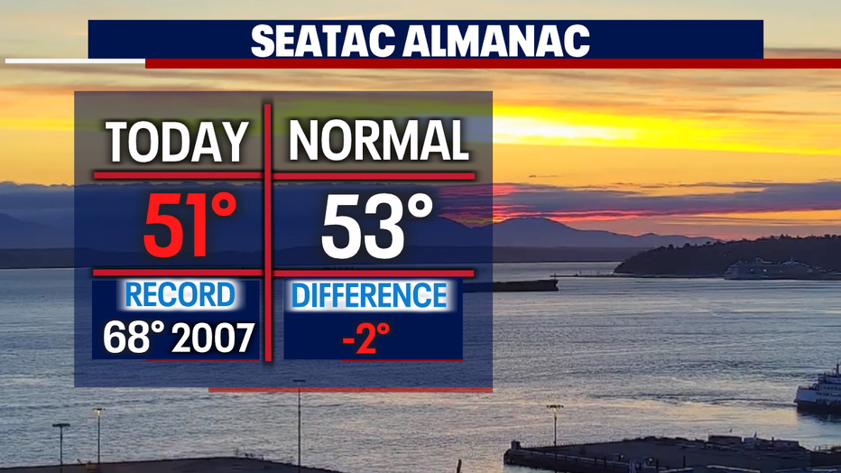
Highs Sunday will land just shy of our seasonal average of 53 for this time of year.
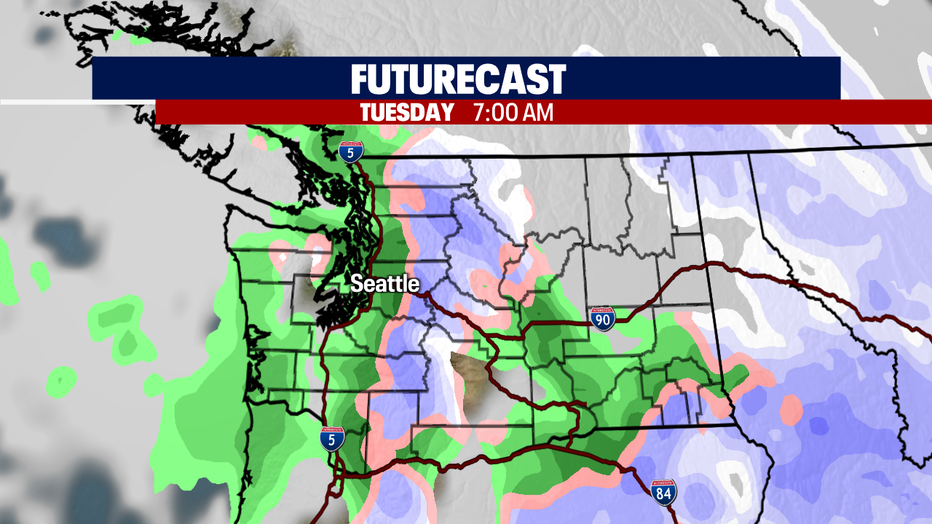
By Tuesday, a cold front will be responsible for rain returning to the region again. Look for light to moderate showers throughout the day with breezy conditions. This means good news for the mountains as snow will fall across the Cascades once again! A nice coating of fresh powder will make for a fantastic day to enjoy the great outdoors in the high country!
By midmorning Wednesday clouds will start to clear out and skies will open up--giving way to a partly cloudy night. Highs land much cooler than average in the mid 40s. Expect lows to drop from freezing to near 30 early Thursday.
Sunny and dry weather hangs with us through the end of the week. The next system delivers rain Saturday. Enjoy!
Have a great Sunday all! ~Erin Mayovsky, FOX 13 Forecaster
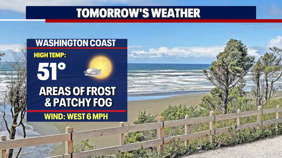
*Beach Forecast
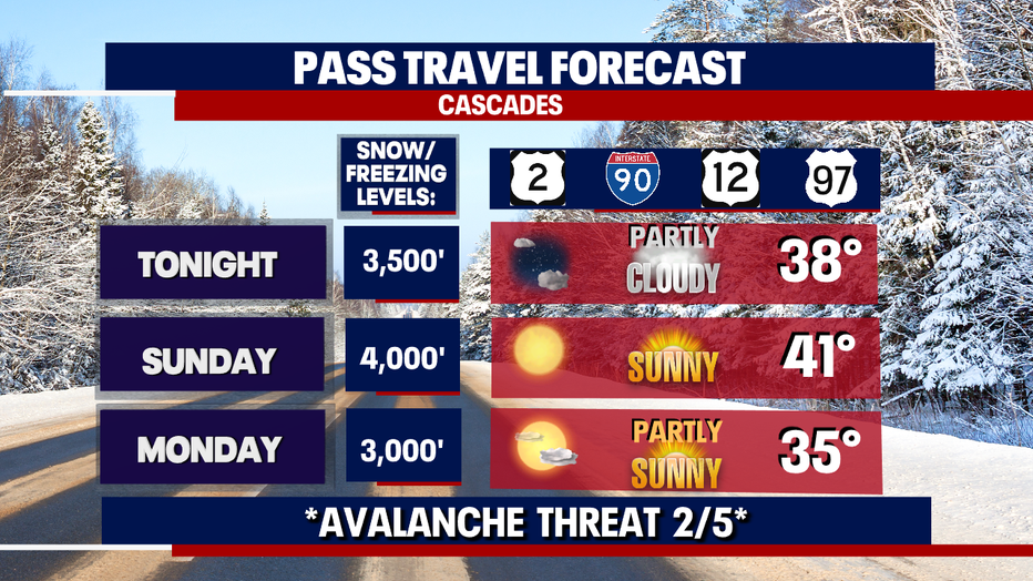
*Mountain Forecast
*Central WA Forecast