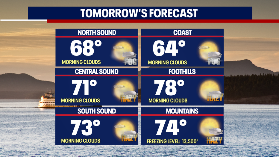
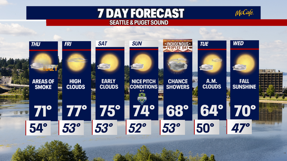
Seattle weather: Less patchy morning fog Thursday will warm temperatures a few degrees

Gradual cooling into the weekend before temperatures rise again
FOX 13 Forecaster Erin Mayovsky and Chief Meteorologist Lisa Villegas have the details.
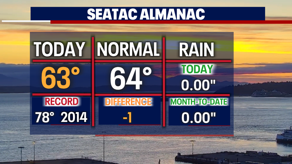
SEATTLE - Highs Wednesday landing cooler than our forecast as morning fog and afternoon haze keeps temperatures near average. The Seattle area only hitting 63 today and that is just one degree shy of normal for this time of year.
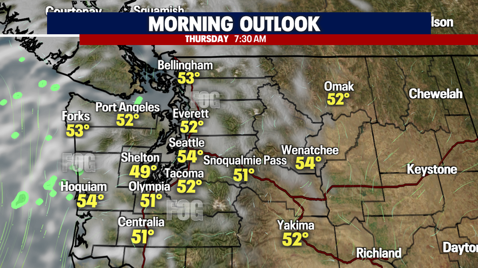
Overnight will look very similar to the last couple of nights with clouds and fog rolling back into the region. Lows will cool into the low to mid 50s.
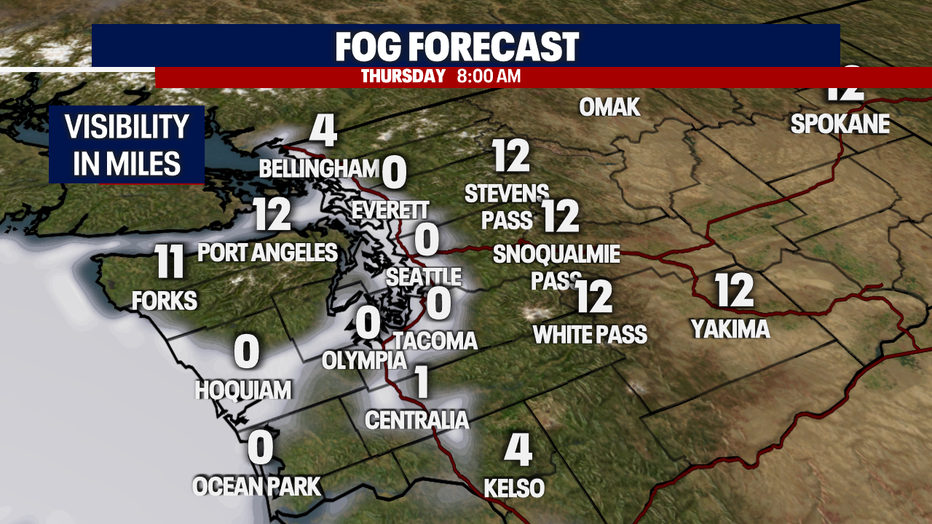
Please be careful out there tomorrow morning, especially around the 7-9 a.m. hours as kids will be out heading to school and visibilities will be low. Some spots drop to just under a mile.
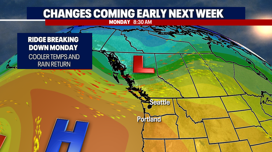
A ridge of high pressure is keeping us slightly warmer and drier than normal for this time of year. These conditions will last through the weekend with temps hanging in the 70s.
By Monday change is on the way. We may just see our first real shot at a few showers as our ridge breaks down allowing a low to push in more clouds, potential showers, and cooler days.
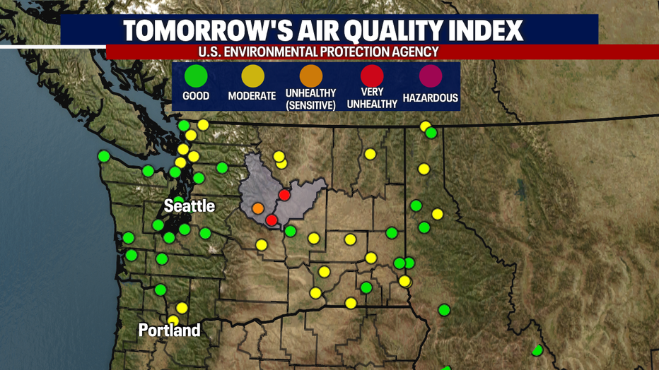
Winds will continue to carry smoke from fires burning to the east into our neck of the woods. Look for degraded air quality across Western WA Thursday into Friday with improvement for the weekend.
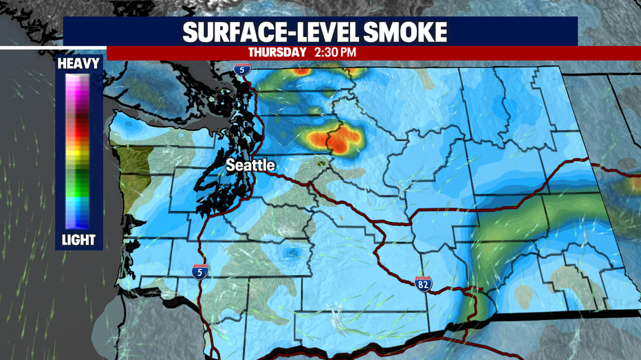
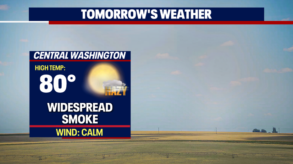
An air quality alert remains in effect for the eastern foothills of the Cascades into Central WA for two counties—Chelan and Douglas. Widespread smoke will keep some areas in the very unhealthy zone into Friday.
Highs Thursday will just depend on how quickly the fog burns off and how much haze stretches over the region.
Monday brings a chance of a few showers moving into the area out of the Northwest. Stay tuned!
Have a great rest of the week all! ~Erin Mayovsky, FOX 13 Forecaster
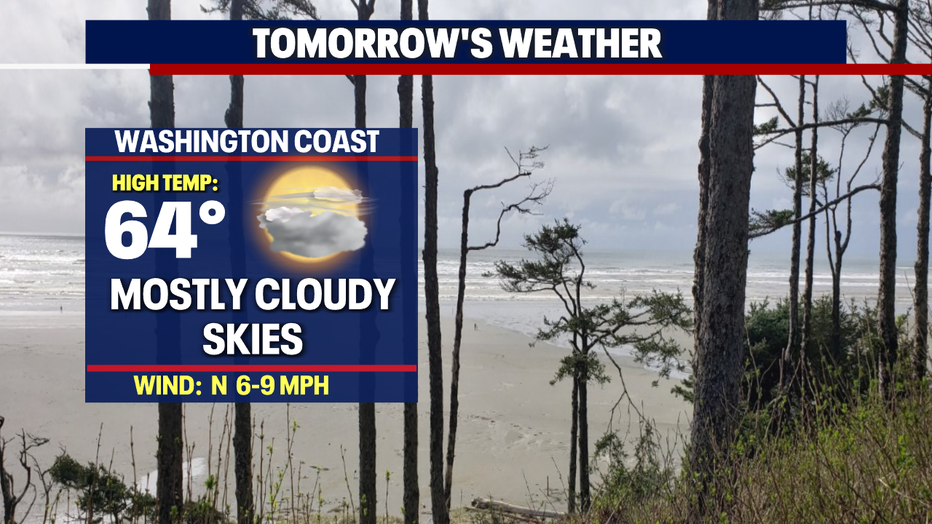
*Beach Forecast
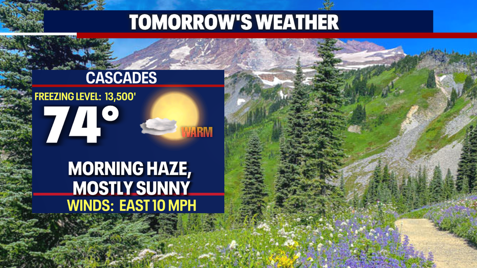
*Mountains Forecast
*Central WA Forecast