

Seattle weather: Mountain snow and lowland rain Monday

Seattle weather: Mountain snow and lowland rain Monday
FOX 13's Claire Anderson has your 7-day forecast.
SEATTLE - Skies today started out cloudy with a few showers for some, but we saw some sunbreaks and highs in the upper 40s this afternoon. Clouds started to fill in just in time for the Seahawks game.
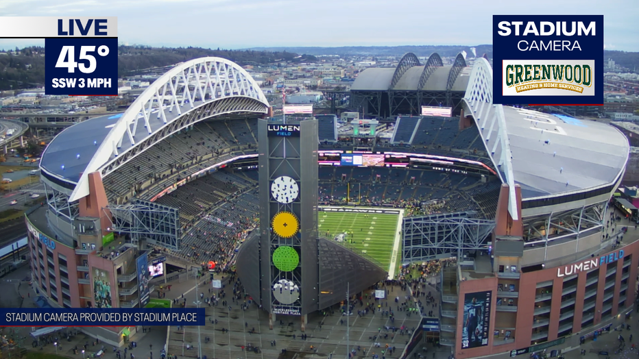
Skies today started out cloudy with a few showers for some, but we saw some sunbreaks and highs in the upper 40s this afternoon. (FOX 13 Seattle)
Showers will start to increase later tonight starting in southwest Washington moving northeastward by early Monday morning. Tonight temperatures will stay relatively mild with lows only dropping into the mid to upper 30s. We will see winds increase a little along the coast.
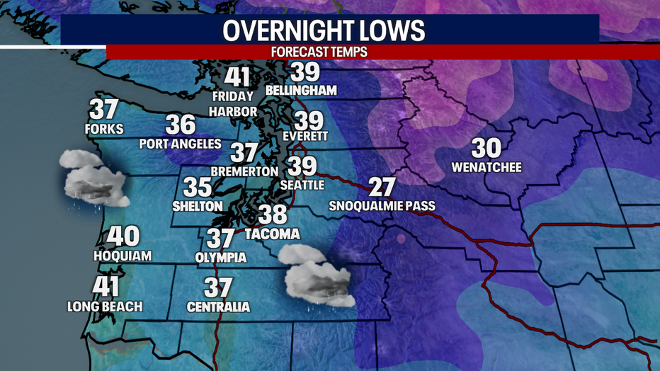
Showers will start to increase later tonight, starting in southwest Washington moving northeastward by early Monday morning.
A Winter Weather Advisory goes into effect for the Cascade Passes above 3000' from 1am to 1pm on Monday. This includes Snoqualmie, Stevens and White Pass. We could see 2-6" of snow accumulation.
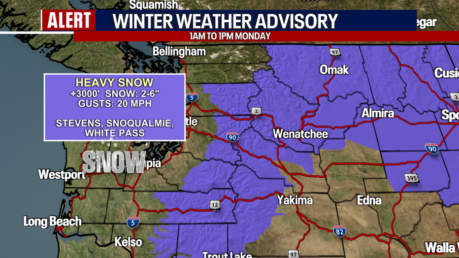
Late tonight we will see a Winter Weather Advisory go into effect for the Cascade Passes above 3000'.
Snow levels will start around 1500-2500' tonight and will raise to around 2500-3500' by Monday afternoon. We will be watching for potential freezing rain and slick conditions for the mountain passes Tuesday night into Wednesday morning.
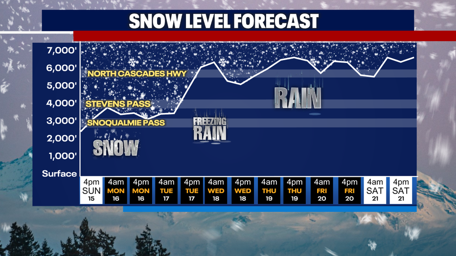
Snow levels will start around 1500-2500' tonight and will raise to around 2500-3500' by Monday afternoon.
Our next round of rain for the Pacific Northwest moves in later this evening as a warm front moves into the area. Showers will continue overnight into Monday morning. It will be a wet start to the day with more showers scattered in the afternoon.
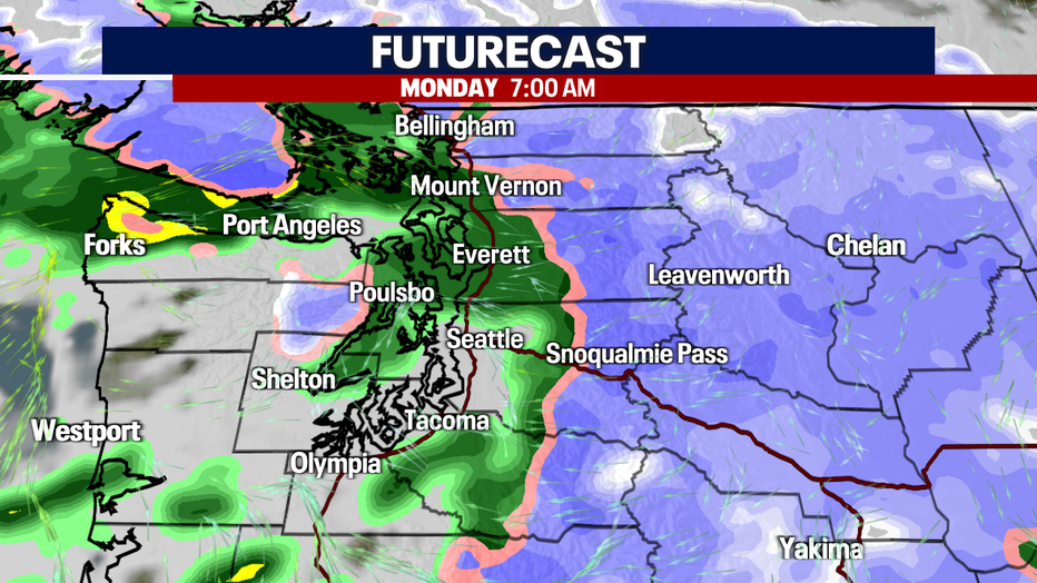
Our next round of rain for Pacific Northwest moves in later this evening as a warm front moves into the area.
Temperatures will be in the mid to upper 40s Monday, with a few sunbreaks into the afternoon.
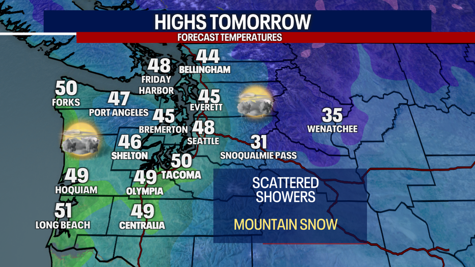
Temperatures will be in the mid to upper 40s Monday, with a few sunbreaks into the afternoon.
We will see high tides again Monday morning, so a Coastal Flood Advisory will be in effect for the central Washington coast and the northern interior. There could be up to 2 feet of flooding, especially around 7am, which is high tide.
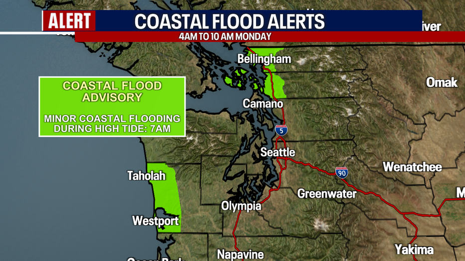
We will see high tides again Monday morning, so a Coastal Flood Advisory will be in effect for the central Washington coast and the northern interior.
An atmospheric river set up will return Tuesday into Wednesday, bringing more widespread rain, mild temperatures and breezy winds. Mild temperatures will also lead to rising snow levels, bringing more rain to the mountains. We will be watching for any flooding concerns and possible river flooding into midweek.
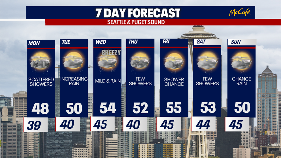
An atmospheric river set up will return Tuesday into Wednesday, bringing more widespread rain, mild temperatures and breezy winds.