Rain, wind and heavy mountain snow on tap as we sail into the weekend
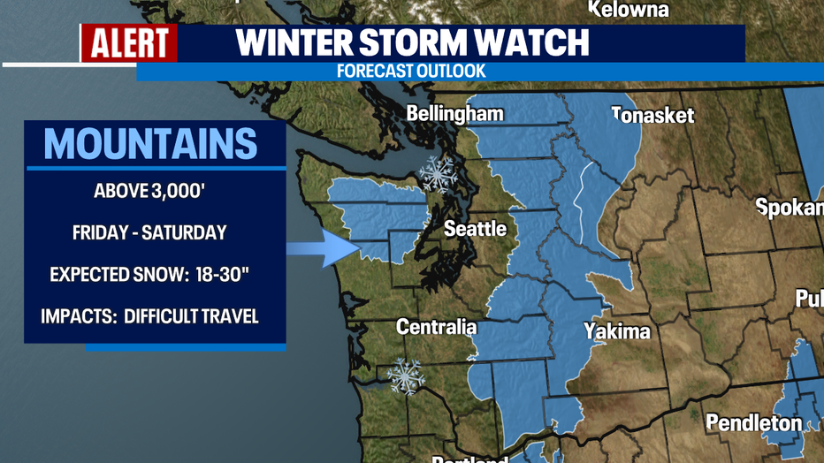
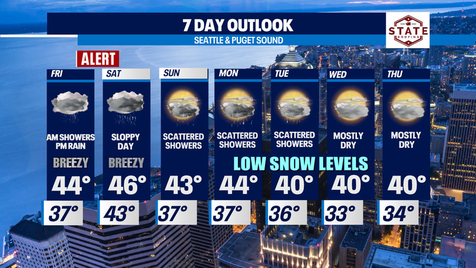
Seattle - Get ready for some sloppy conditions this weekend as a strong storm makes its way into the Pacific Northwest. We expect rain, gusty winds and heavy mountain snow and that is why the FOX forecast team is calling a "Weather Alert" for Friday evening through Saturday morning.

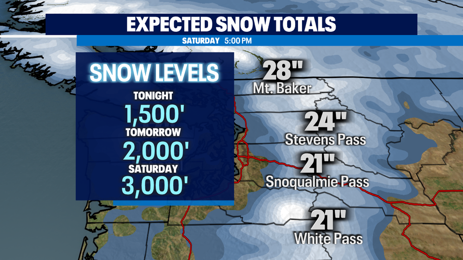
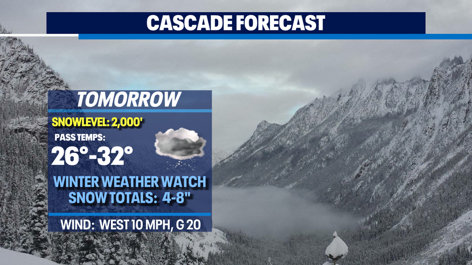
Look for difficult travel through the mountains as a cool and moist airflow from the west and northwest will produce significant snowfall in the Cascades. We're talking up to two and a half feet of snow! And that's great news for our area resorts as bases build and get closer to opening up. The downside, with snow levels dropping between 1,000' to 2,000', pass travel will become very tricky.
A "Winter Storm Watch" will go into effect Friday into Saturday across the Olympics and Cascades. We're forecasting heavy snow at times along with gusty winds too. This combo can be potentially dangerous as areas of snow will blow reducing visibility and those gusty winds could blow down tree limbs.
Here's a look at some projected snow totals through Saturday late afternoon:
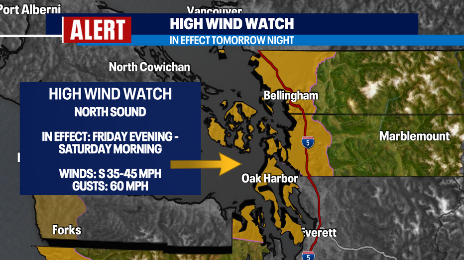
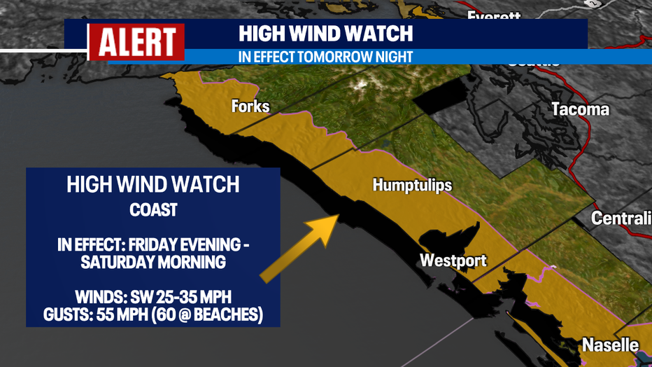
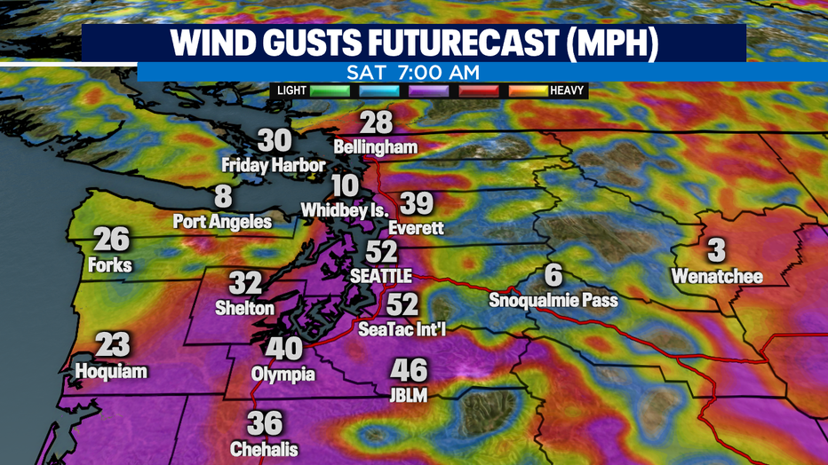
The second part of our big weather story is the wind! A "High Wind Watch" goes into effect Friday evening through Saturday morning for several counties including; San Juan, Western Whatcom, Western Skagit, Admiralty Inlet, along with the North and Central Coast. Winds are forecast out of the south 35-45 mph, gusting to near 60 mph at times. These wind speeds may potentially produce widespread power outages.
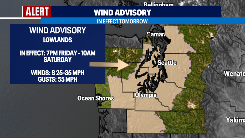
We also have a "Wind Advisory" for many spots around Puget Sound including; the SW Interior, Everett, Seattle, Bremerton, Tacoma, Bellevue, Hood Canal, the Lower Chehalis Valley, and the Foothills. Look for winds out of the south sustained 25-35 mph with gusts up to 55 expected. This alert will remain in effect from Friday evening through Saturday morning. Make sure to secure those garbage cans as they may get blown around.
Showers become scattered Sunday with a chance of thunderstorms firing up mainly along the coast. Otherwise, we'll see on/off rain through the start of the work week. Snow levels will drop to near 200', but there won't be a ton of moisture to work with, but we're not ruling out a few areas seeing a spotty wintry mix.
Travel safe all! ~Erin Mayovsky, FOX 13 Forecaster
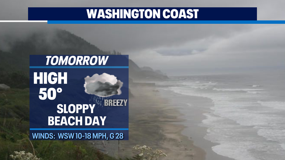
*Beach Forecast
*Mountain Forecast
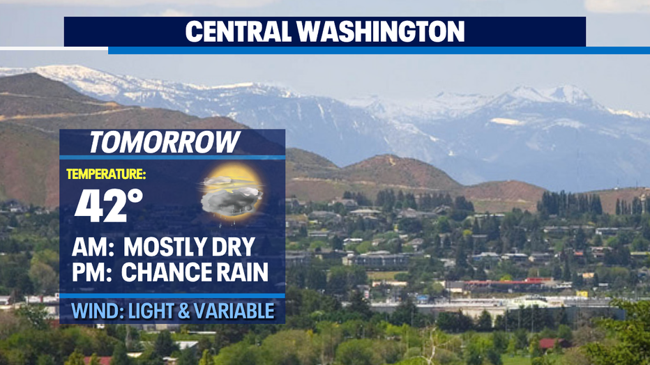
*Central WA Forecast