

Seattle weather: Cloudy, cooler first week of fall in western WA
Seattle weather: 70 degrees to mark the last day of summer
Seattle weather: 70 degrees to mark the last day of summer
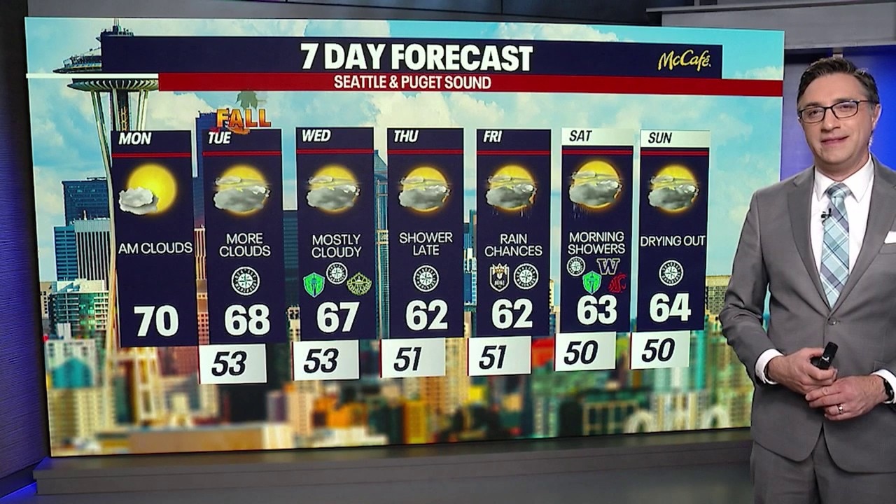
SEATTLE - We are settling into a cooler, more fall-like weather pattern across Western Washington this week with more clouds and a chance of rain by Thursday night.
For Monday afternoon, expect a mix of clouds and sunshine as a weak system passes to the north. Temperatures will remain a little below normal, with highs in the 60s and low 70s.
More clouds Tuesday morning
Increasing onshore flow tonight will bring plenty of low-level moisture back into the region. That means low clouds will develop overnight, with a chance for some early drizzle Tuesday morning.
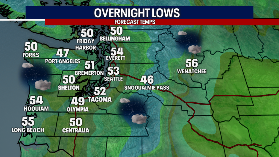
It will be cool with increasing clouds Monday night in Western Washington. (FOX 13 Seattle)
Big picture view:
Stronger onshore flow should limit widespread fog, but low clouds will still be more widespread Tuesday morning. Those clouds should break up around midday, giving way to mostly sunny skies during the afternoon. Highs will drop to the 60s.
The autumnal equinox is at 5:05 PM on Tuesday.
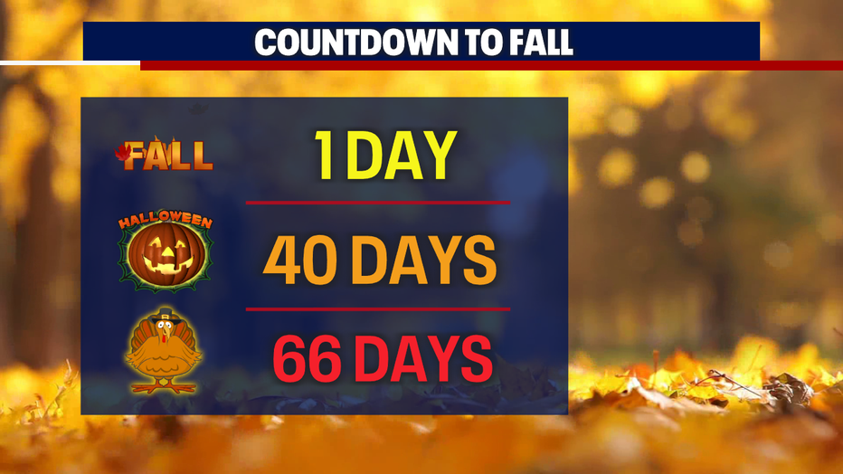
Fall returns Tuesday at 5:05 PM. (FOX 13 Seattle)
Another system will approach the coast early Wednesday, but it's expected to weaken significantly as it moves inland. Most of Western Washington will stay dry, but there is a slight chance of a shower, especially north of Seattle. Otherwise, expect a mix of clouds and sunshine with highs back in the mid 60s.
Rain returns Thursday
What's next:
The biggest change of the week arrives Thursday, as a stronger frontal system moves toward Western Washington. Rain will move into the region by Thursday evening.
Rainfall totals could reach a half-inch to an inch along the coast, Olympics and Central and Southern Cascades, with roughly a quarter-inch to a half-inch possible across the interior. The North Cascades could see 1 to 1.5 inches of precipitation.
Snow levels will drop to around 6,000 to 6,500 feet, meaning some of the higher mountain peaks could pick up a few inches of snow.
The front could linger into Friday morning, keeping some light showers around early. Highs Thursday and Friday will only reach the low to mid-60s.
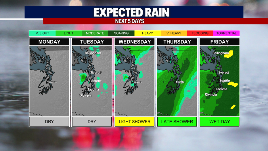
Rain returns to Western Washington Thursday night into Friday. (FOX 13 Seattle)
Cool, damp weekend ahead
The weekend looks quieter, but cool. Highs should remain in the low to mid-60s, with overnight temperatures in the 40s for most locations.
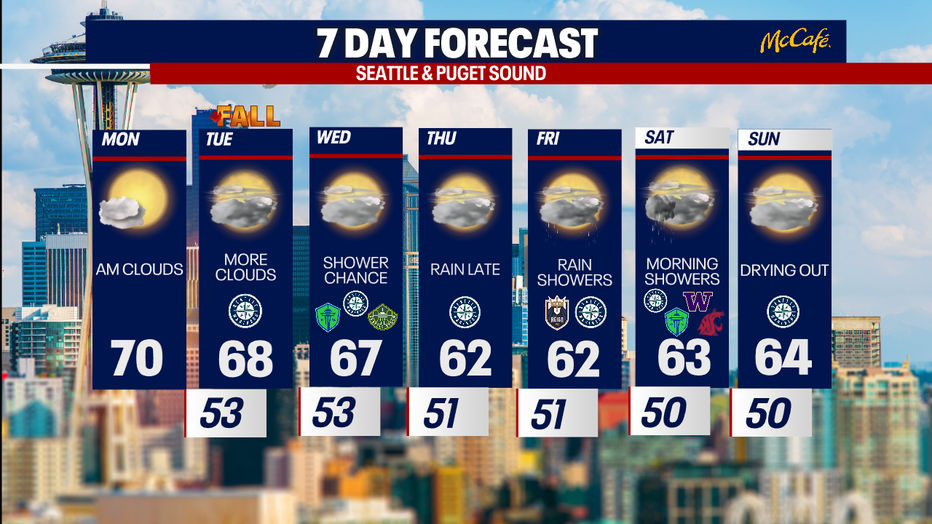
It will be cooler and cloudier across Western Washington this week with rain returning Thursday night. (FOX 13 Seattle)
MORE NEWS FROM FOX 13 SEATTLE
Families speak out after 5 men detained at Washington campsite
Chelan Hills Fire update: US Marshals arrest multiple suspects in western WA
2 killed in Beacon Hill shooting, Seattle police say
Seattle City Council considers ban on grocery ‘surveillance pricing’
Trump strikes deal granting US permanent military access to Greenland
How to watch Seattle Seahawks vs. Arizona Cardinals
To get the best local news, weather and sports in Seattle for free, sign up for the daily FOX Seattle Newsletter.
Download the free FOX LOCAL app for mobile in the Apple App Store or Google Play Store for live Seattle news, top stories, weather updates and more local and national news.
The Source: Information in this story comes from weather models interpreted by the FOX 13 Seattle weather team.